Property Record
Vac Thomas Rd Vic Robinsong Rd, Acton, CA 93510

NEARBY LISTINGS FOR SALE OR LEASE
Property Detail
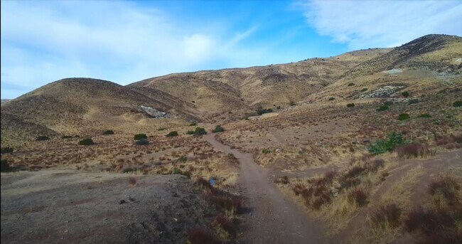
Vac Thomas Rd Vic Robinsong Rd
Los Angeles-Long Beach-Glendale, CA
40 ACS SE 1/4 OF NE 1/4 OF SEC 8 T 5N R 13W
3216-006-009
Los Angeles
Desertorbarrenland
California
X
8
06037C0645G
80.56 AC
2024
Antelope Valley
2025
Los Angeles
910815
DEMOGRAPHICS near Vac Thomas Rd Vic Robinsong Rd
1 Mile
3 Mile
5 Mile
2024 Total Population
146
1,956
5,363
2029 Population
141
1,878
5,153
Pop Growth 2024-2029
(3.42%)
(3.99%)
(3.92%)
Average Age
46
45
44
2024 Total Households
52
696
1,883
HH Growth 2024-2029
(3.85%)
(4.17%)
(4.25%)
Median Household Inc
$104,167
$114,166
$115,580
Avg Household Size
2.70
2.80
2.80
2024 Avg HH Vehicles
3.00
3.00
3.00
Median Home Value
$796,296
$782,160
$764,600
Median Year Built
1980
1982
1983
Nearby Places
Map Layers
Map Styles
 Street
 Aerial
- Restaurants
- Banks
- Shops
- Fitness
- Groceries
PUBLIC TRANSPORTATION
COMMUTER RAIL
Vincent Grade/Acton (Antelope Valley Line - Southern California Regional Rail Authority (Metrolink))
DRIVE
WALK
Distance
Vincent Grade/Acton (Antelope Valley Line - Southern California Regional Rail Authority (Metrolink))
16 min
9.9 mi
AIRPORT
Bob Hope
DRIVE
WALK
Distance
Bob Hope
47 min
38.2 mi
Freight Ports
Port of Long Beach
DRIVE
WALK
Distance
Port of Long Beach
90 min
74.6 mi
SALE & LEASE HISTORY
LISTING DATE
SALE/LEASE

Feb 08, 2021
For Sale
Nearby Properties
Address
Land Use
TOTAL SIZE
Lot Size
Zoning
Address
Land Use
TOTAL SIZE
Lot Size
Zoning
641.54 AC
LCA22*
Address
Land Use
TOTAL SIZE
Lot Size
Zoning
13,193 SF
5.02 AC
LCA11*
Address
Land Use
TOTAL SIZE
Lot Size
Zoning
932 SF
50.15 AC
LCA110000*
Address
Land Use
TOTAL SIZE
Lot Size
Zoning
23,414 SF
40.26 AC
LCC4-A1100
Address
Land Use
TOTAL SIZE
Lot Size
Zoning
5.57 AC
LCA21*
Address
Land Use
TOTAL SIZE
Lot Size
Zoning
9,952 SF
6.13 AC
LCA11*
Address
Land Use
TOTAL SIZE
Lot Size
Zoning
48.40 AC
LCA110000*
Address
Land Use
TOTAL SIZE
Lot Size
Zoning
27,216 SF
78.29 AC
LCA22*
Address
Land Use
TOTAL SIZE
Lot Size
Zoning
3,477 SF
25.03 AC
LCA11*
Address
Land Use
TOTAL SIZE
Lot Size
Zoning
3,531 SF
954.39 AC
LCA21*
Address
Land Use
TOTAL SIZE
Lot Size
Zoning
2,710 SF
2.78 AC
LCA21*
Address
Land Use
TOTAL SIZE
Lot Size
Zoning
77.73 AC
LCA22*
Address
Land Use
TOTAL SIZE
Lot Size
Zoning
1,395 SF
1.11 AC
LCC4*
Address
Land Use
TOTAL SIZE
Lot Size
Zoning
89.31 AC
LCA2
Address
Land Use
TOTAL SIZE
Lot Size
Zoning
38.64 AC
LCA11*
Address
Land Use
TOTAL SIZE
Lot Size
Zoning
46.84 AC
LCA11*
Address
Land Use
TOTAL SIZE
Lot Size
Zoning
49.69 AC
LCA1
Address
Land Use
TOTAL SIZE
Lot Size
Zoning
41.20 AC
LCA11*
Address
Land Use
TOTAL SIZE
Lot Size
Zoning
80.77 AC
LCA21*
Address
Land Use
TOTAL SIZE
Lot Size
Zoning
18.81 AC
LCA11*
Address
Land Use
TOTAL SIZE
Lot Size
Zoning
74.21 AC
LCA11*
Address
Land Use
TOTAL SIZE
Lot Size
Zoning
20.04 AC
LCA11*
Address
Land Use
TOTAL SIZE
Lot Size
Zoning
67.31 AC
LCA21*
Address
Land Use
TOTAL SIZE
Lot Size
Zoning
28.26 AC
LCA11*
Address
Land Use
TOTAL SIZE
Lot Size
Zoning
415.12 AC
LCA21*
Address
Land Use
TOTAL SIZE
Lot Size
Zoning
Address
Land Use
TOTAL SIZE
Lot Size
Zoning
41.82 AC
LCA21*
Address
Land Use
TOTAL SIZE
Lot Size
Zoning
11.27 AC
LCA21*
Address
Land Use
TOTAL SIZE
Lot Size
Zoning
5.36 AC
LCA11*
The World's #1 Commercial Real Estate Marketplace
Connect with us
© 2026 CoStar Group
The information above has been obtained from sources believed reliable. While we do not doubt its accuracy we have not verified it and make no guarantee, warranty or representation about it. It is your responsibility to independently confirm its accuracy and completeness. Any projections, opinions, assumptions, or estimates used are for example only and do not represent the current or future performance of the property. The value of this transaction to you depends on tax and other factors which should be evaluated by your tax, financial, and legal advisors. You and your advisors should conduct a careful, independent investigation of the property to determine to your satisfaction the suitability of the property for your needs.