Property Record
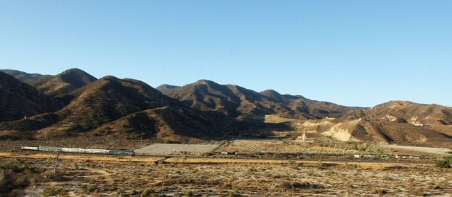
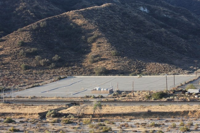
Vac Vic Lang Sta Rd Soledad Cyn, Acton, CA 93510

NEARBY LISTINGS FOR SALE OR LEASE
Property Detail
Vac Vic Lang Sta Rd Soledad Cyn
Los Angeles-Long Beach-Glendale, CA
THAT PART N OF S P R R R/W OF SW 1/4 OF NE 1/4 OF SEC 17 T 4N R 14W
3210-017-042
Los Angeles
Commercialacreage
California
D
17
06037C0865G
31.03 AC
2024
East LA County Outlying
2025
Los Angeles
910815
DEMOGRAPHICS near Vac Vic Lang Sta Rd Soledad Cyn
1 Mile
3 Mile
5 Mile
2024 Total Population
1,157
13,290
42,665
2029 Population
1,115
12,745
40,919
Pop Growth 2024-2029
(3.63%)
(4.10%)
(4.09%)
Average Age
42
40
38
2024 Total Households
348
4,139
13,465
HH Growth 2024-2029
(3.74%)
(4.35%)
(4.39%)
Median Household Inc
$151,119
$127,286
$102,890
Avg Household Size
3.20
3.20
3.10
2024 Avg HH Vehicles
3.00
3.00
2.00
Median Home Value
$755,703
$740,948
$705,250
Median Year Built
1994
1984
1987
Nearby Places
Map Layers
Map Styles
 Street
 Aerial
- Restaurants
- Banks
- Shops
- Fitness
- Groceries
PUBLIC TRANSPORTATION
COMMUTER RAIL
Via Princessa (Antelope Valley Line - Southern California Regional Rail Authority (Metrolink))
DRIVE
WALK
Distance
Via Princessa (Antelope Valley Line - Southern California Regional Rail Authority (Metrolink))
11 min
7.5 mi
Vista Canyon Metrolink Station (Metrolink Antelope Valley Line - Metrolink Trains)
DRIVE
WALK
Distance
Vista Canyon Metrolink Station (Metrolink Antelope Valley Line - Metrolink Trains)
13 min
8.4 mi
AIRPORT
Bob Hope
DRIVE
WALK
Distance
Bob Hope
33 min
26.1 mi
Freight Ports
Port of Long Beach
DRIVE
WALK
Distance
Port of Long Beach
76 min
62.5 mi
SALE & LEASE HISTORY
LISTING DATE
SALE/LEASE

Oct 06, 2016
For Sale
Nearby Properties
Address
Land Use
TOTAL SIZE
Lot Size
Zoning
Address
Land Use
TOTAL SIZE
Lot Size
Zoning
38,308 SF
2.04 AC
SCCC
Address
Land Use
TOTAL SIZE
Lot Size
Zoning
96,666 SF
9.19 AC
SCBP
Address
Land Use
TOTAL SIZE
Lot Size
Zoning
50,639 SF
3.50 AC
SCUR2
Address
Land Use
TOTAL SIZE
Lot Size
Zoning
165.83 AC
LCR1
Address
Land Use
TOTAL SIZE
Lot Size
Zoning
112.98 AC
LCA1
Address
Land Use
TOTAL SIZE
Lot Size
Zoning
43,605 SF
2.36 AC
SCUR2
Address
Land Use
TOTAL SIZE
Lot Size
Zoning
38,362 SF
2.07 AC
SCUR2
Address
Land Use
TOTAL SIZE
Lot Size
Zoning
148.76 AC
LCC3-A11-R
Address
Land Use
TOTAL SIZE
Lot Size
Zoning
24,700 SF
1.81 AC
SCUR3
Address
Land Use
TOTAL SIZE
Lot Size
Zoning
24,700 SF
1.29 AC
SCUR3
Address
Land Use
TOTAL SIZE
Lot Size
Zoning
38,308 SF
0.85 AC
SCCC
Address
Land Use
TOTAL SIZE
Lot Size
Zoning
Address
Land Use
TOTAL SIZE
Lot Size
Zoning
38,308 SF
0.39 AC
SCCC
Address
Land Use
TOTAL SIZE
Lot Size
Zoning
18,525 SF
1.69 AC
SCUR3
Address
Land Use
TOTAL SIZE
Lot Size
Zoning
24,627 SF
6.33 AC
SCOS
Address
Land Use
TOTAL SIZE
Lot Size
Zoning
7,166 SF
4.99 AC
SCNU5
Address
Land Use
TOTAL SIZE
Lot Size
Zoning
12,350 SF
0.60 AC
SCUR3
Address
Land Use
TOTAL SIZE
Lot Size
Zoning
1,175 SF
31.74 AC
LCRR1*
Address
Land Use
TOTAL SIZE
Lot Size
Zoning
252 SF
56 AC
SCOS
Address
Land Use
TOTAL SIZE
Lot Size
Zoning
27.30 AC
LCA21*
Address
Land Use
TOTAL SIZE
Lot Size
Zoning
25.20 AC
LCA21*
Address
Land Use
TOTAL SIZE
Lot Size
Zoning
2,438 SF
11.80 AC
LCA25*
Address
Land Use
TOTAL SIZE
Lot Size
Zoning
75.41 AC
LCA21Y
Address
Land Use
TOTAL SIZE
Lot Size
Zoning
2.26 AC
LCM1
Address
Land Use
TOTAL SIZE
Lot Size
Zoning
211.88 AC
LCA21*
Address
Land Use
TOTAL SIZE
Lot Size
Zoning
1.01 AC
LCA110000*
The World's #1 Commercial Real Estate Marketplace
Connect with us
© 2026 CoStar Group
The information above has been obtained from sources believed reliable. While we do not doubt its accuracy we have not verified it and make no guarantee, warranty or representation about it. It is your responsibility to independently confirm its accuracy and completeness. Any projections, opinions, assumptions, or estimates used are for example only and do not represent the current or future performance of the property. The value of this transaction to you depends on tax and other factors which should be evaluated by your tax, financial, and legal advisors. You and your advisors should conduct a careful, independent investigation of the property to determine to your satisfaction the suitability of the property for your needs.