Property Record
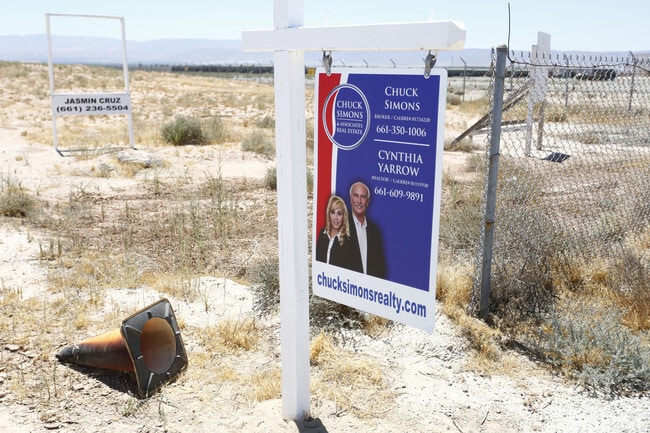
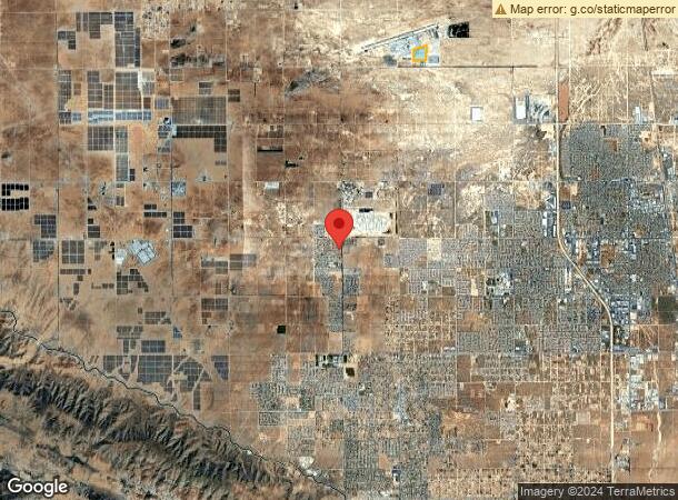
Vac Vic Runway Dr/45Th Stw, Lancaster, CA 93536

NEARBY LISTINGS FOR SALE OR LEASE
Property Detail
Vac Vic Runway Dr/45Th Stw
Los Angeles-Long Beach-Glendale, CA
Parcel Map 60819
3105-001-042
P M 325-44-45 LOT 4
Industrialacreage
Los Angeles
X
California
06037C0405F
4
2024
32.02 AC
2025
Antelope Valley
901214
Los Angeles
DEMOGRAPHICS near Vac Vic Runway Dr/45Th Stw
1 Mile
3 Mile
5 Mile
2024 Total Population
3
2,171
61,964
2029 Population
2
2,114
60,249
Pop Growth 2024-2029
(33.33%)
(2.63%)
(2.77%)
Average Age
0
37
38
2024 Total Households
1
691
19,792
HH Growth 2024-2029
0.00%
(2.89%)
(3.00%)
Median Household Inc
$0
$72,717
$76,226
Avg Household Size
.00
3.00
3.00
2024 Avg HH Vehicles
1.00
2.00
2.00
Median Home Value
$0
$423,863
$369,625
Median Year Built
0
2005
1987
Nearby Places
Map Layers
Map Styles
 Street
 Aerial
- Restaurants
- Banks
- Shops
- Fitness
- Groceries
PUBLIC TRANSPORTATION
COMMUTER RAIL
Lancaster (Antelope Valley Line - Southern California Regional Rail Authority (Metrolink))
DRIVE
WALK
Distance
Lancaster (Antelope Valley Line - Southern California Regional Rail Authority (Metrolink))
11 min
6.6 mi
Freight Ports
Port of Long Beach
DRIVE
WALK
Distance
Port of Long Beach
115 min
97.1 mi
Nearby Properties
Address
Land Use
TOTAL SIZE
Lot Size
Zoning
Address
Land Use
TOTAL SIZE
Lot Size
Zoning
46,328 SF
4.78 AC
LCR1 10000
Address
Land Use
TOTAL SIZE
Lot Size
Zoning
0.34 AC
LCA22*
Address
Land Use
TOTAL SIZE
Lot Size
Zoning
47,294 SF
4.45 AC
LRR315U*
Address
Land Use
TOTAL SIZE
Lot Size
Zoning
67,985 SF
3.34 AC
LCRA10000*
Address
Land Use
TOTAL SIZE
Lot Size
Zoning
221,325 SF
4.19 AC
LRA22*
Address
Land Use
TOTAL SIZE
Lot Size
Zoning
36,115 SF
13.25 AC
LCA210
Address
Land Use
TOTAL SIZE
Lot Size
Zoning
105,077 SF
13.27 AC
LCC1-LCR3*
Address
Land Use
TOTAL SIZE
Lot Size
Zoning
72,584 SF
2.01 AC
LCR1 10000
Address
Land Use
TOTAL SIZE
Lot Size
Zoning
27,821 SF
1.09 AC
LCR3P*
Address
Land Use
TOTAL SIZE
Lot Size
Zoning
41,990 SF
1.21 AC
LCR1 10000
Address
Land Use
TOTAL SIZE
Lot Size
Zoning
138,009 SF
12.01 AC
LCR3*
Address
Land Use
TOTAL SIZE
Lot Size
Zoning
44,160 SF
5.51 AC
LCR3-2DU-D
Address
Land Use
TOTAL SIZE
Lot Size
Zoning
21,873 SF
3.38 AC
LCA22*
Address
Land Use
TOTAL SIZE
Lot Size
Zoning
7,396 SF
1.34 AC
LCMX-DRU
Address
Land Use
TOTAL SIZE
Lot Size
Zoning
33,508 SF
6.51 AC
LRA22*
Address
Land Use
TOTAL SIZE
Lot Size
Zoning
72,020 SF
8.53 AC
LRR311U*
Address
Land Use
TOTAL SIZE
Lot Size
Zoning
19,401 SF
1.81 AC
LCC4
Address
Land Use
TOTAL SIZE
Lot Size
Zoning
77,586 SF
9.49 AC
LCR3*
Address
Land Use
TOTAL SIZE
Lot Size
Zoning
12.44 AC
PDC1*
Address
Land Use
TOTAL SIZE
Lot Size
Zoning
1,862 SF
9.24 AC
LRCP
Address
Land Use
TOTAL SIZE
Lot Size
Zoning
7,980 SF
0.70 AC
LCR1 10000
Address
Land Use
TOTAL SIZE
Lot Size
Zoning
38,410 SF
4.81 AC
LRA22*
Address
Land Use
TOTAL SIZE
Lot Size
Zoning
29,504 SF
0.74 AC
LCR1 10000
Address
Land Use
TOTAL SIZE
Lot Size
Zoning
18,821 SF
6.72 AC
LCR3*
Address
Land Use
TOTAL SIZE
Lot Size
Zoning
9,670 SF
0.93 AC
LCR1 10000
Address
Land Use
TOTAL SIZE
Lot Size
Zoning
50,403 SF
4.49 AC
LRRA10000*
Address
Land Use
TOTAL SIZE
Lot Size
Zoning
2,047 SF
0.58 AC
LCR1 10000
Address
Land Use
TOTAL SIZE
Lot Size
Zoning
13,392 SF
0.60 AC
LCR3
Address
Land Use
TOTAL SIZE
Lot Size
Zoning
3,280 SF
0.37 AC
LCC3*
The World's #1 Commercial Real Estate Marketplace
Connect with us
© 2026 CoStar Group
The information above has been obtained from sources believed reliable. While we do not doubt its accuracy we have not verified it and make no guarantee, warranty or representation about it. It is your responsibility to independently confirm its accuracy and completeness. Any projections, opinions, assumptions, or estimates used are for example only and do not represent the current or future performance of the property. The value of this transaction to you depends on tax and other factors which should be evaluated by your tax, financial, and legal advisors. You and your advisors should conduct a careful, independent investigation of the property to determine to your satisfaction the suitability of the property for your needs.