Property Record
Vac/88Th Ste Vic Ave, Littlerock, CA 93543


Save to a Folder
{{folder.Name}}
{{folder.ListingIds.length}} Properties
{{folder.ListingIds.length}} Property
Create a New Folder
Property Detail
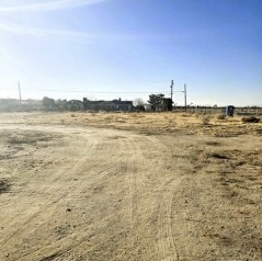
Vac/88Th Ste Vic Ave
Los Angeles-Long Beach-Glendale, CA
R S 64-50 EX OF ST LOT 24
3027-010-033
LOS ANGELES
Residentialacreage
California
LCRA10000*
24
C and X Area of minimal flood hazard, usually depicted on FIRMs as above the 500-year flood level.
1.06 AC
2025
NE LA County Outlying
2025
Los Angeles
910002
NEARBY LISTINGS FOR SALE OR LEASE
-
-
View all Littlerock listings for sale on LoopNet.com
DEMOGRAPHICS near Vac/88Th Ste Vic Ave
1 mile
3 mile
5 mile
2025 Total Population
1,333
16,448
50,687
2030 Population
1,339
16,612
50,568
Pop Growth 2025-2030
+ 0.45%
+ 1.00%
(0.23%)
Average Age
38
37
37
2025 Total Households
336
4,121
12,978
HH Growth 2025-2030
+ 0.30%
+ 0.95%
(0.35%)
Median Household Inc
$65,149
$75,498
$84,437
Avg Household Size
3.80
3.80
3.80
2025 Avg HH Vehicles
3.00
3.00
3.00
Median Home Value
$353,947
$395,946
$417,480
Median Year Built
1983
1990
1990
Nearby Places
Map Layers
Map Styles
 Street
 Aerial
Layers
 Traffic
 Biking
Places
Listings with unknown addresses are not visible on the map
- Restaurants
- Banks
- Shops
- Fitness
- Groceries
PUBLIC TRANSPORTATION
COMMUTER RAIL
Palmdale (Antelope Valley Line - Southern California Regional Rail Authority (Metrolink))
Drive
Walk
Distance
Palmdale (Antelope Valley Line - Southern California Regional Rail Authority (Metrolink))
14 min
9.3 mi
Freight Ports
Port of Long Beach
Drive
Walk
Distance
Port of Long Beach
111 min
91.1 mi
SALE & LEASE HISTORY
LISTING DATE
SALE/LEASE

Feb 12, 2025
For Sale
Nearby Properties
Address
Land Use
TOTAL SIZE
Lot Size
Zoning
Address
Land Use
TOTAL SIZE
Lot Size
Zoning
42,473 SF
12.98 AC
LCA11*
Address
Land Use
TOTAL SIZE
Lot Size
Zoning
111.72 AC
PDM4
Address
Land Use
TOTAL SIZE
Lot Size
Zoning
9,100 SF
1.83 AC
LCC4-A21*
Address
Land Use
TOTAL SIZE
Lot Size
Zoning
24,428 SF
1.54 AC
LCC4*
Address
Land Use
TOTAL SIZE
Lot Size
Zoning
116.63 AC
LCA11*
Address
Land Use
TOTAL SIZE
Lot Size
Zoning
12,984 SF
1.37 AC
LCA11*
Address
Land Use
TOTAL SIZE
Lot Size
Zoning
3,017 SF
2.05 AC
LCCPD
Address
Land Use
TOTAL SIZE
Lot Size
Zoning
80.12 AC
LCA21*
Address
Land Use
TOTAL SIZE
Lot Size
Zoning
2.49 AC
LCC4*
Address
Land Use
TOTAL SIZE
Lot Size
Zoning
7,277 SF
0.53 AC
LCA110000*
Address
Land Use
TOTAL SIZE
Lot Size
Zoning
23.89 AC
PDM4
Address
Land Use
TOTAL SIZE
Lot Size
Zoning
24.67 AC
PDA2*
Address
Land Use
TOTAL SIZE
Lot Size
Zoning
80.04 AC
PDLI
Address
Land Use
TOTAL SIZE
Lot Size
Zoning
39.67 AC
PDLI
Address
Land Use
TOTAL SIZE
Lot Size
Zoning
10.30 AC
PDR1
Address
Land Use
TOTAL SIZE
Lot Size
Zoning
5,430 SF
1.02 AC
LCC4*
Address
Land Use
TOTAL SIZE
Lot Size
Zoning
0.91 AC
LCA11*
Address
Land Use
TOTAL SIZE
Lot Size
Zoning
3,240 SF
6.46 AC
LCM111
Address
Land Use
TOTAL SIZE
Lot Size
Zoning
6,168 SF
0.97 AC
LCA11*
Address
Land Use
TOTAL SIZE
Lot Size
Zoning
0.88 AC
LCA11*
Address
Land Use
TOTAL SIZE
Lot Size
Zoning
3,378 SF
0.33 AC
LCC4*
Address
Land Use
TOTAL SIZE
Lot Size
Zoning
0.84 AC
LCA11*
Address
Land Use
TOTAL SIZE
Lot Size
Zoning
4.78 AC
LCC4-A21*
Address
Land Use
TOTAL SIZE
Lot Size
Zoning
16.62 AC
PDR1
Address
Land Use
TOTAL SIZE
Lot Size
Zoning
38.40 AC
PDA21*
Address
Land Use
TOTAL SIZE
Lot Size
Zoning
1.05 AC
LCA11*
Address
Land Use
TOTAL SIZE
Lot Size
Zoning
2.76 AC
LCC4*
Address
Land Use
TOTAL SIZE
Lot Size
Zoning
37.94 AC
LCA11*
Address
Land Use
TOTAL SIZE
Lot Size
Zoning
1.13 AC
LCA11*
Address
Land Use
TOTAL SIZE
Lot Size
Zoning
0.91 AC
LCA11*
The World's #1 Commercial Real Estate Marketplace
Connect with us
© 2026 CoStar Group
The information above has been obtained from sources believed reliable. While we do not doubt its accuracy we have not verified it and make no guarantee, warranty or representation about it. It is your responsibility to independently confirm its accuracy and completeness. Any projections, opinions, assumptions, or estimates used are for example only and do not represent the current or future performance of the property. The value of this transaction to you depends on tax and other factors which should be evaluated by your tax, financial, and legal advisors. You and your advisors should conduct a careful, independent investigation of the property to determine to your satisfaction the suitability of the property for your needs.