Property Record
Verne Roberts Cir, Antioch, CA 94509


Property Detail
Verne Roberts Cir
Oakland-Fremont-Berkeley, CA
MAP SUB MS 8-89
074-052-041-6
CONTRA COSTA
Commercialacreage
California
B and X Area of moderate flood hazard, usually the area between the limits of the 100-year and 500-year floods.
2.91 AC
2025
Antioch/Pittsburg
2025
East Bay/Oakland
307102
NEARBY LISTINGS FOR SALE OR LEASE
DEMOGRAPHICS near Verne Roberts Cir
1 mile
3 mile
5 mile
2025 Total Population
11,046
90,233
163,491
2030 Population
11,172
90,984
164,999
Pop Growth 2025-2030
+ 1.14%
+ 0.83%
+ 0.92%
Average Age
36
38
39
2025 Total Households
3,824
29,291
50,908
HH Growth 2025-2030
+ 1.18%
+ 0.88%
+ 0.95%
Median Household Inc
$64,680
$78,168
$89,742
Avg Household Size
2.80
3.00
3.10
2025 Avg HH Vehicles
2.00
2.00
2.00
Median Home Value
$442,915
$614,352
$665,797
Median Year Built
1974
1974
1980
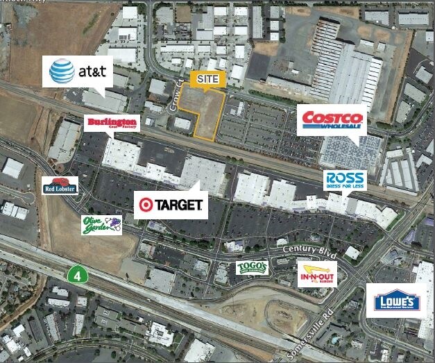
Nearby Places
Map Layers
Map Styles
 Street
 Aerial
Layers
 Traffic
 Biking
Places
Listings with unknown addresses are not visible on the map
- Restaurants
- Banks
- Shops
- Fitness
- Groceries
PUBLIC TRANSPORTATION
AIRPORT
Metro Oakland International
Drive
Walk
Distance
Metro Oakland International
56 min
42.2 mi
Freight Ports
Port of Oakland
Drive
Walk
Distance
Port of Oakland
46 min
35.0 mi
SALE & LEASE HISTORY
LISTING DATE
SALE/LEASE

Sep 24, 2016
For Sale
Nearby Properties
Address
Land Use
TOTAL SIZE
Lot Size
Zoning
Address
Land Use
TOTAL SIZE
Lot Size
Zoning
187.08 AC
Address
Land Use
TOTAL SIZE
Lot Size
Zoning
109,536 SF
24.93 AC
Address
Land Use
TOTAL SIZE
Lot Size
Zoning
29.68 AC
Address
Land Use
TOTAL SIZE
Lot Size
Zoning
198,470 SF
13.49 AC
Address
Land Use
TOTAL SIZE
Lot Size
Zoning
246.20 AC
Address
Land Use
TOTAL SIZE
Lot Size
Zoning
227,244 SF
10.50 AC
Address
Land Use
TOTAL SIZE
Lot Size
Zoning
3,472 SF
11.68 AC
Address
Land Use
TOTAL SIZE
Lot Size
Zoning
206,910 SF
10.10 AC
Address
Land Use
TOTAL SIZE
Lot Size
Zoning
157,250 SF
3.94 AC
Address
Land Use
TOTAL SIZE
Lot Size
Zoning
228,334 SF
30.34 AC
HI
Address
Land Use
TOTAL SIZE
Lot Size
Zoning
164,816 SF
8.72 AC
Address
Land Use
TOTAL SIZE
Lot Size
Zoning
107.94 AC
Address
Land Use
TOTAL SIZE
Lot Size
Zoning
119,482 SF
6.08 AC
Address
Land Use
TOTAL SIZE
Lot Size
Zoning
93,770 SF
14.35 AC
Address
Land Use
TOTAL SIZE
Lot Size
Zoning
2,352 SF
7.29 AC
Address
Land Use
TOTAL SIZE
Lot Size
Zoning
161,131 SF
15.97 AC
Address
Land Use
TOTAL SIZE
Lot Size
Zoning
6,284 SF
5.75 AC
Address
Land Use
TOTAL SIZE
Lot Size
Zoning
47,307 SF
6.70 AC
Address
Land Use
TOTAL SIZE
Lot Size
Zoning
16,775 SF
25.31 AC
Address
Land Use
TOTAL SIZE
Lot Size
Zoning
4,240 SF
11.04 AC
Address
Land Use
TOTAL SIZE
Lot Size
Zoning
204,831 SF
9.08 AC
Address
Land Use
TOTAL SIZE
Lot Size
Zoning
66,039 SF
2.33 AC
Address
Land Use
TOTAL SIZE
Lot Size
Zoning
2.06 AC
Address
Land Use
TOTAL SIZE
Lot Size
Zoning
91,344 SF
4.79 AC
R4
Address
Land Use
TOTAL SIZE
Lot Size
Zoning
5,584 SF
10.47 AC
Address
Land Use
TOTAL SIZE
Lot Size
Zoning
112,736 SF
1.78 AC
Address
Land Use
TOTAL SIZE
Lot Size
Zoning
880 SF
31.41 AC
Address
Land Use
TOTAL SIZE
Lot Size
Zoning
75,119 SF
3.26 AC
Address
Land Use
TOTAL SIZE
Lot Size
Zoning
137,208 SF
10.37 AC
Address
Land Use
TOTAL SIZE
Lot Size
Zoning
191,866 SF
4.40 AC
The World's #1 Commercial Real Estate Marketplace
Connect with us
© 2026 CoStar Group
The information above has been obtained from sources believed reliable. While we do not doubt its accuracy we have not verified it and make no guarantee, warranty or representation about it. It is your responsibility to independently confirm its accuracy and completeness. Any projections, opinions, assumptions, or estimates used are for example only and do not represent the current or future performance of the property. The value of this transaction to you depends on tax and other factors which should be evaluated by your tax, financial, and legal advisors. You and your advisors should conduct a careful, independent investigation of the property to determine to your satisfaction the suitability of the property for your needs.