Property Record
Vine St, Cumberland, MD 21502

Property Detail
Vine St
Other Market Areas
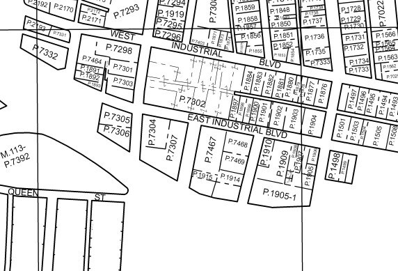
19 E INDUSTRIAL BLVD LOTS 40-41-51- 13 PT52 LAINGS 2ND ADDN
Cumberland, MD-WV
ALLEGANY
04-014367
Maryland
Commercialacreage
40,41
2025
0.11 AC
2025
Maryland West/Hagerstown
010100
NEARBY LISTINGS FOR SALE OR LEASE
DEMOGRAPHICS near Vine St
1 mile
3 mile
5 mile
2024 Total Population
7,235
30,574
40,900
2029 Population
7,185
30,513
40,597
Pop Growth 2024-2029
(0.69%)
(0.20%)
(0.74%)
Average Age
41
43
44
2024 Total Households
3,164
11,809
16,140
HH Growth 2024-2029
(0.95%)
(0.21%)
(0.83%)
Median Household Inc
$41,469
$50,246
$54,485
Avg Household Size
2.20
2.20
2.20
2024 Avg HH Vehicles
1.00
2.00
2.00
Median Home Value
$116,147
$137,035
$151,716
Median Year Built
1949
1950
1955
Nearby Places
Map Layers
Map Styles
 Street
 Aerial
Transit
 Traffic
 Biking
Places
Listings with unknown addresses are not visible on the map
- Restaurants
- Banks
- Shops
- Fitness
- Groceries
PUBLIC TRANSPORTATION
COMMUTER RAIL
Cumberland Amtrak Station (Capitol Limited - Amtrak)
Drive
Walk
Distance
Cumberland Amtrak Station (Capitol Limited - Amtrak)
3 min
1.9 mi
Freight Ports
Port of Baltimore
Drive
Walk
Distance
Port of Baltimore
159 min
140.0 mi
Nearby Properties
Address
Land Use
TOTAL SIZE
Lot Size
Zoning
Address
Land Use
TOTAL SIZE
Lot Size
Zoning
11,700 SF
35.95 AC
G
Address
Land Use
TOTAL SIZE
Lot Size
Zoning
88,600 SF
170.96 AC
Address
Land Use
TOTAL SIZE
Lot Size
Zoning
40,845 SF
26.24 AC
R-O
Address
Land Use
TOTAL SIZE
Lot Size
Zoning
192,770 SF
43.84 AC
Address
Land Use
TOTAL SIZE
Lot Size
Zoning
607,177 SF
90.68 AC
Address
Land Use
TOTAL SIZE
Lot Size
Zoning
45,960 SF
308.49 AC
G
Address
Land Use
TOTAL SIZE
Lot Size
Zoning
120,680 SF
0.64 AC
Address
Land Use
TOTAL SIZE
Lot Size
Zoning
8,712 SF
65.19 AC
Address
Land Use
TOTAL SIZE
Lot Size
Zoning
708 SF
52.22 AC
Address
Land Use
TOTAL SIZE
Lot Size
Zoning
184,242 SF
18.50 AC
R-L
Address
Land Use
TOTAL SIZE
Lot Size
Zoning
117,090 SF
25.38 AC
Address
Land Use
TOTAL SIZE
Lot Size
Zoning
64,000 SF
4.57 AC
Address
Land Use
TOTAL SIZE
Lot Size
Zoning
56,963 SF
3.17 AC
Address
Land Use
TOTAL SIZE
Lot Size
Zoning
151,773 SF
4.48 AC
Address
Land Use
TOTAL SIZE
Lot Size
Zoning
67,844 SF
11.25 AC
Address
Land Use
TOTAL SIZE
Lot Size
Zoning
11,400 SF
47.37 AC
Address
Land Use
TOTAL SIZE
Lot Size
Zoning
38,489 SF
1.46 AC
B-CBD
Address
Land Use
TOTAL SIZE
Lot Size
Zoning
7,452 SF
5.46 AC
Address
Land Use
TOTAL SIZE
Lot Size
Zoning
48,041 SF
3.62 AC
Address
Land Use
TOTAL SIZE
Lot Size
Zoning
20,000 SF
8.69 AC
Address
Land Use
TOTAL SIZE
Lot Size
Zoning
63,412 SF
5.45 AC
R-PUD
Address
Land Use
TOTAL SIZE
Lot Size
Zoning
65,676 SF
17.50 AC
B-L
Address
Land Use
TOTAL SIZE
Lot Size
Zoning
61,486 SF
5.94 AC
Address
Land Use
TOTAL SIZE
Lot Size
Zoning
50,040 SF
1.52 AC
B-CBD
Address
Land Use
TOTAL SIZE
Lot Size
Zoning
56,988 SF
0.34 AC
Address
Land Use
TOTAL SIZE
Lot Size
Zoning
79,296 SF
2.06 AC
R-L
Address
Land Use
TOTAL SIZE
Lot Size
Zoning
59,849 SF
25 AC
R-PUD
Address
Land Use
TOTAL SIZE
Lot Size
Zoning
109,875 SF
39.52 AC
R-S
Address
Land Use
TOTAL SIZE
Lot Size
Zoning
36,794 SF
3.95 AC
I-C
Address
Land Use
TOTAL SIZE
Lot Size
Zoning
980 SF
26.56 AC
The World's #1 Commercial Real Estate Marketplace
Connect with us
© 2026 CoStar Group
The information above has been obtained from sources believed reliable. While we do not doubt its accuracy we have not verified it and make no guarantee, warranty or representation about it. It is your responsibility to independently confirm its accuracy and completeness. Any projections, opinions, assumptions, or estimates used are for example only and do not represent the current or future performance of the property. The value of this transaction to you depends on tax and other factors which should be evaluated by your tax, financial, and legal advisors. You and your advisors should conduct a careful, independent investigation of the property to determine to your satisfaction the suitability of the property for your needs.