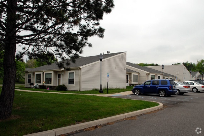
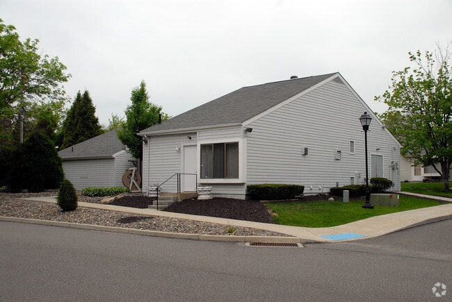
Property Record
Vine St, Hazleton, PA 18202

Property Detail
Vine St
Scranton--Wilkes-Barre, PA
26-C-R2-526-D1-D48-1 VINE ST
26-S8S10A-009-01A-000
LUZERNE
Apartment
Pennsylvania
AE The base floodplain where base flood elevations are provided. AE Zones are now used on new format FIRMs instead of A1-A30 Zones.
1a
2025
9.45 AC
2026
Outlying Luzerne County
217900
Philadelphia
NEARBY LISTINGS FOR SALE OR LEASE
-
-
View all Hazleton listings for sale on LoopNet.com
DEMOGRAPHICS near Vine St
1 mile
3 mile
5 mile
2025 Total Population
6,721
43,721
55,067
2030 Population
6,682
44,067
55,500
Pop Growth 2025-2030
(0.58%)
+ 0.79%
+ 0.79%
Average Age
40
39
40
2025 Total Households
2,583
16,398
21,131
HH Growth 2025-2030
(0.58%)
+ 0.86%
+ 0.83%
Median Household Inc
$49,222
$46,160
$52,391
Avg Household Size
2.50
2.60
2.50
2025 Avg HH Vehicles
2.00
1.00
2.00
Median Home Value
$184,434
$174,546
$189,004
Median Year Built
1964
1954
1958
Nearby Places
Map Layers
Map Styles
 Street
 Aerial
Layers
 Traffic
 Biking
Places
Listings with unknown addresses are not visible on the map
- Restaurants
- Banks
- Shops
- Fitness
- Groceries
PUBLIC TRANSPORTATION
AIRPORT
Wilkes-Barre/Scranton International
Drive
Walk
Distance
Wilkes-Barre/Scranton International
47 min
32.6 mi
Freight Ports
Port of Philadelphia
Drive
Walk
Distance
Port of Philadelphia
132 min
100.4 mi
Nearby Properties
Address
Land Use
TOTAL SIZE
Lot Size
Zoning
Address
Land Use
TOTAL SIZE
Lot Size
Zoning
63.03 AC
Address
Land Use
TOTAL SIZE
Lot Size
Zoning
75.45 AC
Address
Land Use
TOTAL SIZE
Lot Size
Zoning
59.39 AC
Address
Land Use
TOTAL SIZE
Lot Size
Zoning
17.47 AC
Address
Land Use
TOTAL SIZE
Lot Size
Zoning
529.84 AC
Address
Land Use
TOTAL SIZE
Lot Size
Zoning
33.38 AC
Address
Land Use
TOTAL SIZE
Lot Size
Zoning
10.20 AC
Address
Land Use
TOTAL SIZE
Lot Size
Zoning
9.14 AC
Address
Land Use
TOTAL SIZE
Lot Size
Zoning
8.29 AC
Address
Land Use
TOTAL SIZE
Lot Size
Zoning
19.82 AC
Address
Land Use
TOTAL SIZE
Lot Size
Zoning
33.73 AC
Address
Land Use
TOTAL SIZE
Lot Size
Zoning
10.83 AC
Address
Land Use
TOTAL SIZE
Lot Size
Zoning
54.12 AC
Address
Land Use
TOTAL SIZE
Lot Size
Zoning
Address
Land Use
TOTAL SIZE
Lot Size
Zoning
12.21 AC
Address
Land Use
TOTAL SIZE
Lot Size
Zoning
13.68 AC
Address
Land Use
TOTAL SIZE
Lot Size
Zoning
Address
Land Use
TOTAL SIZE
Lot Size
Zoning
25.48 AC
Address
Land Use
TOTAL SIZE
Lot Size
Zoning
Address
Land Use
TOTAL SIZE
Lot Size
Zoning
23.17 AC
Address
Land Use
TOTAL SIZE
Lot Size
Zoning
12.25 AC
Address
Land Use
TOTAL SIZE
Lot Size
Zoning
14.10 AC
Address
Land Use
TOTAL SIZE
Lot Size
Zoning
Address
Land Use
TOTAL SIZE
Lot Size
Zoning
0.72 AC
Address
Land Use
TOTAL SIZE
Lot Size
Zoning
14.15 AC
Address
Land Use
TOTAL SIZE
Lot Size
Zoning
5.04 AC
Address
Land Use
TOTAL SIZE
Lot Size
Zoning
4.56 AC
Address
Land Use
TOTAL SIZE
Lot Size
Zoning
15.30 AC
Address
Land Use
TOTAL SIZE
Lot Size
Zoning
0.34 AC
Address
Land Use
TOTAL SIZE
Lot Size
Zoning
55.38 AC
The World's #1 Commercial Real Estate Marketplace
Connect with us
© 2026 CoStar Group
The information above has been obtained from sources believed reliable. While we do not doubt its accuracy we have not verified it and make no guarantee, warranty or representation about it. It is your responsibility to independently confirm its accuracy and completeness. Any projections, opinions, assumptions, or estimates used are for example only and do not represent the current or future performance of the property. The value of this transaction to you depends on tax and other factors which should be evaluated by your tax, financial, and legal advisors. You and your advisors should conduct a careful, independent investigation of the property to determine to your satisfaction the suitability of the property for your needs.