Property Record
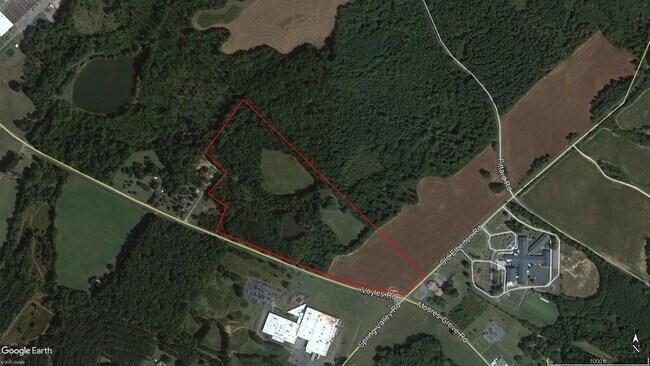
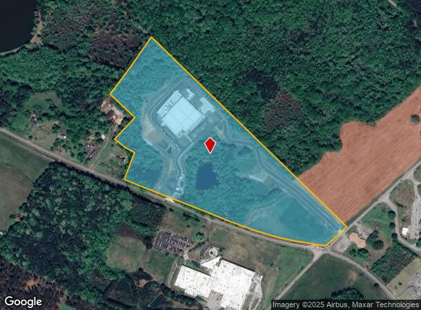
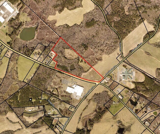
1233 Voyles Rd, Winterville, GA 30683

NEARBY LISTINGS FOR SALE OR LEASE
Property Detail
1233 Voyles Rd
222-010
Com-St-020->15-25
Industrialgeneral
DEEDED ACS: 47.509
AE
Clarke
13059C0018E
Georgia
2025
43.36 AC
2025
East Athens
140500
Other Market Areas
71,472 SF
Athens-Clarke County, GA
DEMOGRAPHICS near 1233 Voyles Rd
1 Mile
3 Mile
5 Mile
2024 Total Population
291
10,666
58,788
2029 Population
285
11,012
60,103
Pop Growth 2024-2029
(2.06%)
+ 3.24%
+ 2.24%
Average Age
40
39
35
2024 Total Households
111
4,017
22,914
HH Growth 2024-2029
(2.70%)
+ 3.21%
+ 2.01%
Median Household Inc
$43,749
$57,470
$44,638
Avg Household Size
2.60
2.60
2.30
2024 Avg HH Vehicles
2.00
2.00
2.00
Median Home Value
$207,143
$165,375
$179,493
Median Year Built
1985
1987
1988
Nearby Places
- Restaurants
- Banks
- Shops
- Fitness
- Groceries
SALE & LEASE HISTORY
LISTING DATE
SALE/LEASE

Jan 20, 2022
For Sale
Apr 15, 2020
For Sale
Nearby Properties
Address
Land Use
TOTAL SIZE
Lot Size
Zoning
Address
Land Use
TOTAL SIZE
Lot Size
Zoning
1,403 SF
21.64 AC
C-G
Address
Land Use
TOTAL SIZE
Lot Size
Zoning
3.16 AC
E-I
Address
Land Use
TOTAL SIZE
Lot Size
Zoning
2,856 SF
39.78 AC
C-G
Address
Land Use
TOTAL SIZE
Lot Size
Zoning
124,959 SF
20.54 AC
E-I
Address
Land Use
TOTAL SIZE
Lot Size
Zoning
2,880 SF
36.84 AC
RM-1
Address
Land Use
TOTAL SIZE
Lot Size
Zoning
140,375 SF
26.15 AC
E-I
Address
Land Use
TOTAL SIZE
Lot Size
Zoning
46.26 AC
G
Address
Land Use
TOTAL SIZE
Lot Size
Zoning
Address
Land Use
TOTAL SIZE
Lot Size
Zoning
14,000 SF
42.62 AC
E-I
Address
Land Use
TOTAL SIZE
Lot Size
Zoning
4,392 SF
11.79 AC
C-G
Address
Land Use
TOTAL SIZE
Lot Size
Zoning
26,100 SF
18.59 AC
C-G
Address
Land Use
TOTAL SIZE
Lot Size
Zoning
262,387 SF
16.45 AC
E-I
Address
Land Use
TOTAL SIZE
Lot Size
Zoning
47,928 SF
80.47 AC
E-I
Address
Land Use
TOTAL SIZE
Lot Size
Zoning
16,800 SF
454.45 AC
G
Address
Land Use
TOTAL SIZE
Lot Size
Zoning
124,136 SF
19.82 AC
C-G (PD)
Address
Land Use
TOTAL SIZE
Lot Size
Zoning
18.38 AC
G
Address
Land Use
TOTAL SIZE
Lot Size
Zoning
67,768 SF
40 AC
E-I
Address
Land Use
TOTAL SIZE
Lot Size
Zoning
258,200 SF
16.49 AC
E-I
Address
Land Use
TOTAL SIZE
Lot Size
Zoning
16.63 AC
G
Address
Land Use
TOTAL SIZE
Lot Size
Zoning
327,319 SF
24.46 AC
E-I
Address
Land Use
TOTAL SIZE
Lot Size
Zoning
8,664 SF
103.89 AC
E-I
Address
Land Use
TOTAL SIZE
Lot Size
Zoning
31.44 AC
G
Address
Land Use
TOTAL SIZE
Lot Size
Zoning
268,400 SF
34.23 AC
I
Address
Land Use
TOTAL SIZE
Lot Size
Zoning
222,180 SF
17.08 AC
E-I
Address
Land Use
TOTAL SIZE
Lot Size
Zoning
16.17 AC
G
Address
Land Use
TOTAL SIZE
Lot Size
Zoning
13,320 SF
60.89 AC
C-G
Address
Land Use
TOTAL SIZE
Lot Size
Zoning
197,738 SF
60.92 AC
E-I
Address
Land Use
TOTAL SIZE
Lot Size
Zoning
69,310 SF
18.55 AC
E-I
Address
Land Use
TOTAL SIZE
Lot Size
Zoning
139,916 SF
21.30 AC
E-I
The World's #1 Commercial Real Estate Marketplace
Connect with us
© 2025 CoStar Group
The information above has been obtained from sources believed reliable. While we do not doubt its accuracy we have not verified it and make no guarantee, warranty or representation about it. It is your responsibility to independently confirm its accuracy and completeness. Any projections, opinions, assumptions, or estimates used are for example only and do not represent the current or future performance of the property. The value of this transaction to you depends on tax and other factors which should be evaluated by your tax, financial, and legal advisors. You and your advisors should conduct a careful, independent investigation of the property to determine to your satisfaction the suitability of the property for your needs.