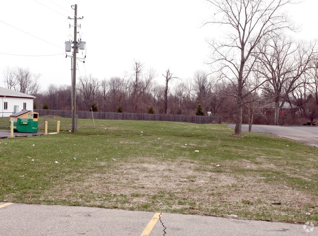
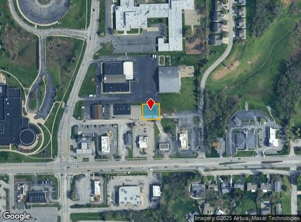
Property Record
7226 W 10Th St, Indianapolis, IN 46214
NEARBY LISTINGS FOR SALE OR LEASE
Property Detail
7226 W 10Th St
49-05-35-101-037.000-982
PT SW1/4 S35 T16 R2 BEG SW COR E350.33, N285.99 TO POB; W76, N95.01, E107, S93, SWLY ALONG ARC 31.08 TO POB. 0.241 AC.
Commercialacreage
Marion
X
Indiana
18097C0118F
2
2023
0.24 AC
2024
Speedway
340901
Indianapolis
5,400 SF
Indianapolis-Carmel-Anderson, IN
DEMOGRAPHICS near 7226 W 10Th St
1 Mile
3 Mile
5 Mile
2024 Total Population
11,162
89,472
204,517
2029 Population
10,915
88,529
205,932
Pop Growth 2024-2029
(2.21%)
(1.05%)
+ 0.69%
Average Age
39
37
36
2024 Total Households
4,434
36,156
79,019
HH Growth 2024-2029
(2.05%)
(1.16%)
+ 0.48%
Median Household Inc
$58,341
$54,085
$54,772
Avg Household Size
2.50
2.40
2.50
2024 Avg HH Vehicles
2.00
2.00
2.00
Median Home Value
$157,779
$158,809
$153,750
Median Year Built
1970
1976
1976
Nearby Places
Map Layers
Map Styles
 Street
 Aerial
- Restaurants
- Banks
- Shops
- Fitness
- Groceries
PUBLIC TRANSPORTATION
COMMUTER RAIL
DRIVE
WALK
Distance
17 min
9.4 mi
AIRPORT
Indianapolis International
DRIVE
WALK
Distance
Indianapolis International
21 min
8.8 mi
SALE & LEASE HISTORY
LISTING DATE
SALE/LEASE

Sep 24, 2016
For Sale
Nearby Properties
Address
Land Use
TOTAL SIZE
Lot Size
Zoning
Address
Land Use
TOTAL SIZE
Lot Size
Zoning
1,340,481 SF
63.99 AC
ZO01
Address
Land Use
TOTAL SIZE
Lot Size
Zoning
315,254 SF
48.71 AC
Address
Land Use
TOTAL SIZE
Lot Size
Zoning
6,486 SF
17.63 AC
Address
Land Use
TOTAL SIZE
Lot Size
Zoning
80,249 SF
71.96 AC
ZO01
Address
Land Use
TOTAL SIZE
Lot Size
Zoning
5,280 SF
97.87 AC
ZO01
Address
Land Use
TOTAL SIZE
Lot Size
Zoning
4,515 SF
23.95 AC
ZO01
Address
Land Use
TOTAL SIZE
Lot Size
Zoning
18,072 SF
29.73 AC
Address
Land Use
TOTAL SIZE
Lot Size
Zoning
1,413,414 SF
115.43 AC
ZO01
Address
Land Use
TOTAL SIZE
Lot Size
Zoning
145,816 SF
1.07 AC
Address
Land Use
TOTAL SIZE
Lot Size
Zoning
415,877 SF
55.83 AC
ZO01
Address
Land Use
TOTAL SIZE
Lot Size
Zoning
578,964 SF
35.50 AC
ZO01
Address
Land Use
TOTAL SIZE
Lot Size
Zoning
3,827 SF
24.15 AC
ZO01
Address
Land Use
TOTAL SIZE
Lot Size
Zoning
1,889,477 SF
89.82 AC
ZO01
Address
Land Use
TOTAL SIZE
Lot Size
Zoning
3,348 SF
32.01 AC
ZO01
Address
Land Use
TOTAL SIZE
Lot Size
Zoning
27,327 SF
15 AC
Address
Land Use
TOTAL SIZE
Lot Size
Zoning
1,904 SF
47.31 AC
ZO01
Address
Land Use
TOTAL SIZE
Lot Size
Zoning
19,314 SF
32.88 AC
ZO01
Address
Land Use
TOTAL SIZE
Lot Size
Zoning
2,737 SF
9.65 AC
Address
Land Use
TOTAL SIZE
Lot Size
Zoning
3,878 SF
17.76 AC
Address
Land Use
TOTAL SIZE
Lot Size
Zoning
438,643 SF
43.63 AC
ZO01
Address
Land Use
TOTAL SIZE
Lot Size
Zoning
7,364 SF
9.20 AC
Address
Land Use
TOTAL SIZE
Lot Size
Zoning
Address
Land Use
TOTAL SIZE
Lot Size
Zoning
3,618 SF
31.13 AC
ZO01
Address
Land Use
TOTAL SIZE
Lot Size
Zoning
30,545 SF
3.41 AC
ZO01
Address
Land Use
TOTAL SIZE
Lot Size
Zoning
3,706 SF
30.57 AC
ZO01
Address
Land Use
TOTAL SIZE
Lot Size
Zoning
1,868 SF
14.50 AC
ZO01
Address
Land Use
TOTAL SIZE
Lot Size
Zoning
28,400 SF
22.04 AC
ZO01
Address
Land Use
TOTAL SIZE
Lot Size
Zoning
73,528 SF
80 AC
ZO01
Address
Land Use
TOTAL SIZE
Lot Size
Zoning
2,000 SF
57.60 AC
ZO01
Address
Land Use
TOTAL SIZE
Lot Size
Zoning
1,700 SF
40.37 AC
ZO01
The World's #1 Commercial Real Estate Marketplace
Connect with us
© 2025 CoStar Group
The information above has been obtained from sources believed reliable. While we do not doubt its accuracy we have not verified it and make no guarantee, warranty or representation about it. It is your responsibility to independently confirm its accuracy and completeness. Any projections, opinions, assumptions, or estimates used are for example only and do not represent the current or future performance of the property. The value of this transaction to you depends on tax and other factors which should be evaluated by your tax, financial, and legal advisors. You and your advisors should conduct a careful, independent investigation of the property to determine to your satisfaction the suitability of the property for your needs.