Property Record
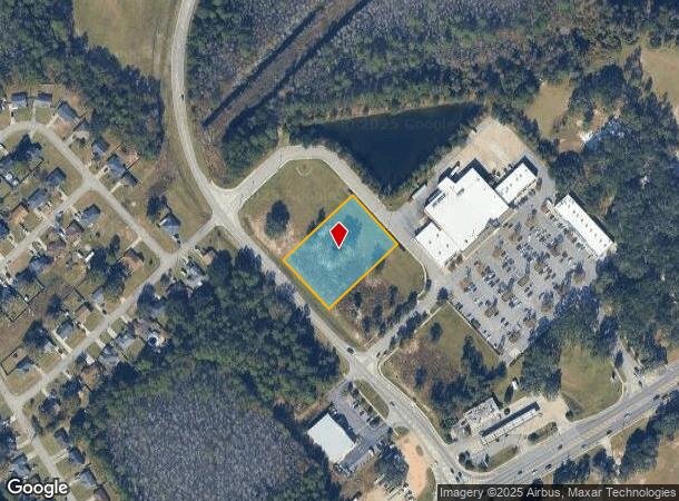
W 15Th Wythe St, Hinesville, GA 31313
NEARBY LISTINGS FOR SALE OR LEASE
Property Detail
W 15Th Wythe St
Hinesville, GA
Gmass Commercial
037A-005
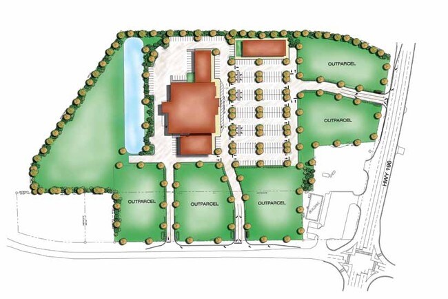
OUT PARCEL E E/S 15TH ST EXT
Commercialacreage
Liberty
X
Georgia
13179C0210E
1.30 AC
2024
Liberty County
2024
Savannah
010205
DEMOGRAPHICS near W 15Th Wythe St
1 Mile
3 Mile
5 Mile
2024 Total Population
2,154
28,786
51,646
2029 Population
2,267
30,951
56,173
Pop Growth 2024-2029
+ 5.25%
+ 7.52%
+ 8.77%
Average Age
31
32
33
2024 Total Households
743
10,465
18,435
HH Growth 2024-2029
+ 5.52%
+ 7.28%
+ 8.69%
Median Household Inc
$56,823
$50,383
$48,343
Avg Household Size
2.80
2.70
2.70
2024 Avg HH Vehicles
2.00
2.00
2.00
Median Home Value
$160,597
$147,373
$153,041
Median Year Built
1999
1992
1992
Nearby Places
- Restaurants
- Banks
- Shops
- Fitness
- Groceries
SALE & LEASE HISTORY
LISTING DATE
SALE/LEASE

Sep 24, 2016
For Sale
Apr 09, 2018
For Sale
Nearby Properties
Address
Land Use
TOTAL SIZE
Lot Size
Zoning
Address
Land Use
TOTAL SIZE
Lot Size
Zoning
258,552 SF
41.57 AC
PUD
Address
Land Use
TOTAL SIZE
Lot Size
Zoning
24,288 SF
12.05 AC
PUD
Address
Land Use
TOTAL SIZE
Lot Size
Zoning
148,364 SF
18.53 AC
PUD
Address
Land Use
TOTAL SIZE
Lot Size
Zoning
11,944 SF
39.41 AC
LI
Address
Land Use
TOTAL SIZE
Lot Size
Zoning
81,366 SF
28.01 AC
R20
Address
Land Use
TOTAL SIZE
Lot Size
Zoning
1,884 SF
9.25 AC
C2
Address
Land Use
TOTAL SIZE
Lot Size
Zoning
81,366 SF
35.17 AC
R8
Address
Land Use
TOTAL SIZE
Lot Size
Zoning
81,366 SF
16.50 AC
R20
Address
Land Use
TOTAL SIZE
Lot Size
Zoning
71,899 SF
50.12 AC
LI
Address
Land Use
TOTAL SIZE
Lot Size
Zoning
155,001 SF
10.56 AC
MFR
Address
Land Use
TOTAL SIZE
Lot Size
Zoning
53,103 SF
34.03 AC
I1
Address
Land Use
TOTAL SIZE
Lot Size
Zoning
12,261 SF
10.99 AC
C2
Address
Land Use
TOTAL SIZE
Lot Size
Zoning
39,252 SF
4.93 AC
MFR
Address
Land Use
TOTAL SIZE
Lot Size
Zoning
14,274 SF
6.34 AC
MFR
Address
Land Use
TOTAL SIZE
Lot Size
Zoning
13,500 SF
4.90 AC
LI
Address
Land Use
TOTAL SIZE
Lot Size
Zoning
8,520 SF
5.87 AC
C3
Address
Land Use
TOTAL SIZE
Lot Size
Zoning
9,320 SF
6.74 AC
C2/C3
Address
Land Use
TOTAL SIZE
Lot Size
Zoning
31.34 AC
C3/R8
Address
Land Use
TOTAL SIZE
Lot Size
Zoning
777 SF
5.97 AC
MFR
Address
Land Use
TOTAL SIZE
Lot Size
Zoning
1,520 SF
5.51 AC
C2
Address
Land Use
TOTAL SIZE
Lot Size
Zoning
29,704 SF
3.09 AC
AR1
Address
Land Use
TOTAL SIZE
Lot Size
Zoning
17,000 SF
1.99 AC
C3
Address
Land Use
TOTAL SIZE
Lot Size
Zoning
12,000 SF
4.14 AC
AR1
Address
Land Use
TOTAL SIZE
Lot Size
Zoning
46,592 SF
10.49 AC
MFR
Address
Land Use
TOTAL SIZE
Lot Size
Zoning
2,000 SF
69 AC
LI
Address
Land Use
TOTAL SIZE
Lot Size
Zoning
27,129 SF
7.29 AC
LI
Address
Land Use
TOTAL SIZE
Lot Size
Zoning
1,078 SF
8 AC
MFR
Address
Land Use
TOTAL SIZE
Lot Size
Zoning
76.06 AC
LI
Address
Land Use
TOTAL SIZE
Lot Size
Zoning
25,640 SF
1.43 AC
C2
Address
Land Use
TOTAL SIZE
Lot Size
Zoning
17,218 SF
2.28 AC
MFR
The World's #1 Commercial Real Estate Marketplace
Connect with us
© 2025 CoStar Group
The information above has been obtained from sources believed reliable. While we do not doubt its accuracy we have not verified it and make no guarantee, warranty or representation about it. It is your responsibility to independently confirm its accuracy and completeness. Any projections, opinions, assumptions, or estimates used are for example only and do not represent the current or future performance of the property. The value of this transaction to you depends on tax and other factors which should be evaluated by your tax, financial, and legal advisors. You and your advisors should conduct a careful, independent investigation of the property to determine to your satisfaction the suitability of the property for your needs.