Property Record
4841 W 18Th Ave, Eugene, OR 97402
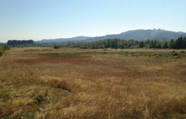

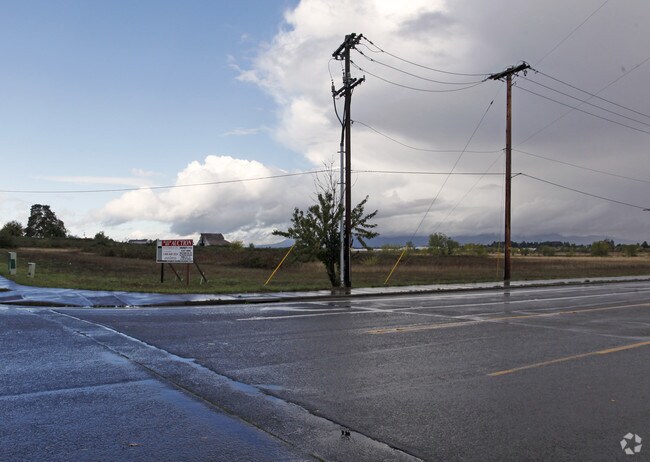

Property Detail
4841 W 18Th Ave
Eugene-Springfield, OR
PLAT 2000-P1398 PARCEL 3 TL 100
1655487
Lane
Multifamilydwelling
Oregon
NR
100
B and X Area of moderate flood hazard, usually the area between the limits of the 100-year and 500-year floods.
12.07 AC
2025
Lane County
2025
Portland
001002
NEARBY LISTINGS FOR SALE OR LEASE
-
-
-
-
-
-
-
-
-
Westgate Loop Loop @ S Danebo Avenue
Eugene, OR 97402
$554,000 - $18,652,762
1.34 - 7.98 AC Lot
Land
-
-
-
-
View all Eugene listings for sale on LoopNet.com
DEMOGRAPHICS near 4841 W 18Th Ave
1 mile
3 mile
5 mile
2025 Total Population
2,645
44,001
125,615
2030 Population
2,648
43,517
124,459
Pop Growth 2025-2030
+ 0.11%
(1.10%)
(0.92%)
Average Age
41
41
40
2025 Total Households
1,087
16,766
52,865
HH Growth 2025-2030
+ 0.28%
(1.26%)
(1.00%)
Median Household Inc
$62,916
$66,523
$60,818
Avg Household Size
2.30
2.30
2.20
2025 Avg HH Vehicles
2.00
2.00
2.00
Median Home Value
$513,227
$389,453
$434,261
Median Year Built
1986
1978
1975
Nearby Places
Map Layers
Map Styles
 Street
 Aerial
Transit
 Traffic
 Biking
Places
Listings with unknown addresses are not visible on the map
- Restaurants
- Banks
- Shops
- Fitness
- Groceries
PUBLIC TRANSPORTATION
COMMUTER RAIL
Eugene (Amtrak Cascades - Amtrak, Coast Starlight - Amtrak)
Drive
Walk
Distance
Eugene (Amtrak Cascades - Amtrak, Coast Starlight - Amtrak)
10 min
5.3 mi
AIRPORT
Mahlon Sweet Field
Drive
Walk
Distance
Mahlon Sweet Field
15 min
8.3 mi
Freight Ports
Port of Coos Bay, OR
Drive
Walk
Distance
Port of Coos Bay, OR
144 min
104.3 mi
SALE & LEASE HISTORY
LISTING DATE
SALE/LEASE

Sep 24, 2016
For Sale
Nearby Properties
Address
Land Use
TOTAL SIZE
Lot Size
Zoning
Address
Land Use
TOTAL SIZE
Lot Size
Zoning
44.56 AC
PL
Address
Land Use
TOTAL SIZE
Lot Size
Zoning
Address
Land Use
TOTAL SIZE
Lot Size
Zoning
12.12 AC
C-2
Address
Land Use
TOTAL SIZE
Lot Size
Zoning
45.78 AC
I-3
Address
Land Use
TOTAL SIZE
Lot Size
Zoning
75.36 AC
PL
Address
Land Use
TOTAL SIZE
Lot Size
Zoning
14.14 AC
R-1
Address
Land Use
TOTAL SIZE
Lot Size
Zoning
19.65 AC
C-2
Address
Land Use
TOTAL SIZE
Lot Size
Zoning
3,324 SF
8.70 AC
NR
Address
Land Use
TOTAL SIZE
Lot Size
Zoning
29.96 AC
AG
Address
Land Use
TOTAL SIZE
Lot Size
Zoning
Address
Land Use
TOTAL SIZE
Lot Size
Zoning
Address
Land Use
TOTAL SIZE
Lot Size
Zoning
13.14 AC
I-2
Address
Land Use
TOTAL SIZE
Lot Size
Zoning
4.97 AC
I-3
Address
Land Use
TOTAL SIZE
Lot Size
Zoning
10.50 AC
C-2
Address
Land Use
TOTAL SIZE
Lot Size
Zoning
5.13 AC
I-3
Address
Land Use
TOTAL SIZE
Lot Size
Zoning
3.12 AC
I-2
Address
Land Use
TOTAL SIZE
Lot Size
Zoning
12.30 AC
C-2
Address
Land Use
TOTAL SIZE
Lot Size
Zoning
Address
Land Use
TOTAL SIZE
Lot Size
Zoning
16.18 AC
E-1
Address
Land Use
TOTAL SIZE
Lot Size
Zoning
11.13 AC
C-2
Address
Land Use
TOTAL SIZE
Lot Size
Zoning
25.02 AC
PL
Address
Land Use
TOTAL SIZE
Lot Size
Zoning
560 SF
11.02 AC
I-2
Address
Land Use
TOTAL SIZE
Lot Size
Zoning
2.32 AC
E-2
Address
Land Use
TOTAL SIZE
Lot Size
Zoning
13.55 AC
R-1
Address
Land Use
TOTAL SIZE
Lot Size
Zoning
9.46 AC
C-2
Address
Land Use
TOTAL SIZE
Lot Size
Zoning
13.64 AC
R-1
Address
Land Use
TOTAL SIZE
Lot Size
Zoning
3,980 SF
85.16 AC
AG
Address
Land Use
TOTAL SIZE
Lot Size
Zoning
2.93 AC
I-3
Address
Land Use
TOTAL SIZE
Lot Size
Zoning
8.53 AC
E-1
The World's #1 Commercial Real Estate Marketplace
Connect with us
© 2026 CoStar Group
The information above has been obtained from sources believed reliable. While we do not doubt its accuracy we have not verified it and make no guarantee, warranty or representation about it. It is your responsibility to independently confirm its accuracy and completeness. Any projections, opinions, assumptions, or estimates used are for example only and do not represent the current or future performance of the property. The value of this transaction to you depends on tax and other factors which should be evaluated by your tax, financial, and legal advisors. You and your advisors should conduct a careful, independent investigation of the property to determine to your satisfaction the suitability of the property for your needs.