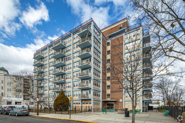
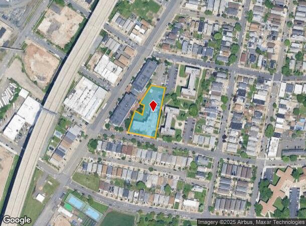
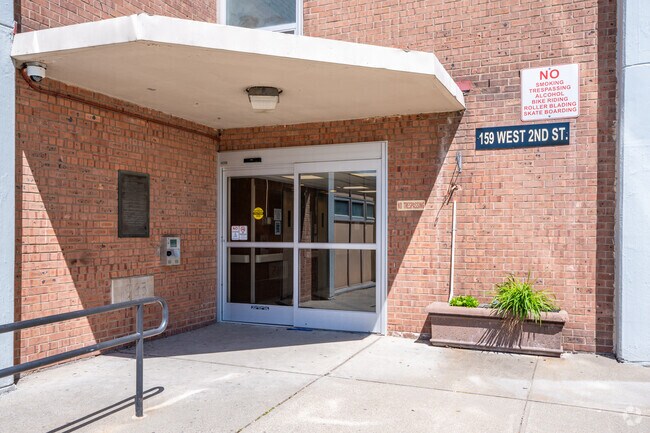
Property Record
W 2Nd West 3Rd St, Bayonne, NJ 07002
NEARBY LISTINGS FOR SALE OR LEASE
Property Detail
W 2Nd West 3Rd St
New York-Jersey City-White Plains, NY-NJ
FACILITY NAME: PUBLIC HOUSING
01-00363-0000-00007
Hudson
Governmentalpublicusegeneral
New Jersey
X
7.1
3604970169F
0.87 AC
0
Constable Hook
2025
Northern New Jersey
010701
DEMOGRAPHICS near W 2Nd West 3Rd St
1 Mile
3 Mile
5 Mile
2024 Total Population
25,185
219,147
516,072
2029 Population
23,756
213,382
501,605
Pop Growth 2024-2029
(5.67%)
(2.63%)
(2.80%)
Average Age
38
39
39
2024 Total Households
8,850
76,253
180,595
HH Growth 2024-2029
(6.29%)
(2.82%)
(2.93%)
Median Household Inc
$66,593
$77,358
$68,970
Avg Household Size
2.70
2.70
2.70
2024 Avg HH Vehicles
1.00
1.00
1.00
Median Home Value
$409,330
$504,994
$519,286
Median Year Built
1950
1960
1964
Nearby Places
Map Layers
Map Styles
 Street
 Aerial
- Restaurants
- Banks
- Shops
- Fitness
- Groceries
PUBLIC TRANSPORTATION
TRANSIT/SUBWAY
8Th Street Light Rail Station (Hudson-Bergen Light Rail - NJ TRANSIT RAIL)
DRIVE
WALK
Distance
8Th Street Light Rail Station (Hudson-Bergen Light Rail - NJ TRANSIT RAIL)
2 min
16 min
0.8 mi
COMMUTER RAIL
St George (Staten Island Railway - New York MTA Subway (The Subway))
DRIVE
WALK
Distance
St George (Staten Island Railway - New York MTA Subway (The Subway))
17 min
7.2 mi
Tompkinsville (Staten Island Railway - New York MTA Subway (The Subway))
DRIVE
WALK
Distance
Tompkinsville (Staten Island Railway - New York MTA Subway (The Subway))
18 min
7.5 mi
AIRPORT
Newark Liberty International
DRIVE
WALK
Distance
Newark Liberty International
14 min
9.1 mi
LaGuardia
DRIVE
WALK
Distance
LaGuardia
40 min
21.5 mi
John F Kennedy International
DRIVE
WALK
Distance
John F Kennedy International
46 min
30.5 mi
Freight Ports
New York Container Terminal
DRIVE
WALK
Distance
New York Container Terminal
11 min
5.9 mi
Nearby Properties
Address
Land Use
TOTAL SIZE
Lot Size
Zoning
Address
Land Use
TOTAL SIZE
Lot Size
Zoning
961.13 AC
Address
Land Use
TOTAL SIZE
Lot Size
Zoning
113.19 AC
Address
Land Use
TOTAL SIZE
Lot Size
Zoning
633,280 SF
202.90 AC
R3-2
Address
Land Use
TOTAL SIZE
Lot Size
Zoning
19.03 AC
Address
Land Use
TOTAL SIZE
Lot Size
Zoning
4,450,000 SF
95.24 AC
Address
Land Use
TOTAL SIZE
Lot Size
Zoning
216 AC
Address
Land Use
TOTAL SIZE
Lot Size
Zoning
22.49 AC
HC
Address
Land Use
TOTAL SIZE
Lot Size
Zoning
Address
Land Use
TOTAL SIZE
Lot Size
Zoning
70.39 AC
Address
Land Use
TOTAL SIZE
Lot Size
Zoning
16.63 AC
Address
Land Use
TOTAL SIZE
Lot Size
Zoning
2.21 AC
Address
Land Use
TOTAL SIZE
Lot Size
Zoning
1.01 AC
Address
Land Use
TOTAL SIZE
Lot Size
Zoning
51.62 AC
Address
Land Use
TOTAL SIZE
Lot Size
Zoning
91,760 SF
210.43 AC
M3-1
Address
Land Use
TOTAL SIZE
Lot Size
Zoning
Address
Land Use
TOTAL SIZE
Lot Size
Zoning
3,500,000 SF
11.97 AC
MRC2
Address
Land Use
TOTAL SIZE
Lot Size
Zoning
3.27 AC
Address
Land Use
TOTAL SIZE
Lot Size
Zoning
17.60 AC
Address
Land Use
TOTAL SIZE
Lot Size
Zoning
51.61 AC
Address
Land Use
TOTAL SIZE
Lot Size
Zoning
39.64 AC
Address
Land Use
TOTAL SIZE
Lot Size
Zoning
28.47 AC
I-H
Address
Land Use
TOTAL SIZE
Lot Size
Zoning
6,188,000 SF
8.18 AC
Address
Land Use
TOTAL SIZE
Lot Size
Zoning
11.96 AC
Address
Land Use
TOTAL SIZE
Lot Size
Zoning
5,400,000 SF
35.22 AC
Address
Land Use
TOTAL SIZE
Lot Size
Zoning
89.40 AC
R1
Address
Land Use
TOTAL SIZE
Lot Size
Zoning
1 SF
20 AC
Address
Land Use
TOTAL SIZE
Lot Size
Zoning
115.33 AC
IH
Address
Land Use
TOTAL SIZE
Lot Size
Zoning
74.35 AC
TDD
Address
Land Use
TOTAL SIZE
Lot Size
Zoning
30.70 AC
Address
Land Use
TOTAL SIZE
Lot Size
Zoning
The World's #1 Commercial Real Estate Marketplace
Connect with us
© 2025 CoStar Group
The information above has been obtained from sources believed reliable. While we do not doubt its accuracy we have not verified it and make no guarantee, warranty or representation about it. It is your responsibility to independently confirm its accuracy and completeness. Any projections, opinions, assumptions, or estimates used are for example only and do not represent the current or future performance of the property. The value of this transaction to you depends on tax and other factors which should be evaluated by your tax, financial, and legal advisors. You and your advisors should conduct a careful, independent investigation of the property to determine to your satisfaction the suitability of the property for your needs.