Property Record
W Airport Rd, Cornelia, GA 30531
NEARBY LISTINGS FOR SALE OR LEASE
-
-
View all Cornelia listings for sale on LoopNet.com
Property Detail
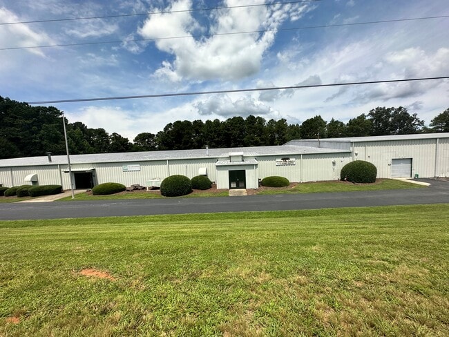
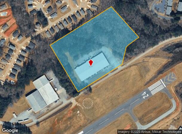
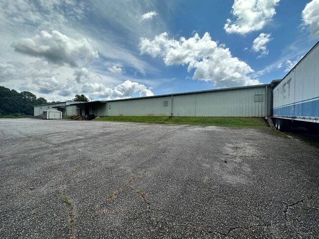
W Airport Rd
088-037
10-151 152 RELOCAT 1355-70
Manufacturinglight
Habersham
X
Georgia
13137C0218D
11.43 AC
2025
Georgia Northeast
2025
Other Market Areas
000604
Cornelia, GA
52,800 SF
DEMOGRAPHICS near W Airport Rd
1 Mile
3 Mile
5 Mile
2024 Total Population
2,338
14,951
26,698
2029 Population
2,581
16,573
29,448
Pop Growth 2024-2029
+ 10.39%
+ 10.85%
+ 10.30%
Average Age
34
37
38
2024 Total Households
770
5,229
9,108
HH Growth 2024-2029
+ 10.00%
+ 10.59%
+ 10.24%
Median Household Inc
$41,516
$50,604
$54,856
Avg Household Size
2.90
2.70
2.70
2024 Avg HH Vehicles
2.00
2.00
2.00
Median Home Value
$113,975
$147,486
$163,878
Median Year Built
1987
1989
1990
Nearby Places
Map Layers
Map Styles
 Street
 Aerial
- Restaurants
- Banks
- Shops
- Fitness
- Groceries
SALE & LEASE HISTORY
LISTING DATE
SALE/LEASE

Aug 07, 2023
For Sale
Nearby Properties
Address
Land Use
TOTAL SIZE
Lot Size
Zoning
Address
Land Use
TOTAL SIZE
Lot Size
Zoning
97,144 SF
18 AC
R1A
Address
Land Use
TOTAL SIZE
Lot Size
Zoning
88,728 SF
37.73 AC
LI
Address
Land Use
TOTAL SIZE
Lot Size
Zoning
195,516 SF
19.95 AC
B2
Address
Land Use
TOTAL SIZE
Lot Size
Zoning
153,996 SF
24.72 AC
HI
Address
Land Use
TOTAL SIZE
Lot Size
Zoning
75,612 SF
29.13 AC
LI
Address
Land Use
TOTAL SIZE
Lot Size
Zoning
266,882 SF
152.11 AC
I
Address
Land Use
TOTAL SIZE
Lot Size
Zoning
21,000 SF
28.32 AC
ARR
Address
Land Use
TOTAL SIZE
Lot Size
Zoning
11,776 SF
34.53 AC
HI
Address
Land Use
TOTAL SIZE
Lot Size
Zoning
119,632 SF
7.49 AC
HB
Address
Land Use
TOTAL SIZE
Lot Size
Zoning
137,005 SF
20.74 AC
HI
Address
Land Use
TOTAL SIZE
Lot Size
Zoning
131,703 SF
15.25 AC
B1
Address
Land Use
TOTAL SIZE
Lot Size
Zoning
119,181 SF
12.98 AC
HI
Address
Land Use
TOTAL SIZE
Lot Size
Zoning
210,142 SF
27.50 AC
HI
Address
Land Use
TOTAL SIZE
Lot Size
Zoning
161,855 SF
26.12 AC
HI
Address
Land Use
TOTAL SIZE
Lot Size
Zoning
75,762 SF
9.98 AC
R2
Address
Land Use
TOTAL SIZE
Lot Size
Zoning
53,453 SF
27.79 AC
R1
Address
Land Use
TOTAL SIZE
Lot Size
Zoning
13,072 SF
5 AC
Address
Land Use
TOTAL SIZE
Lot Size
Zoning
21,168 SF
5.32 AC
HI
Address
Land Use
TOTAL SIZE
Lot Size
Zoning
35,874 SF
4 AC
HI
Address
Land Use
TOTAL SIZE
Lot Size
Zoning
74,565 SF
7.80 AC
HB
Address
Land Use
TOTAL SIZE
Lot Size
Zoning
4,296 SF
5 AC
R111
Address
Land Use
TOTAL SIZE
Lot Size
Zoning
8,235 SF
5.01 AC
HB
Address
Land Use
TOTAL SIZE
Lot Size
Zoning
76,344 SF
38.40 AC
HI
Address
Land Use
TOTAL SIZE
Lot Size
Zoning
45,064 SF
27.23 AC
HB
Address
Land Use
TOTAL SIZE
Lot Size
Zoning
47,520 SF
2.02 AC
HI
Address
Land Use
TOTAL SIZE
Lot Size
Zoning
137,296 SF
23.65 AC
I
Address
Land Use
TOTAL SIZE
Lot Size
Zoning
58,572 SF
5.83 AC
B2
Address
Land Use
TOTAL SIZE
Lot Size
Zoning
53,089 SF
15.21 AC
HB
Address
Land Use
TOTAL SIZE
Lot Size
Zoning
651 AC
R1
Address
Land Use
TOTAL SIZE
Lot Size
Zoning
35,720 SF
7.75 AC
HI
The World's #1 Commercial Real Estate Marketplace
Connect with us
© 2026 CoStar Group
The information above has been obtained from sources believed reliable. While we do not doubt its accuracy we have not verified it and make no guarantee, warranty or representation about it. It is your responsibility to independently confirm its accuracy and completeness. Any projections, opinions, assumptions, or estimates used are for example only and do not represent the current or future performance of the property. The value of this transaction to you depends on tax and other factors which should be evaluated by your tax, financial, and legal advisors. You and your advisors should conduct a careful, independent investigation of the property to determine to your satisfaction the suitability of the property for your needs.