Property Record
W Bayles Rd, Bloomington, IN 47403
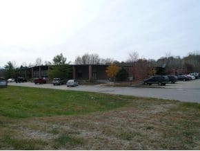

Property Detail
W Bayles Rd
53-05-17-100-010.000-004
PT NE NE 17-9-1W 4.0456A
Commercialacreage
MONROE
BP
Indiana
AE The base floodplain where base flood elevations are provided. AE Zones are now used on new format FIRMs instead of A1-A30 Zones.
4.05 AC
2024
Bloomington/Terre Haute
2025
Other Market Areas
001102
Bloomington, IN
NEARBY LISTINGS FOR SALE OR LEASE
-
-
View all Bloomington listings for sale on LoopNet.com
DEMOGRAPHICS near W Bayles Rd
1 mile
3 mile
5 mile
2025 Total Population
212
13,551
79,211
2030 Population
205
13,423
80,698
Pop Growth 2025-2030
(3.30%)
(0.94%)
+ 1.88%
Average Age
44
39
33
2025 Total Households
86
5,771
31,380
HH Growth 2025-2030
(3.49%)
(1.02%)
+ 2.07%
Median Household Inc
$106,731
$67,949
$47,341
Avg Household Size
2.40
2.30
2.10
2025 Avg HH Vehicles
2.00
2.00
2.00
Median Home Value
$374,999
$322,417
$299,299
Median Year Built
1968
1986
1988
Nearby Places
Map Layers
Map Styles
 Street
 Aerial
Layers
 Traffic
 Biking
Places
Listings with unknown addresses are not visible on the map
- Restaurants
- Banks
- Shops
- Fitness
- Groceries
Nearby Properties
Address
Land Use
TOTAL SIZE
Lot Size
Zoning
Address
Land Use
TOTAL SIZE
Lot Size
Zoning
13,910 SF
3.86 AC
Address
Land Use
TOTAL SIZE
Lot Size
Zoning
79,763 SF
12.34 AC
Address
Land Use
TOTAL SIZE
Lot Size
Zoning
8,327 SF
1.64 AC
Address
Land Use
TOTAL SIZE
Lot Size
Zoning
8,064 SF
1.29 AC
Address
Land Use
TOTAL SIZE
Lot Size
Zoning
53,005 SF
10.03 AC
PUD
Address
Land Use
TOTAL SIZE
Lot Size
Zoning
38,208 SF
8.03 AC
Address
Land Use
TOTAL SIZE
Lot Size
Zoning
1,509 SF
3 AC
Address
Land Use
TOTAL SIZE
Lot Size
Zoning
45,676 SF
4.18 AC
Address
Land Use
TOTAL SIZE
Lot Size
Zoning
59,601 SF
2.42 AC
GB
Address
Land Use
TOTAL SIZE
Lot Size
Zoning
60,184 SF
1.95 AC
Address
Land Use
TOTAL SIZE
Lot Size
Zoning
75,012 SF
1.22 AC
Address
Land Use
TOTAL SIZE
Lot Size
Zoning
9,798 SF
4.01 AC
Address
Land Use
TOTAL SIZE
Lot Size
Zoning
11,529 SF
18.49 AC
Address
Land Use
TOTAL SIZE
Lot Size
Zoning
48,212 SF
2.11 AC
Address
Land Use
TOTAL SIZE
Lot Size
Zoning
42,575 SF
0.41 AC
Address
Land Use
TOTAL SIZE
Lot Size
Zoning
68,575 SF
9.67 AC
PUD
Address
Land Use
TOTAL SIZE
Lot Size
Zoning
65,533 SF
2.25 AC
Address
Land Use
TOTAL SIZE
Lot Size
Zoning
52,756 SF
5 AC
Address
Land Use
TOTAL SIZE
Lot Size
Zoning
12,288 SF
3.24 AC
Address
Land Use
TOTAL SIZE
Lot Size
Zoning
9,010 SF
2.08 AC
Address
Land Use
TOTAL SIZE
Lot Size
Zoning
73,768 SF
8.77 AC
GB
Address
Land Use
TOTAL SIZE
Lot Size
Zoning
Address
Land Use
TOTAL SIZE
Lot Size
Zoning
54,161 SF
7.64 AC
Address
Land Use
TOTAL SIZE
Lot Size
Zoning
11,008 SF
1 AC
Address
Land Use
TOTAL SIZE
Lot Size
Zoning
24,415 SF
4.92 AC
GB
Address
Land Use
TOTAL SIZE
Lot Size
Zoning
42,186 SF
2.63 AC
Address
Land Use
TOTAL SIZE
Lot Size
Zoning
29,636 SF
5.42 AC
PUD
Address
Land Use
TOTAL SIZE
Lot Size
Zoning
38,178 SF
38.16 AC
Address
Land Use
TOTAL SIZE
Lot Size
Zoning
50,456 SF
1.30 AC
Address
Land Use
TOTAL SIZE
Lot Size
Zoning
16,082 SF
0.72 AC
The World's #1 Commercial Real Estate Marketplace
Connect with us
© 2026 CoStar Group
The information above has been obtained from sources believed reliable. While we do not doubt its accuracy we have not verified it and make no guarantee, warranty or representation about it. It is your responsibility to independently confirm its accuracy and completeness. Any projections, opinions, assumptions, or estimates used are for example only and do not represent the current or future performance of the property. The value of this transaction to you depends on tax and other factors which should be evaluated by your tax, financial, and legal advisors. You and your advisors should conduct a careful, independent investigation of the property to determine to your satisfaction the suitability of the property for your needs.