Property Record
W Bennett St, Springfield, MO 65807
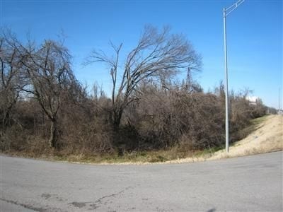

Property Detail
W Bennett St
13-29-104-017
2.6A M/L S 660 FT E 350 FT SE1/4 NE1/4 29/29/22 (EX HWY)
Commercialacreage
GREENE
C-2
Missouri
B and X Area of moderate flood hazard, usually the area between the limits of the 100-year and 500-year floods.
2.60 AC
0
Northwest
2025
Springfield
001401
Springfield, MO
NEARBY LISTINGS FOR SALE OR LEASE
-
-
-
-
-
-
-
-
West Chestnut Expressway @ Chestnut Expressway and I-44
Springfield, MO 65802
Rent Upon Request
2.10 - 8.80 AC Lot
Land
-
-
-
-
-
-
-
-
View all Springfield listings for sale on LoopNet.com
DEMOGRAPHICS near W Bennett St
1 mile
3 mile
5 mile
2024 Total Population
5,219
58,314
146,927
2029 Population
5,343
59,896
150,919
Pop Growth 2024-2029
+ 2.38%
+ 2.71%
+ 2.72%
Average Age
38
38
38
2024 Total Households
2,027
24,741
63,520
HH Growth 2024-2029
+ 2.52%
+ 2.87%
+ 2.90%
Median Household Inc
$56,562
$52,323
$51,364
Avg Household Size
2.50
2.20
2.10
2024 Avg HH Vehicles
2.00
2.00
2.00
Median Home Value
$177,932
$165,369
$190,374
Median Year Built
1994
1988
1980
Nearby Places
Map Layers
Map Styles
 Street
 Aerial
Transit
 Traffic
 Biking
Places
Listings with unknown addresses are not visible on the map
- Restaurants
- Banks
- Shops
- Fitness
- Groceries
PUBLIC TRANSPORTATION
AIRPORT
Springfield-Branson Ntl
Drive
Walk
Distance
Springfield-Branson Ntl
19 min
7.4 mi
Nearby Properties
Address
Land Use
TOTAL SIZE
Lot Size
Zoning
Address
Land Use
TOTAL SIZE
Lot Size
Zoning
320,532 SF
33.54 AC
INC
Address
Land Use
TOTAL SIZE
Lot Size
Zoning
23.75 AC
Address
Land Use
TOTAL SIZE
Lot Size
Zoning
22.64 AC
INC
Address
Land Use
TOTAL SIZE
Lot Size
Zoning
312,092 SF
38 AC
INC
Address
Land Use
TOTAL SIZE
Lot Size
Zoning
614,588 SF
57.27 AC
INC
Address
Land Use
TOTAL SIZE
Lot Size
Zoning
129,652 SF
16.40 AC
INC
Address
Land Use
TOTAL SIZE
Lot Size
Zoning
334,594 SF
17.75 AC
INC
Address
Land Use
TOTAL SIZE
Lot Size
Zoning
253,781 SF
9.65 AC
INC
Address
Land Use
TOTAL SIZE
Lot Size
Zoning
9.82 AC
INC
Address
Land Use
TOTAL SIZE
Lot Size
Zoning
102,925 SF
57.24 AC
INC
Address
Land Use
TOTAL SIZE
Lot Size
Zoning
159,007 SF
16.05 AC
INC
Address
Land Use
TOTAL SIZE
Lot Size
Zoning
16.41 AC
INC
Address
Land Use
TOTAL SIZE
Lot Size
Zoning
2.92 AC
INC
Address
Land Use
TOTAL SIZE
Lot Size
Zoning
65,208 SF
12.40 AC
INC
Address
Land Use
TOTAL SIZE
Lot Size
Zoning
12.81 AC
INC
Address
Land Use
TOTAL SIZE
Lot Size
Zoning
172,976 SF
5.99 AC
INC
Address
Land Use
TOTAL SIZE
Lot Size
Zoning
157,773 SF
18.55 AC
INC
Address
Land Use
TOTAL SIZE
Lot Size
Zoning
154,470 SF
16.97 AC
INC
Address
Land Use
TOTAL SIZE
Lot Size
Zoning
16.39 AC
INC
Address
Land Use
TOTAL SIZE
Lot Size
Zoning
20.54 AC
Address
Land Use
TOTAL SIZE
Lot Size
Zoning
10.58 AC
INC
Address
Land Use
TOTAL SIZE
Lot Size
Zoning
12.39 AC
Address
Land Use
TOTAL SIZE
Lot Size
Zoning
59,989 SF
6.20 AC
INC
Address
Land Use
TOTAL SIZE
Lot Size
Zoning
47,500 SF
5.24 AC
INC
Address
Land Use
TOTAL SIZE
Lot Size
Zoning
44,000 SF
3.05 AC
INC
Address
Land Use
TOTAL SIZE
Lot Size
Zoning
20,211 SF
2.25 AC
INC.
Address
Land Use
TOTAL SIZE
Lot Size
Zoning
85,030 SF
8.89 AC
INC
Address
Land Use
TOTAL SIZE
Lot Size
Zoning
200,942 SF
15.70 AC
INC
Address
Land Use
TOTAL SIZE
Lot Size
Zoning
52,772 SF
5.12 AC
INC
Address
Land Use
TOTAL SIZE
Lot Size
Zoning
13.80 AC
C-2
The World's #1 Commercial Real Estate Marketplace
Connect with us
© 2026 CoStar Group
The information above has been obtained from sources believed reliable. While we do not doubt its accuracy we have not verified it and make no guarantee, warranty or representation about it. It is your responsibility to independently confirm its accuracy and completeness. Any projections, opinions, assumptions, or estimates used are for example only and do not represent the current or future performance of the property. The value of this transaction to you depends on tax and other factors which should be evaluated by your tax, financial, and legal advisors. You and your advisors should conduct a careful, independent investigation of the property to determine to your satisfaction the suitability of the property for your needs.