Property Record
68 W Hubbard Rd, Galloway, OH 43119

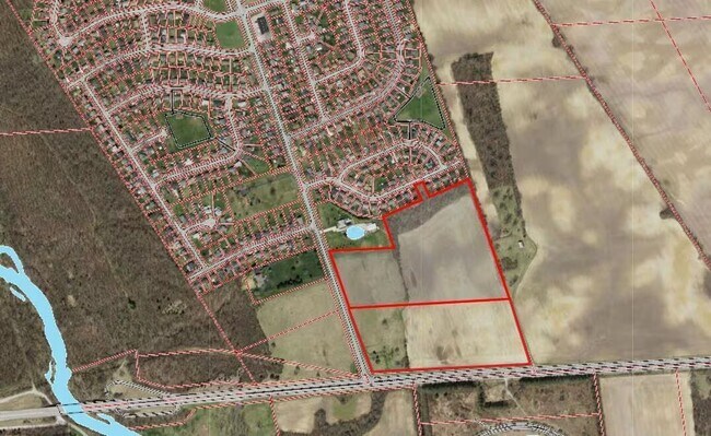
Property Detail
68 W Hubbard Rd
Columbus, OH
WEST BROAD ST LAKE DARBY EST 1 RES L
240-005466
FRANKLIN
Recreationalacreage
Ohio
B and X Area of moderate flood hazard, usually the area between the limits of the 100-year and 500-year floods.
12.93 AC
2024
Southwest
2025
Columbus
008170
NEARBY LISTINGS FOR SALE OR LEASE
-
-
View all Galloway listings for sale on LoopNet.com
DEMOGRAPHICS near 68 W Hubbard Rd
1 mile
3 mile
5 mile
2025 Total Population
2,721
9,619
66,130
2030 Population
2,788
9,891
67,701
Pop Growth 2025-2030
+ 2.46%
+ 2.83%
+ 2.38%
Average Age
38
39
37
2025 Total Households
931
3,502
25,802
HH Growth 2025-2030
+ 2.79%
+ 3.08%
+ 2.48%
Median Household Inc
$101,321
$89,258
$79,947
Avg Household Size
2.80
2.70
2.50
2025 Avg HH Vehicles
2.00
2.00
2.00
Median Home Value
$244,393
$249,914
$263,630
Median Year Built
1977
1978
1991
Nearby Places
Map Layers
Map Styles
 Street
 Aerial
Layers
 Traffic
 Biking
Places
Listings with unknown addresses are not visible on the map
- Restaurants
- Banks
- Shops
- Fitness
- Groceries
PUBLIC TRANSPORTATION
AIRPORT
John Glenn Columbus International
Drive
Walk
Distance
John Glenn Columbus International
30 min
21.5 mi
Rickenbacker International
Drive
Walk
Distance
Rickenbacker International
32 min
22.7 mi
Freight Ports
Port of Toledo
Drive
Walk
Distance
Port of Toledo
188 min
136.7 mi
SALE & LEASE HISTORY
LISTING DATE
SALE/LEASE

Sep 24, 2016
For Sale
Aug 22, 2023
For Sale
Nearby Properties
Address
Land Use
TOTAL SIZE
Lot Size
Zoning
Address
Land Use
TOTAL SIZE
Lot Size
Zoning
12,336 SF
1,041.66 AC
Address
Land Use
TOTAL SIZE
Lot Size
Zoning
108,716 SF
28.28 AC
Address
Land Use
TOTAL SIZE
Lot Size
Zoning
195,464 SF
50.10 AC
Address
Land Use
TOTAL SIZE
Lot Size
Zoning
10,768 SF
27.09 AC
Address
Land Use
TOTAL SIZE
Lot Size
Zoning
68,039 SF
9.08 AC
Address
Land Use
TOTAL SIZE
Lot Size
Zoning
82,588 SF
40.43 AC
Address
Land Use
TOTAL SIZE
Lot Size
Zoning
1,978 SF
3.65 AC
Address
Land Use
TOTAL SIZE
Lot Size
Zoning
3,024 SF
361.28 AC
Address
Land Use
TOTAL SIZE
Lot Size
Zoning
32,840 SF
8.11 AC
Address
Land Use
TOTAL SIZE
Lot Size
Zoning
75.03 AC
Address
Land Use
TOTAL SIZE
Lot Size
Zoning
1,764 SF
1,041.66 AC
Address
Land Use
TOTAL SIZE
Lot Size
Zoning
8,048 SF
40 AC
Address
Land Use
TOTAL SIZE
Lot Size
Zoning
1,380 SF
488.99 AC
Address
Land Use
TOTAL SIZE
Lot Size
Zoning
145.65 AC
Address
Land Use
TOTAL SIZE
Lot Size
Zoning
1,392 SF
135.85 AC
Address
Land Use
TOTAL SIZE
Lot Size
Zoning
44.22 AC
Address
Land Use
TOTAL SIZE
Lot Size
Zoning
2,552 SF
150.93 AC
Address
Land Use
TOTAL SIZE
Lot Size
Zoning
226.06 AC
Address
Land Use
TOTAL SIZE
Lot Size
Zoning
224.38 AC
Address
Land Use
TOTAL SIZE
Lot Size
Zoning
9,648 SF
123.84 AC
Address
Land Use
TOTAL SIZE
Lot Size
Zoning
206.58 AC
Address
Land Use
TOTAL SIZE
Lot Size
Zoning
4,101 SF
174.28 AC
Address
Land Use
TOTAL SIZE
Lot Size
Zoning
2,574 SF
197.59 AC
Address
Land Use
TOTAL SIZE
Lot Size
Zoning
2,464 SF
28.25 AC
Address
Land Use
TOTAL SIZE
Lot Size
Zoning
1,329 SF
188.81 AC
Address
Land Use
TOTAL SIZE
Lot Size
Zoning
20,702 SF
8.50 AC
Address
Land Use
TOTAL SIZE
Lot Size
Zoning
118.23 AC
Address
Land Use
TOTAL SIZE
Lot Size
Zoning
11,366 SF
208.06 AC
Address
Land Use
TOTAL SIZE
Lot Size
Zoning
8,426 SF
141.46 AC
Address
Land Use
TOTAL SIZE
Lot Size
Zoning
173.16 AC
The World's #1 Commercial Real Estate Marketplace
Connect with us
© 2026 CoStar Group
The information above has been obtained from sources believed reliable. While we do not doubt its accuracy we have not verified it and make no guarantee, warranty or representation about it. It is your responsibility to independently confirm its accuracy and completeness. Any projections, opinions, assumptions, or estimates used are for example only and do not represent the current or future performance of the property. The value of this transaction to you depends on tax and other factors which should be evaluated by your tax, financial, and legal advisors. You and your advisors should conduct a careful, independent investigation of the property to determine to your satisfaction the suitability of the property for your needs.