Property Record
W Brooks St, Ontario, CA 91762
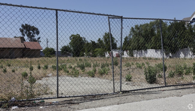


Property Detail
W Brooks St
Riverside-San Bernardino-Ontario, CA
NEMAHA TRACT E 177.06 FT W 184.06 FT LOT 2 EX THAT PTN LYING WITHIN PARCEL MAP 557 PARCEL 1 AND EX PTN LYING S OF A LI 147 FT N OF AND PARALLEL TO THE N LI BROOKS ST AND EX ST AND EX ADDL ST
1011-141-34
SAN BERNARDINO
Vacantlandnec
California
B and X Area of moderate flood hazard, usually the area between the limits of the 100-year and 500-year floods.
2
2025
0.60 AC
2025
Airport Area
001600
Inland Empire (California)
NEARBY LISTINGS FOR SALE OR LEASE
-
-
-
No Photo
-
-
-
-
-
-
-
-
-
-
-
-
-
-
-
-
View all Ontario listings for sale on LoopNet.com
DEMOGRAPHICS near W Brooks St
1 mile
3 mile
5 mile
2025 Total Population
26,668
200,817
440,319
2030 Population
26,741
201,826
441,840
Pop Growth 2025-2030
+ 0.27%
+ 0.50%
+ 0.35%
Average Age
35
37
38
2025 Total Households
7,978
59,880
132,443
HH Growth 2025-2030
+ 0.30%
+ 0.57%
+ 0.39%
Median Household Inc
$72,107
$82,004
$91,226
Avg Household Size
3.30
3.20
3.20
2025 Avg HH Vehicles
2.00
2.00
2.00
Median Home Value
$571,232
$656,605
$689,469
Median Year Built
1966
1972
1974
Nearby Places
Map Layers
Map Styles
 Street
 Aerial
Layers
 Traffic
 Biking
Places
Listings with unknown addresses are not visible on the map
- Restaurants
- Banks
- Shops
- Fitness
- Groceries
PUBLIC TRANSPORTATION
COMMUTER RAIL
Ontario Amtrak (Sunset Limited - Amtrak, Texas Eagle - Amtrak)
Drive
Walk
Distance
Ontario Amtrak (Sunset Limited - Amtrak, Texas Eagle - Amtrak)
3 min
1.2 mi
Upland (San Bernardino Line - Southern California Regional Rail Authority (Metrolink))
Drive
Walk
Distance
Upland (San Bernardino Line - Southern California Regional Rail Authority (Metrolink))
6 min
3.4 mi
AIRPORT
Ontario International
Drive
Walk
Distance
Ontario International
8 min
4.2 mi
John Wayne/Orange County
Drive
Walk
Distance
John Wayne/Orange County
47 min
38.8 mi
Freight Ports
Port of Long Beach
Drive
Walk
Distance
Port of Long Beach
63 min
47.8 mi
Nearby Properties
Address
Land Use
TOTAL SIZE
Lot Size
Zoning
Address
Land Use
TOTAL SIZE
Lot Size
Zoning
244,370 SF
59.72 AC
Address
Land Use
TOTAL SIZE
Lot Size
Zoning
788,560 SF
36.86 AC
Address
Land Use
TOTAL SIZE
Lot Size
Zoning
245,931 SF
10.84 AC
Address
Land Use
TOTAL SIZE
Lot Size
Zoning
123,833 SF
11.23 AC
Address
Land Use
TOTAL SIZE
Lot Size
Zoning
174,430 SF
7.47 AC
Address
Land Use
TOTAL SIZE
Lot Size
Zoning
116,804 SF
5.48 AC
Address
Land Use
TOTAL SIZE
Lot Size
Zoning
214,920 SF
9.33 AC
Address
Land Use
TOTAL SIZE
Lot Size
Zoning
120,602 SF
5.58 AC
Address
Land Use
TOTAL SIZE
Lot Size
Zoning
857,182 SF
35.66 AC
Address
Land Use
TOTAL SIZE
Lot Size
Zoning
125,663 SF
7.04 AC
Address
Land Use
TOTAL SIZE
Lot Size
Zoning
218,376 SF
12.50 AC
Address
Land Use
TOTAL SIZE
Lot Size
Zoning
250,200 SF
15.06 AC
Address
Land Use
TOTAL SIZE
Lot Size
Zoning
83,562 SF
10.06 AC
Address
Land Use
TOTAL SIZE
Lot Size
Zoning
168,251 SF
7.01 AC
Address
Land Use
TOTAL SIZE
Lot Size
Zoning
416,000 SF
20.01 AC
Address
Land Use
TOTAL SIZE
Lot Size
Zoning
1.86 AC
Address
Land Use
TOTAL SIZE
Lot Size
Zoning
175,000 SF
15.24 AC
Address
Land Use
TOTAL SIZE
Lot Size
Zoning
173,531 SF
2.52 AC
Address
Land Use
TOTAL SIZE
Lot Size
Zoning
100,815 SF
3.96 AC
Address
Land Use
TOTAL SIZE
Lot Size
Zoning
504,530 SF
22.76 AC
Address
Land Use
TOTAL SIZE
Lot Size
Zoning
120,939 SF
3.87 AC
Address
Land Use
TOTAL SIZE
Lot Size
Zoning
180,868 SF
8.24 AC
Address
Land Use
TOTAL SIZE
Lot Size
Zoning
73,190 SF
5.43 AC
Address
Land Use
TOTAL SIZE
Lot Size
Zoning
106,212 SF
5.33 AC
Address
Land Use
TOTAL SIZE
Lot Size
Zoning
83,776 SF
4.55 AC
Address
Land Use
TOTAL SIZE
Lot Size
Zoning
135,758 SF
14.72 AC
Address
Land Use
TOTAL SIZE
Lot Size
Zoning
102,454 SF
7.70 AC
Address
Land Use
TOTAL SIZE
Lot Size
Zoning
139,325 SF
6.95 AC
Address
Land Use
TOTAL SIZE
Lot Size
Zoning
129,480 SF
6.39 AC
Address
Land Use
TOTAL SIZE
Lot Size
Zoning
112,960 SF
6.30 AC
The World's #1 Commercial Real Estate Marketplace
Connect with us
© 2026 CoStar Group
The information above has been obtained from sources believed reliable. While we do not doubt its accuracy we have not verified it and make no guarantee, warranty or representation about it. It is your responsibility to independently confirm its accuracy and completeness. Any projections, opinions, assumptions, or estimates used are for example only and do not represent the current or future performance of the property. The value of this transaction to you depends on tax and other factors which should be evaluated by your tax, financial, and legal advisors. You and your advisors should conduct a careful, independent investigation of the property to determine to your satisfaction the suitability of the property for your needs.