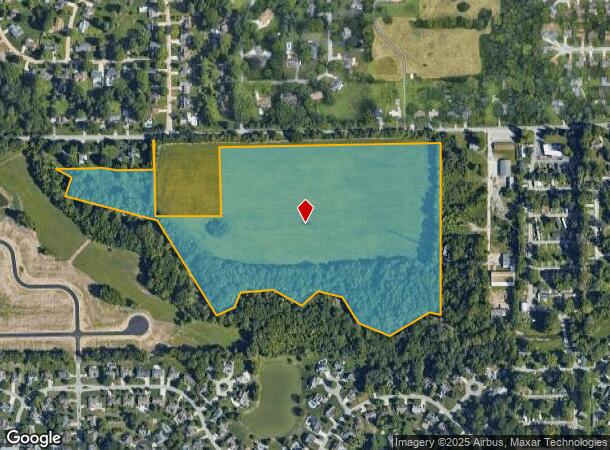
Property Record
W County Line Rd, Greenwood, IN 46142

NEARBY LISTINGS FOR SALE OR LEASE
Property Detail
W County Line Rd
41-03-27-021-015.000-038
NW NW N NW S27 T14 R3
Agriculturalland
Johnson
AE
Indiana
18081C0014E
36.29 AC
2024
Greenwood
2025
Indianapolis
610606
Indianapolis-Carmel-Anderson, IN
DEMOGRAPHICS near W County Line Rd
1 Mile
3 Mile
5 Mile
2024 Total Population
6,624
57,022
142,115
2029 Population
6,863
57,853
144,496
Pop Growth 2024-2029
+ 3.61%
+ 1.46%
+ 1.68%
Average Age
42
39
38
2024 Total Households
2,512
21,345
54,076
HH Growth 2024-2029
+ 3.74%
+ 1.44%
+ 1.71%
Median Household Inc
$108,563
$86,104
$73,260
Avg Household Size
2.60
2.60
2.60
2024 Avg HH Vehicles
2.00
2.00
2.00
Median Home Value
$232,026
$222,949
$218,881
Median Year Built
1985
1989
1984
Nearby Places
- Restaurants
- Banks
- Shops
- Fitness
- Groceries
PUBLIC TRANSPORTATION
AIRPORT
Indianapolis International
DRIVE
WALK
Distance
Indianapolis International
29 min
17.5 mi
Freight Ports
Port of Toledo
DRIVE
WALK
Distance
Port of Toledo
286 min
239.6 mi
Nearby Properties
Address
Land Use
TOTAL SIZE
Lot Size
Zoning
Address
Land Use
TOTAL SIZE
Lot Size
Zoning
5,470 SF
35.46 AC
Address
Land Use
TOTAL SIZE
Lot Size
Zoning
3,346 SF
21.35 AC
Address
Land Use
TOTAL SIZE
Lot Size
Zoning
5,279 SF
18.07 AC
ZO01
Address
Land Use
TOTAL SIZE
Lot Size
Zoning
23,040 SF
9.28 AC
ZO01
Address
Land Use
TOTAL SIZE
Lot Size
Zoning
33,790 SF
13.01 AC
Address
Land Use
TOTAL SIZE
Lot Size
Zoning
3,818 SF
15.24 AC
Address
Land Use
TOTAL SIZE
Lot Size
Zoning
1,102 SF
9.98 AC
Address
Land Use
TOTAL SIZE
Lot Size
Zoning
5,779 SF
15.77 AC
Address
Land Use
TOTAL SIZE
Lot Size
Zoning
11,546 SF
14.18 AC
Address
Land Use
TOTAL SIZE
Lot Size
Zoning
3,793 SF
23.47 AC
ZO01
Address
Land Use
TOTAL SIZE
Lot Size
Zoning
1,925 SF
29.98 AC
Address
Land Use
TOTAL SIZE
Lot Size
Zoning
3,337 SF
21.53 AC
ZO01
Address
Land Use
TOTAL SIZE
Lot Size
Zoning
3,296 SF
21 AC
Address
Land Use
TOTAL SIZE
Lot Size
Zoning
3,701 SF
26 AC
ZO01
Address
Land Use
TOTAL SIZE
Lot Size
Zoning
65,551 SF
12.84 AC
ZO01
Address
Land Use
TOTAL SIZE
Lot Size
Zoning
108,092 SF
23.62 AC
ZO01
Address
Land Use
TOTAL SIZE
Lot Size
Zoning
152,664 SF
14.82 AC
Address
Land Use
TOTAL SIZE
Lot Size
Zoning
173,052 SF
17.35 AC
Address
Land Use
TOTAL SIZE
Lot Size
Zoning
748 SF
6.83 AC
Address
Land Use
TOTAL SIZE
Lot Size
Zoning
3,360 SF
14.68 AC
Address
Land Use
TOTAL SIZE
Lot Size
Zoning
11,326 SF
7.88 AC
Address
Land Use
TOTAL SIZE
Lot Size
Zoning
28,590 SF
7.16 AC
Address
Land Use
TOTAL SIZE
Lot Size
Zoning
217,468 SF
28.06 AC
Address
Land Use
TOTAL SIZE
Lot Size
Zoning
193,178 SF
14.48 AC
Address
Land Use
TOTAL SIZE
Lot Size
Zoning
1,491 SF
3.74 AC
ZO01
Address
Land Use
TOTAL SIZE
Lot Size
Zoning
1,448 SF
5 AC
ZO01
Address
Land Use
TOTAL SIZE
Lot Size
Zoning
75,167 SF
13.75 AC
Address
Land Use
TOTAL SIZE
Lot Size
Zoning
15,024 SF
5.62 AC
Address
Land Use
TOTAL SIZE
Lot Size
Zoning
46,171 SF
4.55 AC
Address
Land Use
TOTAL SIZE
Lot Size
Zoning
4,308 SF
8.36 AC
ZO01
The World's #1 Commercial Real Estate Marketplace
Connect with us
© 2025 CoStar Group
The information above has been obtained from sources believed reliable. While we do not doubt its accuracy we have not verified it and make no guarantee, warranty or representation about it. It is your responsibility to independently confirm its accuracy and completeness. Any projections, opinions, assumptions, or estimates used are for example only and do not represent the current or future performance of the property. The value of this transaction to you depends on tax and other factors which should be evaluated by your tax, financial, and legal advisors. You and your advisors should conduct a careful, independent investigation of the property to determine to your satisfaction the suitability of the property for your needs.