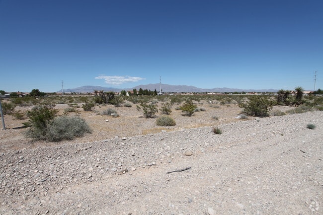
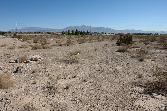
Property Record
2131 Americas Cup Cir, Las Vegas, NV 89117


NEARBY LISTINGS FOR SALE OR LEASE
Property Detail
2131 Americas Cup Cir
138-05-203-017
PT SE4 NW4 SEC 5 20 60
Vacantlandnec
Clark
X
Nevada
32003C2135F
2.50 AC
2024
Northwest Las Vegas
2025
Las Vegas
003242
Las Vegas-Henderson-North Las Vegas, NV
DEMOGRAPHICS near 2131 Americas Cup Cir
1 Mile
3 Mile
5 Mile
2024 Total Population
8,870
108,431
324,415
2029 Population
9,509
116,406
349,018
Pop Growth 2024-2029
+ 7.20%
+ 7.35%
+ 7.58%
Average Age
42
43
41
2024 Total Households
2,949
43,142
124,380
HH Growth 2024-2029
+ 7.09%
+ 7.36%
+ 7.57%
Median Household Inc
$119,254
$78,729
$75,849
Avg Household Size
3.00
2.50
2.60
2024 Avg HH Vehicles
3.00
2.00
2.00
Median Home Value
$615,726
$396,818
$385,044
Median Year Built
1996
1995
1996
Nearby Places
Map Layers
Map Styles
 Street
 Aerial
- Restaurants
- Banks
- Shops
- Fitness
- Groceries
PUBLIC TRANSPORTATION
AIRPORT
Harry Reid International
DRIVE
WALK
Distance
Harry Reid International
20 min
10.8 mi
Boulder City Municipal
DRIVE
WALK
Distance
Boulder City Municipal
45 min
31.4 mi
Freight Ports
Port of Long Beach
DRIVE
WALK
Distance
Port of Long Beach
322 min
286.0 mi
SALE & LEASE HISTORY
LISTING DATE
SALE/LEASE

Sep 25, 2016
For Lease
Nearby Properties
Address
Land Use
TOTAL SIZE
Lot Size
Zoning
Address
Land Use
TOTAL SIZE
Lot Size
Zoning
336,142 SF
39.99 AC
PC
Address
Land Use
TOTAL SIZE
Lot Size
Zoning
338,051 SF
49.13 AC
C1
Address
Land Use
TOTAL SIZE
Lot Size
Zoning
974,131 SF
19.93 AC
Address
Land Use
TOTAL SIZE
Lot Size
Zoning
40 AC
PF
Address
Land Use
TOTAL SIZE
Lot Size
Zoning
157.50 AC
Address
Land Use
TOTAL SIZE
Lot Size
Zoning
408,908 SF
15.60 AC
Address
Land Use
TOTAL SIZE
Lot Size
Zoning
Address
Land Use
TOTAL SIZE
Lot Size
Zoning
Address
Land Use
TOTAL SIZE
Lot Size
Zoning
7,292 SF
24.24 AC
R3
Address
Land Use
TOTAL SIZE
Lot Size
Zoning
5,427 SF
17.57 AC
Address
Land Use
TOTAL SIZE
Lot Size
Zoning
12.23 AC
PF
Address
Land Use
TOTAL SIZE
Lot Size
Zoning
2,754 SF
17.17 AC
RPD20
Address
Land Use
TOTAL SIZE
Lot Size
Zoning
223,030 SF
18.11 AC
C1
Address
Land Use
TOTAL SIZE
Lot Size
Zoning
28,956 SF
75.82 AC
CV
Address
Land Use
TOTAL SIZE
Lot Size
Zoning
4,872 SF
18.22 AC
R3
Address
Land Use
TOTAL SIZE
Lot Size
Zoning
3.61 AC
PF
Address
Land Use
TOTAL SIZE
Lot Size
Zoning
5,979 SF
17.27 AC
RPD21
Address
Land Use
TOTAL SIZE
Lot Size
Zoning
3,020 SF
19.68 AC
L:R-PD23
Address
Land Use
TOTAL SIZE
Lot Size
Zoning
8,849 SF
16.80 AC
RPD20
Address
Land Use
TOTAL SIZE
Lot Size
Zoning
5,396 SF
13.95 AC
R3
Address
Land Use
TOTAL SIZE
Lot Size
Zoning
181,262 SF
16.63 AC
L:C-2
Address
Land Use
TOTAL SIZE
Lot Size
Zoning
52,058 SF
6.44 AC
C1
Address
Land Use
TOTAL SIZE
Lot Size
Zoning
66.57 AC
CV
Address
Land Use
TOTAL SIZE
Lot Size
Zoning
285,929 SF
5.06 AC
C1
Address
Land Use
TOTAL SIZE
Lot Size
Zoning
211,331 SF
6.70 AC
USC
Address
Land Use
TOTAL SIZE
Lot Size
Zoning
2,694 SF
14.11 AC
L:R-PD23
Address
Land Use
TOTAL SIZE
Lot Size
Zoning
6,037 SF
15.12 AC
R3
Address
Land Use
TOTAL SIZE
Lot Size
Zoning
10 AC
PF
Address
Land Use
TOTAL SIZE
Lot Size
Zoning
5,466 SF
13.59 AC
RPD20
Address
Land Use
TOTAL SIZE
Lot Size
Zoning
16,491 SF
25.25 AC
C1
The World's #1 Commercial Real Estate Marketplace
Connect with us
© 2026 CoStar Group
The information above has been obtained from sources believed reliable. While we do not doubt its accuracy we have not verified it and make no guarantee, warranty or representation about it. It is your responsibility to independently confirm its accuracy and completeness. Any projections, opinions, assumptions, or estimates used are for example only and do not represent the current or future performance of the property. The value of this transaction to you depends on tax and other factors which should be evaluated by your tax, financial, and legal advisors. You and your advisors should conduct a careful, independent investigation of the property to determine to your satisfaction the suitability of the property for your needs.