Property Record
W End Ave, Statesville, NC 28677


NEARBY LISTINGS FOR SALE OR LEASE
Property Detail
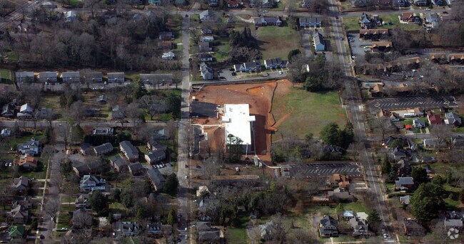
W End Ave
Charlotte-Concord-Gastonia, NC-SC
W END AVE
4734-65-9011.000
Iredell
University
North Carolina
2025
7.22 AC
2025
Iredell County
060300
Charlotte
40,212 SF
DEMOGRAPHICS near W End Ave
1 Mile
3 Mile
5 Mile
2024 Total Population
7,066
29,738
48,576
2029 Population
8,010
33,551
54,842
Pop Growth 2024-2029
+ 13.36%
+ 12.82%
+ 12.90%
Average Age
39
40
41
2024 Total Households
2,957
12,057
19,342
HH Growth 2024-2029
+ 13.26%
+ 12.68%
+ 12.79%
Median Household Inc
$38,502
$43,509
$51,330
Avg Household Size
2.30
2.40
2.40
2024 Avg HH Vehicles
2.00
2.00
2.00
Median Home Value
$159,192
$168,391
$187,952
Median Year Built
1962
1974
1982
Nearby Places
Map Layers
Map Styles
 Street
 Aerial
- Restaurants
- Banks
- Shops
- Fitness
- Groceries
PUBLIC TRANSPORTATION
AIRPORT
Concord-Padgett Regional
DRIVE
WALK
Distance
Concord-Padgett Regional
52 min
40.1 mi
Freight Ports
Port of Wilmington
DRIVE
WALK
Distance
Port of Wilmington
296 min
239.0 mi
Nearby Properties
Address
Land Use
TOTAL SIZE
Lot Size
Zoning
Address
Land Use
TOTAL SIZE
Lot Size
Zoning
398,888 SF
21.48 AC
O2
Address
Land Use
TOTAL SIZE
Lot Size
Zoning
512,156 SF
92.28 AC
LI
Address
Land Use
TOTAL SIZE
Lot Size
Zoning
7,376 SF
21.51 AC
R-5MF
Address
Land Use
TOTAL SIZE
Lot Size
Zoning
35,125 SF
9.57 AC
O-1
Address
Land Use
TOTAL SIZE
Lot Size
Zoning
100,844 SF
18.49 AC
R-5MF
Address
Land Use
TOTAL SIZE
Lot Size
Zoning
327,320 SF
34.11 AC
R-5
Address
Land Use
TOTAL SIZE
Lot Size
Zoning
15,156 SF
13.20 AC
R-5MF
Address
Land Use
TOTAL SIZE
Lot Size
Zoning
39,346 SF
13.85 AC
R-10 H-D
Address
Land Use
TOTAL SIZE
Lot Size
Zoning
126,288 SF
13.99 AC
B-3
Address
Land Use
TOTAL SIZE
Lot Size
Zoning
343,815 SF
34.13 AC
HI
Address
Land Use
TOTAL SIZE
Lot Size
Zoning
7,596 SF
8.84 AC
R-5MF
Address
Land Use
TOTAL SIZE
Lot Size
Zoning
72,027 SF
9.24 AC
B-4
Address
Land Use
TOTAL SIZE
Lot Size
Zoning
16,400 SF
17.17 AC
B-3
Address
Land Use
TOTAL SIZE
Lot Size
Zoning
106,171 SF
12 AC
R-10
Address
Land Use
TOTAL SIZE
Lot Size
Zoning
67,954 SF
10.35 AC
R-5
Address
Land Use
TOTAL SIZE
Lot Size
Zoning
62,103 SF
14.18 AC
B-4
Address
Land Use
TOTAL SIZE
Lot Size
Zoning
50,756 SF
8.86 AC
CU-8 B-4
Address
Land Use
TOTAL SIZE
Lot Size
Zoning
209,138 SF
17.46 AC
B-3
Address
Land Use
TOTAL SIZE
Lot Size
Zoning
81,634 SF
2.52 AC
B-4
Address
Land Use
TOTAL SIZE
Lot Size
Zoning
19,982 SF
3.87 AC
CBP
Address
Land Use
TOTAL SIZE
Lot Size
Zoning
319,474 SF
31.55 AC
HI
Address
Land Use
TOTAL SIZE
Lot Size
Zoning
115,800 SF
4.43 AC
B4
Address
Land Use
TOTAL SIZE
Lot Size
Zoning
66,229 SF
21.27 AC
LI
Address
Land Use
TOTAL SIZE
Lot Size
Zoning
58,008 SF
2.03 AC
CU-26 B-4
Address
Land Use
TOTAL SIZE
Lot Size
Zoning
56,812 SF
3.60 AC
B-5
Address
Land Use
TOTAL SIZE
Lot Size
Zoning
6,685 SF
5.02 AC
R-8MFM
Address
Land Use
TOTAL SIZE
Lot Size
Zoning
8,706 SF
9.51 AC
R-5MF
Address
Land Use
TOTAL SIZE
Lot Size
Zoning
329,715 SF
18.23 AC
HI
Address
Land Use
TOTAL SIZE
Lot Size
Zoning
5,824 SF
70.18 AC
B-5
Address
Land Use
TOTAL SIZE
Lot Size
Zoning
56,450 SF
23.41 AC
R-8MFM
The World's #1 Commercial Real Estate Marketplace
Connect with us
© 2026 CoStar Group
The information above has been obtained from sources believed reliable. While we do not doubt its accuracy we have not verified it and make no guarantee, warranty or representation about it. It is your responsibility to independently confirm its accuracy and completeness. Any projections, opinions, assumptions, or estimates used are for example only and do not represent the current or future performance of the property. The value of this transaction to you depends on tax and other factors which should be evaluated by your tax, financial, and legal advisors. You and your advisors should conduct a careful, independent investigation of the property to determine to your satisfaction the suitability of the property for your needs.