Property Record
W Fourth St, Mansfield, OH 44906

Save to a Folder
{{folder.Name}}
{{folder.ListingIds.length}} Properties
{{folder.ListingIds.length}} Property
Create a New Folder
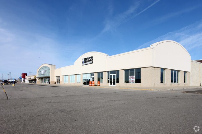
Property Detail
W Fourth St
Mansfield, OH
SE A .578 LT 14 PT
038-60-318-24-003
RICHLAND
Commercialacreage
Ohio
B and X Area of moderate flood hazard, usually the area between the limits of the 100-year and 500-year floods.
14
2025
0.58 AC
2025
Richland County
001400
Cleveland
NEARBY LISTINGS FOR SALE OR LEASE
DEMOGRAPHICS near W Fourth St
1 mile
3 mile
5 mile
2025 Total Population
2,070
17,904
53,028
2030 Population
2,098
17,867
53,007
Pop Growth 2025-2030
+ 1.35%
(0.21%)
(0.04%)
Average Age
43
43
42
2025 Total Households
1,011
7,793
21,675
HH Growth 2025-2030
+ 1.29%
(0.18%)
(0.08%)
Median Household Inc
$56,025
$55,222
$49,889
Avg Household Size
2.00
2.20
2.20
2025 Avg HH Vehicles
2.00
2.00
2.00
Median Home Value
$158,397
$168,110
$155,580
Median Year Built
1994
1965
1959
Nearby Places
Map Layers
Map Styles
 Street
 Aerial
Layers
 Traffic
 Biking
Places
Listings with unknown addresses are not visible on the map
- Restaurants
- Banks
- Shops
- Fitness
- Groceries
SALE & LEASE HISTORY
LISTING DATE
SALE/LEASE

Sep 24, 2016
For Lease
Nearby Properties
Address
Land Use
TOTAL SIZE
Lot Size
Zoning
Address
Land Use
TOTAL SIZE
Lot Size
Zoning
6,400 SF
137.67 AC
Address
Land Use
TOTAL SIZE
Lot Size
Zoning
354,710 SF
7.07 AC
Address
Land Use
TOTAL SIZE
Lot Size
Zoning
172,938 SF
16.05 AC
Address
Land Use
TOTAL SIZE
Lot Size
Zoning
136,951 SF
35.76 AC
Address
Land Use
TOTAL SIZE
Lot Size
Zoning
137,091 SF
20.40 AC
Address
Land Use
TOTAL SIZE
Lot Size
Zoning
263,840 SF
16 AC
Address
Land Use
TOTAL SIZE
Lot Size
Zoning
36,708 SF
12.56 AC
Address
Land Use
TOTAL SIZE
Lot Size
Zoning
204,882 SF
32.98 AC
Address
Land Use
TOTAL SIZE
Lot Size
Zoning
217,680 SF
22.86 AC
Address
Land Use
TOTAL SIZE
Lot Size
Zoning
131,816 SF
17.69 AC
Address
Land Use
TOTAL SIZE
Lot Size
Zoning
15,490 SF
89.80 AC
Address
Land Use
TOTAL SIZE
Lot Size
Zoning
58,960 SF
2.30 AC
Address
Land Use
TOTAL SIZE
Lot Size
Zoning
81,113 SF
20 AC
Address
Land Use
TOTAL SIZE
Lot Size
Zoning
161,730 SF
31.07 AC
Address
Land Use
TOTAL SIZE
Lot Size
Zoning
125,778 SF
11.63 AC
Address
Land Use
TOTAL SIZE
Lot Size
Zoning
27,501 SF
16.40 AC
Address
Land Use
TOTAL SIZE
Lot Size
Zoning
134,984 SF
17.98 AC
Address
Land Use
TOTAL SIZE
Lot Size
Zoning
179,262 SF
22.54 AC
Address
Land Use
TOTAL SIZE
Lot Size
Zoning
26,616 SF
1.10 AC
Address
Land Use
TOTAL SIZE
Lot Size
Zoning
63,442 SF
5.51 AC
Address
Land Use
TOTAL SIZE
Lot Size
Zoning
121,887 SF
12.68 AC
Address
Land Use
TOTAL SIZE
Lot Size
Zoning
161,297 SF
8.12 AC
Address
Land Use
TOTAL SIZE
Lot Size
Zoning
88,556 SF
12.32 AC
Address
Land Use
TOTAL SIZE
Lot Size
Zoning
236,276 SF
19.68 AC
Address
Land Use
TOTAL SIZE
Lot Size
Zoning
26,700 SF
1.08 AC
Address
Land Use
TOTAL SIZE
Lot Size
Zoning
53,034 SF
2.67 AC
Address
Land Use
TOTAL SIZE
Lot Size
Zoning
21,337 SF
11.30 AC
Address
Land Use
TOTAL SIZE
Lot Size
Zoning
80,956 SF
17.24 AC
Address
Land Use
TOTAL SIZE
Lot Size
Zoning
71,606 SF
9.03 AC
Address
Land Use
TOTAL SIZE
Lot Size
Zoning
4,700 SF
102.16 AC
The World's #1 Commercial Real Estate Marketplace
Connect with us
© 2026 CoStar Group
The information above has been obtained from sources believed reliable. While we do not doubt its accuracy we have not verified it and make no guarantee, warranty or representation about it. It is your responsibility to independently confirm its accuracy and completeness. Any projections, opinions, assumptions, or estimates used are for example only and do not represent the current or future performance of the property. The value of this transaction to you depends on tax and other factors which should be evaluated by your tax, financial, and legal advisors. You and your advisors should conduct a careful, independent investigation of the property to determine to your satisfaction the suitability of the property for your needs.