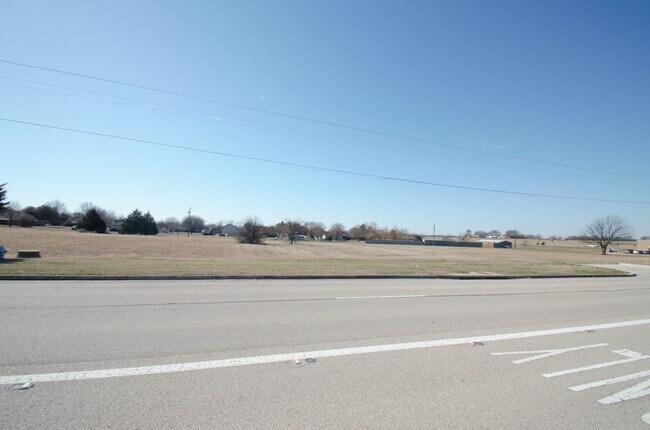
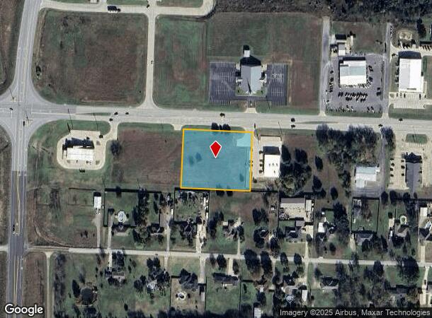
Property Record
W Highway 120, Pottsboro, TX 75076
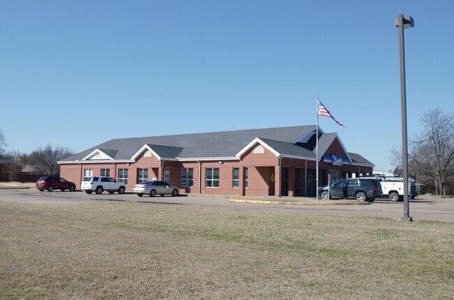
NEARBY LISTINGS FOR SALE OR LEASE
Property Detail
W Highway 120
Sherman-Denison, TX
Preston Ridge Addn
153776
PRESTON RIDGE ADDN, BLOCK 4, LOT 19, & 21, ACRES 2.0
Commercialacreage
Grayson
X
Texas
40013C0475E
19
2024
2 AC
2025
Texas East Area
000305
Other Market Areas
DEMOGRAPHICS near W Highway 120
1 Mile
3 Mile
5 Mile
2024 Total Population
1,474
3,327
9,458
2029 Population
1,655
3,753
10,774
Pop Growth 2024-2029
+ 12.28%
+ 12.80%
+ 13.91%
Average Age
40
42
44
2024 Total Households
568
1,316
3,880
HH Growth 2024-2029
+ 12.68%
+ 13.22%
+ 14.56%
Median Household Inc
$65,602
$75,599
$79,527
Avg Household Size
2.60
2.50
2.40
2024 Avg HH Vehicles
2.00
2.00
2.00
Median Home Value
$277,333
$304,130
$285,136
Median Year Built
1988
1989
1985
Nearby Places
- Restaurants
- Banks
- Shops
- Fitness
- Groceries
SALE & LEASE HISTORY
LISTING DATE
SALE/LEASE

Mar 09, 2021
For Sale
Nearby Properties
Address
Land Use
TOTAL SIZE
Lot Size
Zoning
Address
Land Use
TOTAL SIZE
Lot Size
Zoning
269,202 SF
41.11 AC
Address
Land Use
TOTAL SIZE
Lot Size
Zoning
153,705 SF
70 AC
Address
Land Use
TOTAL SIZE
Lot Size
Zoning
160 AC
Address
Land Use
TOTAL SIZE
Lot Size
Zoning
37,501 SF
6.42 AC
Address
Land Use
TOTAL SIZE
Lot Size
Zoning
151.74 AC
Address
Land Use
TOTAL SIZE
Lot Size
Zoning
67,640 SF
8.80 AC
Address
Land Use
TOTAL SIZE
Lot Size
Zoning
55,450 SF
6.09 AC
Address
Land Use
TOTAL SIZE
Lot Size
Zoning
40,800 SF
2.84 AC
Address
Land Use
TOTAL SIZE
Lot Size
Zoning
14,200 SF
2.04 AC
Address
Land Use
TOTAL SIZE
Lot Size
Zoning
9,241 SF
2.27 AC
Address
Land Use
TOTAL SIZE
Lot Size
Zoning
40,756 SF
39 AC
Address
Land Use
TOTAL SIZE
Lot Size
Zoning
10,744 SF
3.87 AC
Address
Land Use
TOTAL SIZE
Lot Size
Zoning
33,390 SF
62.89 AC
Address
Land Use
TOTAL SIZE
Lot Size
Zoning
26,800 SF
2.81 AC
Address
Land Use
TOTAL SIZE
Lot Size
Zoning
22,284 SF
80.23 AC
Address
Land Use
TOTAL SIZE
Lot Size
Zoning
7,000 SF
1.60 AC
Address
Land Use
TOTAL SIZE
Lot Size
Zoning
22,944 SF
2.94 AC
Address
Land Use
TOTAL SIZE
Lot Size
Zoning
38,944 SF
2.35 AC
Address
Land Use
TOTAL SIZE
Lot Size
Zoning
73,340 SF
8.22 AC
Address
Land Use
TOTAL SIZE
Lot Size
Zoning
48,000 SF
4.97 AC
Address
Land Use
TOTAL SIZE
Lot Size
Zoning
16,400 SF
2.45 AC
Address
Land Use
TOTAL SIZE
Lot Size
Zoning
9,718 SF
119.13 AC
Address
Land Use
TOTAL SIZE
Lot Size
Zoning
1,380 SF
5.05 AC
Address
Land Use
TOTAL SIZE
Lot Size
Zoning
7,857 SF
3.75 AC
Address
Land Use
TOTAL SIZE
Lot Size
Zoning
7,246 SF
0.77 AC
Address
Land Use
TOTAL SIZE
Lot Size
Zoning
12,660 SF
2.25 AC
Address
Land Use
TOTAL SIZE
Lot Size
Zoning
8,000 SF
0.82 AC
Address
Land Use
TOTAL SIZE
Lot Size
Zoning
20,259 SF
2.19 AC
Address
Land Use
TOTAL SIZE
Lot Size
Zoning
13,400 SF
5 AC
Address
Land Use
TOTAL SIZE
Lot Size
Zoning
14,780 SF
The World's #1 Commercial Real Estate Marketplace
Connect with us
© 2025 CoStar Group
The information above has been obtained from sources believed reliable. While we do not doubt its accuracy we have not verified it and make no guarantee, warranty or representation about it. It is your responsibility to independently confirm its accuracy and completeness. Any projections, opinions, assumptions, or estimates used are for example only and do not represent the current or future performance of the property. The value of this transaction to you depends on tax and other factors which should be evaluated by your tax, financial, and legal advisors. You and your advisors should conduct a careful, independent investigation of the property to determine to your satisfaction the suitability of the property for your needs.