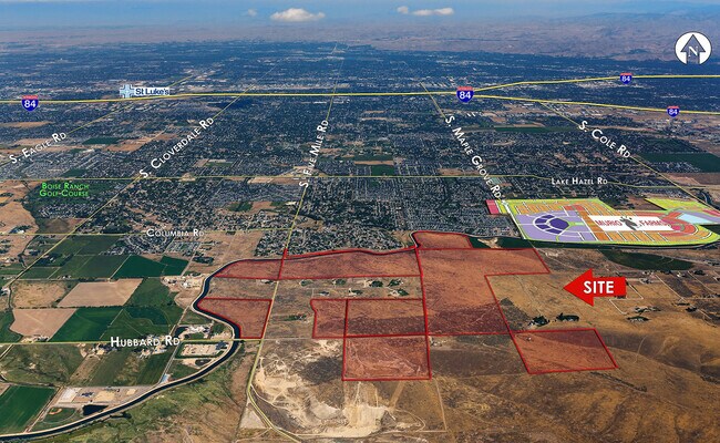
Property Record
W Hubbard Rd, Kuna, ID 83634
NEARBY LISTINGS FOR SALE OR LEASE
Property Detail
W Hubbard Rd
S1410449005
PAR #1800 POR SE4NE4 LYING SOUTH OF NEW YORK CANAL SEC 10 2N 1E
Vacantlandnec
Ada
X
Idaho
16001C0265J
23.64 AC
2024
South Ada County
2025
Boise City/Nampa
010101
Boise City, ID
DEMOGRAPHICS near W Hubbard Rd
1 Mile
3 Mile
5 Mile
2024 Total Population
4,545
37,943
83,619
2029 Population
5,123
42,970
95,107
Pop Growth 2024-2029
+ 12.72%
+ 13.25%
+ 13.74%
Average Age
36
38
39
2024 Total Households
1,449
12,487
28,228
HH Growth 2024-2029
+ 12.97%
+ 13.65%
+ 14.16%
Median Household Inc
$75,161
$86,356
$89,858
Avg Household Size
3.00
2.80
2.80
2024 Avg HH Vehicles
2.00
2.00
2.00
Median Home Value
$383,244
$438,694
$454,027
Median Year Built
2000
2004
2003
Nearby Places
Map Layers
Map Styles
 Street
 Aerial
- Restaurants
- Banks
- Shops
- Fitness
- Groceries
PUBLIC TRANSPORTATION
AIRPORT
Boise Air Trml/Gowen Field
DRIVE
WALK
Distance
Boise Air Trml/Gowen Field
35 min
13.0 mi
Freight Ports
Port of Portland
DRIVE
WALK
Distance
Port of Portland
482 min
432.1 mi
SALE & LEASE HISTORY
LISTING DATE
SALE/LEASE

Sep 23, 2021
For Sale
Nearby Properties
Address
Land Use
TOTAL SIZE
Lot Size
Zoning
Address
Land Use
TOTAL SIZE
Lot Size
Zoning
164,981 SF
7.47 AC
R20
Address
Land Use
TOTAL SIZE
Lot Size
Zoning
70.14 AC
SP-03
Address
Land Use
TOTAL SIZE
Lot Size
Zoning
121,203 SF
5.56 AC
LO
Address
Land Use
TOTAL SIZE
Lot Size
Zoning
12,231 SF
6.72 AC
R-12
Address
Land Use
TOTAL SIZE
Lot Size
Zoning
17,175 SF
2.96 AC
C1
Address
Land Use
TOTAL SIZE
Lot Size
Zoning
9.87 AC
R-8
Address
Land Use
TOTAL SIZE
Lot Size
Zoning
14,739 SF
1.74 AC
C2
Address
Land Use
TOTAL SIZE
Lot Size
Zoning
15,290 SF
0.56 AC
C2
Address
Land Use
TOTAL SIZE
Lot Size
Zoning
42,680 SF
3.46 AC
C2
Address
Land Use
TOTAL SIZE
Lot Size
Zoning
40.19 AC
R-6
Address
Land Use
TOTAL SIZE
Lot Size
Zoning
5,148 SF
1.48 AC
C2
Address
Land Use
TOTAL SIZE
Lot Size
Zoning
15,217 SF
286.60 AC
R-6
Address
Land Use
TOTAL SIZE
Lot Size
Zoning
4,268 SF
2.02 AC
C2
Address
Land Use
TOTAL SIZE
Lot Size
Zoning
20.88 AC
SP-03
Address
Land Use
TOTAL SIZE
Lot Size
Zoning
12.61 AC
R-8
Address
Land Use
TOTAL SIZE
Lot Size
Zoning
12,904 SF
121.58 AC
RUT
Address
Land Use
TOTAL SIZE
Lot Size
Zoning
4,337 SF
2.55 AC
C1
Address
Land Use
TOTAL SIZE
Lot Size
Zoning
11.23 AC
C2
Address
Land Use
TOTAL SIZE
Lot Size
Zoning
14.84 AC
SP-03
Address
Land Use
TOTAL SIZE
Lot Size
Zoning
1,372 SF
9.59 AC
R-8
Address
Land Use
TOTAL SIZE
Lot Size
Zoning
160 AC
RP
Address
Land Use
TOTAL SIZE
Lot Size
Zoning
20,484 SF
2.36 AC
C2
Address
Land Use
TOTAL SIZE
Lot Size
Zoning
14,779 SF
2.50 AC
C2
Address
Land Use
TOTAL SIZE
Lot Size
Zoning
17.63 AC
C2
Address
Land Use
TOTAL SIZE
Lot Size
Zoning
80 AC
RP
Address
Land Use
TOTAL SIZE
Lot Size
Zoning
1,079 SF
9.24 AC
RUT
Address
Land Use
TOTAL SIZE
Lot Size
Zoning
17.44 AC
R-6
Address
Land Use
TOTAL SIZE
Lot Size
Zoning
16.49 AC
R-6
Address
Land Use
TOTAL SIZE
Lot Size
Zoning
15.90 AC
R-6
Address
Land Use
TOTAL SIZE
Lot Size
Zoning
8.62 AC
SP-03
The World's #1 Commercial Real Estate Marketplace
Connect with us
© 2025 CoStar Group
The information above has been obtained from sources believed reliable. While we do not doubt its accuracy we have not verified it and make no guarantee, warranty or representation about it. It is your responsibility to independently confirm its accuracy and completeness. Any projections, opinions, assumptions, or estimates used are for example only and do not represent the current or future performance of the property. The value of this transaction to you depends on tax and other factors which should be evaluated by your tax, financial, and legal advisors. You and your advisors should conduct a careful, independent investigation of the property to determine to your satisfaction the suitability of the property for your needs.