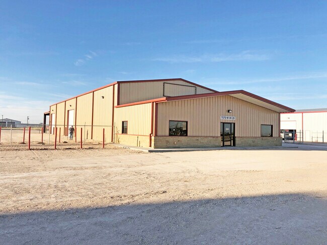
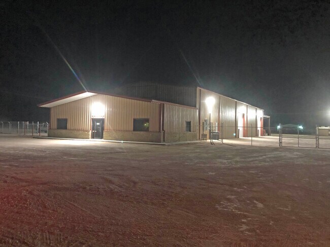
Property Record
W Ih 20, Odessa, TX 79763

Property Detail
W Ih 20
03300-00770-00000
BOLES INDUSTRIAL SITES BLOCK 4 LOTS 6-7
Commercialnec
ECTOR
EW3
Texas
B and X Area of moderate flood hazard, usually the area between the limits of the 100-year and 500-year floods.
6-7
2025
1.84 AC
2025
Midland & Odessa
002803
Other Market Areas
1,250 SF
Odessa, TX
NEARBY LISTINGS FOR SALE OR LEASE
DEMOGRAPHICS near W Ih 20
1 mile
3 mile
5 mile
2025 Total Population
70
10,873
43,944
2030 Population
74
11,627
46,819
Pop Growth 2025-2030
+ 5.71%
+ 6.93%
+ 6.54%
Average Age
33
33
34
2025 Total Households
21
3,480
14,625
HH Growth 2025-2030
+ 9.52%
+ 8.07%
+ 7.65%
Median Household Inc
$74,999
$66,572
$57,381
Avg Household Size
3.50
3.10
3.00
2025 Avg HH Vehicles
2.00
2.00
2.00
Median Home Value
$116,667
$115,878
$145,471
Median Year Built
1979
1988
1980
Nearby Places
Map Layers
Map Styles
 Street
 Aerial
Layers
 Traffic
 Biking
Places
Listings with unknown addresses are not visible on the map
- Restaurants
- Banks
- Shops
- Fitness
- Groceries
PUBLIC TRANSPORTATION
AIRPORT
Midland International Air And Space Port
Drive
Walk
Distance
Midland International Air And Space Port
29 min
17.9 mi
Freight Ports
Port of Corpus Christi
Drive
Walk
Distance
Port of Corpus Christi
506 min
486.7 mi
SALE & LEASE HISTORY
LISTING DATE
SALE/LEASE

May 14, 2024
For Lease
Nearby Properties
Address
Land Use
TOTAL SIZE
Lot Size
Zoning
Address
Land Use
TOTAL SIZE
Lot Size
Zoning
9,560 SF
141.91 AC
ES1
Address
Land Use
TOTAL SIZE
Lot Size
Zoning
34,762 SF
77.94 AC
ES1
Address
Land Use
TOTAL SIZE
Lot Size
Zoning
8,847 SF
104.28 AC
EW5
Address
Land Use
TOTAL SIZE
Lot Size
Zoning
106,872 SF
10.59 AC
EW3
Address
Land Use
TOTAL SIZE
Lot Size
Zoning
26,482 SF
4.56 AC
EW1
Address
Land Use
TOTAL SIZE
Lot Size
Zoning
17,000 SF
10.29 AC
ES1
Address
Land Use
TOTAL SIZE
Lot Size
Zoning
11,500 SF
11.42 AC
ES1
Address
Land Use
TOTAL SIZE
Lot Size
Zoning
72,428 SF
6.47 AC
EW3
Address
Land Use
TOTAL SIZE
Lot Size
Zoning
750 SF
13.58 AC
EW3
Address
Land Use
TOTAL SIZE
Lot Size
Zoning
8,266 SF
8.91 AC
ES2
Address
Land Use
TOTAL SIZE
Lot Size
Zoning
1,872 SF
19.87 AC
ES1
Address
Land Use
TOTAL SIZE
Lot Size
Zoning
8,865 SF
2.83 AC
EW5
Address
Land Use
TOTAL SIZE
Lot Size
Zoning
12,000 SF
2.35 AC
Address
Land Use
TOTAL SIZE
Lot Size
Zoning
10,128 SF
2 AC
EW5
Address
Land Use
TOTAL SIZE
Lot Size
Zoning
3,500 SF
10.77 AC
EW5
Address
Land Use
TOTAL SIZE
Lot Size
Zoning
12,000 SF
5.54 AC
Address
Land Use
TOTAL SIZE
Lot Size
Zoning
12,000 SF
5 AC
Address
Land Use
TOTAL SIZE
Lot Size
Zoning
2,800 SF
0.92 AC
EW3
Address
Land Use
TOTAL SIZE
Lot Size
Zoning
17,200 SF
5.34 AC
EW1
Address
Land Use
TOTAL SIZE
Lot Size
Zoning
14,000 SF
2.32 AC
Address
Land Use
TOTAL SIZE
Lot Size
Zoning
12,784 SF
1.53 AC
EW5
Address
Land Use
TOTAL SIZE
Lot Size
Zoning
14,000 SF
5.51 AC
ES1
Address
Land Use
TOTAL SIZE
Lot Size
Zoning
2,500 SF
4.52 AC
EW1
Address
Land Use
TOTAL SIZE
Lot Size
Zoning
10,500 SF
6.38 AC
EW3
Address
Land Use
TOTAL SIZE
Lot Size
Zoning
10,000 SF
1.03 AC
EW5
Address
Land Use
TOTAL SIZE
Lot Size
Zoning
27,160 SF
0.64 AC
EW1
Address
Land Use
TOTAL SIZE
Lot Size
Zoning
10,168 SF
5.70 AC
ES1
Address
Land Use
TOTAL SIZE
Lot Size
Zoning
5,196 SF
23.16 AC
EW1
Address
Land Use
TOTAL SIZE
Lot Size
Zoning
22,400 SF
18.22 AC
EW3
Address
Land Use
TOTAL SIZE
Lot Size
Zoning
2,520 SF
12.73 AC
EW5
The World's #1 Commercial Real Estate Marketplace
Connect with us
© 2026 CoStar Group
The information above has been obtained from sources believed reliable. While we do not doubt its accuracy we have not verified it and make no guarantee, warranty or representation about it. It is your responsibility to independently confirm its accuracy and completeness. Any projections, opinions, assumptions, or estimates used are for example only and do not represent the current or future performance of the property. The value of this transaction to you depends on tax and other factors which should be evaluated by your tax, financial, and legal advisors. You and your advisors should conduct a careful, independent investigation of the property to determine to your satisfaction the suitability of the property for your needs.