Property Record
W Lasalle St, Tampa, FL 33607
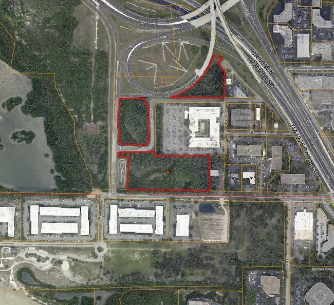

Property Detail
W Lasalle St
Tampa-St. Petersburg-Clearwater, FL
TRACT BEG AT SE COR OF SW 1/4 OF SE 1/4 RUN N 412.05 FT W 710 FT N 541 FT E 710 FT N TO SLY R/W OF MEMORIAL HWY AND TO PT A BEG AGAIN AT POB RUN W TO PT 165.69 FT E OF SW COR OF SW 1/4 OF SE 1/4 RUN N 1162 FT MOL E 499.05 FT S 56.88 FT E 100 FT N 55.
A-18-29-18-ZZZ-000005-49120.0
HILLSBOROUGH
Commercialacreage
Florida
M-AP-1
49120
AE The base floodplain where base flood elevations are provided. AE Zones are now used on new format FIRMs instead of A1-A30 Zones.
12.24 AC
2024
Westshore
2025
Tampa/St Petersburg
004601
NEARBY LISTINGS FOR SALE OR LEASE
DEMOGRAPHICS near W Lasalle St
1 mile
3 mile
5 mile
2025 Total Population
1,825
52,190
212,251
2030 Population
1,974
56,194
228,279
Pop Growth 2025-2030
+ 8.16%
+ 7.67%
+ 7.55%
Average Age
41
40
40
2025 Total Households
811
23,024
90,552
HH Growth 2025-2030
+ 8.26%
+ 7.91%
+ 7.89%
Median Household Inc
$131,402
$101,199
$80,261
Avg Household Size
2.20
2.20
2.20
2025 Avg HH Vehicles
2.00
2.00
2.00
Median Home Value
$859,210
$685,121
$495,573
Median Year Built
1997
1986
1982
Nearby Places
Map Layers
Map Styles
 Street
 Aerial
Layers
 Traffic
 Biking
Places
Listings with unknown addresses are not visible on the map
- Restaurants
- Banks
- Shops
- Fitness
- Groceries
PUBLIC TRANSPORTATION
COMMUTER RAIL
Tampa (Silver Star - Amtrak)
Drive
Walk
Distance
Tampa (Silver Star - Amtrak)
11 min
6.6 mi
AIRPORT
Tampa International
Drive
Walk
Distance
Tampa International
8 min
4.4 mi
St Pete-Clearwater International
Drive
Walk
Distance
St Pete-Clearwater International
25 min
13.1 mi
Freight Ports
Port of Tampa Bay
Drive
Walk
Distance
Port of Tampa Bay
19 min
10.0 mi
Nearby Properties
Address
Land Use
TOTAL SIZE
Lot Size
Zoning
Address
Land Use
TOTAL SIZE
Lot Size
Zoning
2,080,593 SF
1,915.65 AC
M-AP-1
Address
Land Use
TOTAL SIZE
Lot Size
Zoning
927,709 SF
74.68 AC
PD-A
Address
Land Use
TOTAL SIZE
Lot Size
Zoning
1,278,217 SF
0.02 AC
CI
Address
Land Use
TOTAL SIZE
Lot Size
Zoning
142,972 SF
21.79 AC
M-AP-1
Address
Land Use
TOTAL SIZE
Lot Size
Zoning
439,758 SF
22.14 AC
PD
Address
Land Use
TOTAL SIZE
Lot Size
Zoning
532,661 SF
76.96 AC
CI
Address
Land Use
TOTAL SIZE
Lot Size
Zoning
429,656 SF
6.97 AC
PD
Address
Land Use
TOTAL SIZE
Lot Size
Zoning
401,486 SF
13.22 AC
PD-A
Address
Land Use
TOTAL SIZE
Lot Size
Zoning
356,025 SF
4.57 AC
PD
Address
Land Use
TOTAL SIZE
Lot Size
Zoning
352,071 SF
21.42 AC
M-AP-2
Address
Land Use
TOTAL SIZE
Lot Size
Zoning
387,234 SF
5.31 AC
OP-1
Address
Land Use
TOTAL SIZE
Lot Size
Zoning
289,875 SF
19.58 AC
IG
Address
Land Use
TOTAL SIZE
Lot Size
Zoning
367,609 SF
5.46 AC
PD
Address
Land Use
TOTAL SIZE
Lot Size
Zoning
393,971 SF
6.85 AC
PD
Address
Land Use
TOTAL SIZE
Lot Size
Zoning
351,344 SF
84.32 AC
PD
Address
Land Use
TOTAL SIZE
Lot Size
Zoning
245,701 SF
3.15 AC
PD
Address
Land Use
TOTAL SIZE
Lot Size
Zoning
382,217 SF
29.74 AC
PD
Address
Land Use
TOTAL SIZE
Lot Size
Zoning
309,242 SF
7.44 AC
PD-A
Address
Land Use
TOTAL SIZE
Lot Size
Zoning
305,936 SF
5.47 AC
PD-A
Address
Land Use
TOTAL SIZE
Lot Size
Zoning
485,897 SF
2.90 AC
PD
Address
Land Use
TOTAL SIZE
Lot Size
Zoning
331,003 SF
3.07 AC
PD
Address
Land Use
TOTAL SIZE
Lot Size
Zoning
344,612 SF
6.09 AC
PD
Address
Land Use
TOTAL SIZE
Lot Size
Zoning
2,226 SF
438.48 AC
SPI-AP-1
Address
Land Use
TOTAL SIZE
Lot Size
Zoning
369,417 SF
13.42 AC
PD
Address
Land Use
TOTAL SIZE
Lot Size
Zoning
421,814 SF
22.34 AC
PD
Address
Land Use
TOTAL SIZE
Lot Size
Zoning
521,097 SF
30.92 AC
RMC-20
Address
Land Use
TOTAL SIZE
Lot Size
Zoning
297,410 SF
3.43 AC
PD
Address
Land Use
TOTAL SIZE
Lot Size
Zoning
365,470 SF
13.29 AC
M-AP-1
Address
Land Use
TOTAL SIZE
Lot Size
Zoning
280,274 SF
5.32 AC
PD
The World's #1 Commercial Real Estate Marketplace
Connect with us
© 2026 CoStar Group
The information above has been obtained from sources believed reliable. While we do not doubt its accuracy we have not verified it and make no guarantee, warranty or representation about it. It is your responsibility to independently confirm its accuracy and completeness. Any projections, opinions, assumptions, or estimates used are for example only and do not represent the current or future performance of the property. The value of this transaction to you depends on tax and other factors which should be evaluated by your tax, financial, and legal advisors. You and your advisors should conduct a careful, independent investigation of the property to determine to your satisfaction the suitability of the property for your needs.