Property Record
W Main St, Lewisville, TX 75067
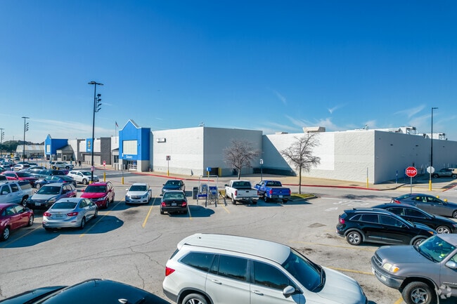

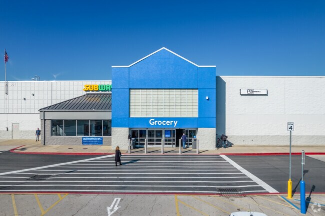
Property Detail
W Main St
Dallas-Fort Worth-Arlington, TX
VALLEY RIDGE BUSINESS PARK WEST BLK C LOT 3-R1-A
R1016214
DENTON
Commercialnec
Texas
2024
3
2025
18.16 AC
021740
Lewisville
198,685 SF
Dallas/Ft Worth
NEARBY LISTINGS FOR SALE OR LEASE
DEMOGRAPHICS near W Main St
1 mile
3 mile
5 mile
2024 Total Population
16,723
114,149
218,553
2029 Population
18,654
127,136
242,758
Pop Growth 2024-2029
+ 11.55%
+ 11.38%
+ 11.08%
Average Age
37
38
39
2024 Total Households
5,684
41,816
81,135
HH Growth 2024-2029
+ 11.77%
+ 11.65%
+ 11.37%
Median Household Inc
$68,300
$92,509
$103,651
Avg Household Size
2.80
2.70
2.60
2024 Avg HH Vehicles
2.00
2.00
2.00
Median Home Value
$314,825
$369,346
$444,590
Median Year Built
1985
1991
1995
Nearby Places
Map Layers
Map Styles
 Street
 Aerial
Transit
 Traffic
 Biking
Places
Listings with unknown addresses are not visible on the map
- Restaurants
- Banks
- Shops
- Fitness
- Groceries
PUBLIC TRANSPORTATION
COMMUTER RAIL
Drive
Walk
Distance
6 min
2.0 mi
Drive
Walk
Distance
6 min
3.2 mi
AIRPORT
Dallas-Fort Worth International
Drive
Walk
Distance
Dallas-Fort Worth International
19 min
12.5 mi
Dallas Love Field
Drive
Walk
Distance
Dallas Love Field
31 min
21.6 mi
Nearby Properties
Address
Land Use
TOTAL SIZE
Lot Size
Zoning
Address
Land Use
TOTAL SIZE
Lot Size
Zoning
334,685 SF
38.12 AC
Address
Land Use
TOTAL SIZE
Lot Size
Zoning
599,705 SF
10.38 AC
Address
Land Use
TOTAL SIZE
Lot Size
Zoning
394,048 SF
16.36 AC
Address
Land Use
TOTAL SIZE
Lot Size
Zoning
309,498 SF
9.57 AC
Address
Land Use
TOTAL SIZE
Lot Size
Zoning
323,048 SF
14.78 AC
Address
Land Use
TOTAL SIZE
Lot Size
Zoning
412,389 SF
16.69 AC
3B
Address
Land Use
TOTAL SIZE
Lot Size
Zoning
282,766 SF
9 AC
Address
Land Use
TOTAL SIZE
Lot Size
Zoning
189,200 SF
5.08 AC
Address
Land Use
TOTAL SIZE
Lot Size
Zoning
269,300 SF
60.39 AC
Address
Land Use
TOTAL SIZE
Lot Size
Zoning
340,081 SF
18.06 AC
6
Address
Land Use
TOTAL SIZE
Lot Size
Zoning
380,316 SF
26.10 AC
Address
Land Use
TOTAL SIZE
Lot Size
Zoning
295,098 SF
10.65 AC
Address
Land Use
TOTAL SIZE
Lot Size
Zoning
266,959 SF
3.83 AC
Address
Land Use
TOTAL SIZE
Lot Size
Zoning
297,636 SF
9.43 AC
Address
Land Use
TOTAL SIZE
Lot Size
Zoning
295,668 SF
13.03 AC
Address
Land Use
TOTAL SIZE
Lot Size
Zoning
226,888 SF
5.62 AC
Address
Land Use
TOTAL SIZE
Lot Size
Zoning
345,310 SF
11.71 AC
Address
Land Use
TOTAL SIZE
Lot Size
Zoning
288,735 SF
15.50 AC
3B
Address
Land Use
TOTAL SIZE
Lot Size
Zoning
344,932 SF
18.28 AC
3G
Address
Land Use
TOTAL SIZE
Lot Size
Zoning
212,454 SF
13 AC
6B
Address
Land Use
TOTAL SIZE
Lot Size
Zoning
572,808 SF
25.26 AC
Address
Land Use
TOTAL SIZE
Lot Size
Zoning
244,310 SF
6.24 AC
Address
Land Use
TOTAL SIZE
Lot Size
Zoning
440,000 SF
3.67 AC
Address
Land Use
TOTAL SIZE
Lot Size
Zoning
99,272 SF
16.60 AC
Address
Land Use
TOTAL SIZE
Lot Size
Zoning
241,095 SF
13.02 AC
Address
Land Use
TOTAL SIZE
Lot Size
Zoning
259,728 SF
14.30 AC
3G
Address
Land Use
TOTAL SIZE
Lot Size
Zoning
241,592 SF
11.09 AC
3G
Address
Land Use
TOTAL SIZE
Lot Size
Zoning
268,441 SF
13.89 AC
3G
Address
Land Use
TOTAL SIZE
Lot Size
Zoning
134,061 SF
17.87 AC
Address
Land Use
TOTAL SIZE
Lot Size
Zoning
221,320 SF
12.79 AC
6B
The World's #1 Commercial Real Estate Marketplace
Connect with us
© 2026 CoStar Group
The information above has been obtained from sources believed reliable. While we do not doubt its accuracy we have not verified it and make no guarantee, warranty or representation about it. It is your responsibility to independently confirm its accuracy and completeness. Any projections, opinions, assumptions, or estimates used are for example only and do not represent the current or future performance of the property. The value of this transaction to you depends on tax and other factors which should be evaluated by your tax, financial, and legal advisors. You and your advisors should conduct a careful, independent investigation of the property to determine to your satisfaction the suitability of the property for your needs.