Property Record
W Mclean Rd, Hope Hull, AL 36043

Property Detail
W Mclean Rd
Montgomery, AL
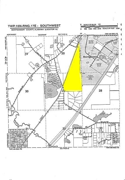
SEC 29 T15N R17E 11.66 AC IN W1/2 OF NE1/4 & SITUATED W OF L&N RR 1409290000003000
14-09-29-0-000-003.000
MONTGOMERY
Pasture
Alabama
B and X Area of moderate flood hazard, usually the area between the limits of the 100-year and 500-year floods.
d
2025
11.70 AC
2025
Outlying Montgomery Cnty
780800
Montgomery
NEARBY LISTINGS FOR SALE OR LEASE
-
-
View all Hope Hull listings for sale on LoopNet.com
DEMOGRAPHICS near W Mclean Rd
1 mile
3 mile
5 mile
2025 Total Population
137
1,254
7,552
2030 Population
139
1,263
7,474
Pop Growth 2025-2030
+ 1.46%
+ 0.72%
(1.03%)
Average Age
45
45
43
2025 Total Households
61
549
3,047
HH Growth 2025-2030
+ 1.64%
+ 0.73%
(0.92%)
Median Household Inc
$94,444
$78,427
$49,128
Avg Household Size
2.20
2.30
2.50
2025 Avg HH Vehicles
2.00
2.00
2.00
Median Home Value
$240,000
$226,250
$92,843
Median Year Built
1986
1989
1975
Nearby Places
Map Layers
Map Styles
 Street
 Aerial
Transit
 Traffic
 Biking
Places
Listings with unknown addresses are not visible on the map
- Restaurants
- Banks
- Shops
- Fitness
- Groceries
PUBLIC TRANSPORTATION
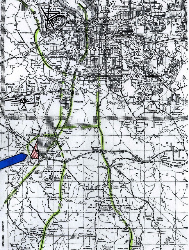
AIRPORT
Montgomery Regional (Dannelly Field)
Drive
Walk
Distance
Montgomery Regional (Dannelly Field)
16 min
8.6 mi
Freight Ports
Port of Mobile
Drive
Walk
Distance
Port of Mobile
180 min
162.3 mi
SALE & LEASE HISTORY
LISTING DATE
SALE/LEASE

Sep 24, 2016
For Sale
Nearby Properties
Address
Land Use
TOTAL SIZE
Lot Size
Zoning
Address
Land Use
TOTAL SIZE
Lot Size
Zoning
21,991 SF
100.36 AC
M-3
Address
Land Use
TOTAL SIZE
Lot Size
Zoning
37,700 SF
Address
Land Use
TOTAL SIZE
Lot Size
Zoning
189 SF
42 AC
Address
Land Use
TOTAL SIZE
Lot Size
Zoning
250,600 SF
41.59 AC
M-1
Address
Land Use
TOTAL SIZE
Lot Size
Zoning
189,246 SF
16.79 AC
M-3
Address
Land Use
TOTAL SIZE
Lot Size
Zoning
407,491 SF
37.98 AC
M-1
Address
Land Use
TOTAL SIZE
Lot Size
Zoning
482.36 AC
AGR-1
Address
Land Use
TOTAL SIZE
Lot Size
Zoning
200,012 SF
12.39 AC
M-1
Address
Land Use
TOTAL SIZE
Lot Size
Zoning
213,941 SF
28 AC
M-1
Address
Land Use
TOTAL SIZE
Lot Size
Zoning
240,744 SF
22 AC
M-1
Address
Land Use
TOTAL SIZE
Lot Size
Zoning
63,046 SF
2.85 AC
M-1
Address
Land Use
TOTAL SIZE
Lot Size
Zoning
96,162 SF
20 AC
M-1
Address
Land Use
TOTAL SIZE
Lot Size
Zoning
287,509 SF
32.30 AC
M-1
Address
Land Use
TOTAL SIZE
Lot Size
Zoning
154,853 SF
14.67 AC
M-1
Address
Land Use
TOTAL SIZE
Lot Size
Zoning
52,355 SF
2.19 AC
B-2
Address
Land Use
TOTAL SIZE
Lot Size
Zoning
114,714 SF
24.60 AC
M-1
Address
Land Use
TOTAL SIZE
Lot Size
Zoning
246.64 AC
AGR-1
Address
Land Use
TOTAL SIZE
Lot Size
Zoning
47,519 SF
1.93 AC
B-2
Address
Land Use
TOTAL SIZE
Lot Size
Zoning
160,232 SF
26 AC
M-1
Address
Land Use
TOTAL SIZE
Lot Size
Zoning
40,661 SF
1.62 AC
M-1
Address
Land Use
TOTAL SIZE
Lot Size
Zoning
125,540 SF
14 AC
M-1
Address
Land Use
TOTAL SIZE
Lot Size
Zoning
171.02 AC
M-3
Address
Land Use
TOTAL SIZE
Lot Size
Zoning
19,777 SF
20 AC
AGR-1
Address
Land Use
TOTAL SIZE
Lot Size
Zoning
25,273 SF
1.50 AC
M-1
Address
Land Use
TOTAL SIZE
Lot Size
Zoning
37,389 SF
13.86 AC
M-1
Address
Land Use
TOTAL SIZE
Lot Size
Zoning
27,888 SF
1.20 AC
M-1
Address
Land Use
TOTAL SIZE
Lot Size
Zoning
79.25 AC
Address
Land Use
TOTAL SIZE
Lot Size
Zoning
2,767 SF
43.60 AC
AGR-1
Address
Land Use
TOTAL SIZE
Lot Size
Zoning
114.84 AC
M-3
Address
Land Use
TOTAL SIZE
Lot Size
Zoning
12.60 AC
AGR-1
The World's #1 Commercial Real Estate Marketplace
Connect with us
© 2026 CoStar Group
The information above has been obtained from sources believed reliable. While we do not doubt its accuracy we have not verified it and make no guarantee, warranty or representation about it. It is your responsibility to independently confirm its accuracy and completeness. Any projections, opinions, assumptions, or estimates used are for example only and do not represent the current or future performance of the property. The value of this transaction to you depends on tax and other factors which should be evaluated by your tax, financial, and legal advisors. You and your advisors should conduct a careful, independent investigation of the property to determine to your satisfaction the suitability of the property for your needs.