Property Record
W Northside Dr, Jackson, MS 39213
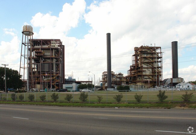


Property Detail
W Northside Dr
Jackson, MS
THAT PT LOTS 5 & 6 S 1/2 S 1/2 SEC 17 T6 R1E GARLAND COMMUNITY FARMS
0413-0001-000
HINDS
Charitableorganization
Mississippi
B and X Area of moderate flood hazard, usually the area between the limits of the 100-year and 500-year floods.
5,6
0
45 AC
2025
North Jackson
000600
Jackson
NEARBY LISTINGS FOR SALE OR LEASE
DEMOGRAPHICS near W Northside Dr
1 mile
3 mile
5 mile
2025 Total Population
4,282
38,480
94,248
2030 Population
4,153
37,749
91,817
Pop Growth 2025-2030
(3.01%)
(1.90%)
(2.58%)
Average Age
40
41
39
2025 Total Households
1,864
16,451
40,331
HH Growth 2025-2030
(3.17%)
(2.07%)
(2.74%)
Median Household Inc
$28,208
$35,155
$41,395
Avg Household Size
2.30
2.20
2.20
2025 Avg HH Vehicles
2.00
2.00
2.00
Median Home Value
$70,062
$85,594
$112,497
Median Year Built
1966
1964
1967
Nearby Places
Map Layers
Map Styles
 Street
 Aerial
Transit
 Traffic
 Biking
Places
Listings with unknown addresses are not visible on the map
- Restaurants
- Banks
- Shops
- Fitness
- Groceries
PUBLIC TRANSPORTATION
COMMUTER RAIL
Jackson (City of New Orleans - Amtrak)
Drive
Walk
Distance
Jackson (City of New Orleans - Amtrak)
11 min
5.2 mi
AIRPORT
Jackson-Medgar Wiley Evers International
Drive
Walk
Distance
Jackson-Medgar Wiley Evers International
26 min
14.2 mi
Freight Ports
Port of Greater Baton Rouge
Drive
Walk
Distance
Port of Greater Baton Rouge
207 min
183.4 mi
Nearby Properties
Address
Land Use
TOTAL SIZE
Lot Size
Zoning
Address
Land Use
TOTAL SIZE
Lot Size
Zoning
560,993 SF
47 AC
Address
Land Use
TOTAL SIZE
Lot Size
Zoning
10,100 SF
548 AC
Address
Land Use
TOTAL SIZE
Lot Size
Zoning
51,260 SF
1 AC
Address
Land Use
TOTAL SIZE
Lot Size
Zoning
16,932 SF
41.60 AC
Address
Land Use
TOTAL SIZE
Lot Size
Zoning
126,628 SF
6.74 AC
Address
Land Use
TOTAL SIZE
Lot Size
Zoning
55,160 SF
3 AC
Address
Land Use
TOTAL SIZE
Lot Size
Zoning
15,374 SF
0.64 AC
Address
Land Use
TOTAL SIZE
Lot Size
Zoning
310,650 SF
17 AC
Address
Land Use
TOTAL SIZE
Lot Size
Zoning
Address
Land Use
TOTAL SIZE
Lot Size
Zoning
9,003 SF
1 AC
Address
Land Use
TOTAL SIZE
Lot Size
Zoning
108,979 SF
5 AC
Address
Land Use
TOTAL SIZE
Lot Size
Zoning
34,821 SF
2 AC
Address
Land Use
TOTAL SIZE
Lot Size
Zoning
3,370 SF
13.37 AC
Address
Land Use
TOTAL SIZE
Lot Size
Zoning
132,342 SF
4 AC
Address
Land Use
TOTAL SIZE
Lot Size
Zoning
40,000 SF
63.11 AC
Address
Land Use
TOTAL SIZE
Lot Size
Zoning
15.09 AC
Address
Land Use
TOTAL SIZE
Lot Size
Zoning
562.15 AC
Address
Land Use
TOTAL SIZE
Lot Size
Zoning
73,196 SF
3.24 AC
Address
Land Use
TOTAL SIZE
Lot Size
Zoning
38,142 SF
16.35 AC
Address
Land Use
TOTAL SIZE
Lot Size
Zoning
38,436 SF
1 AC
Address
Land Use
TOTAL SIZE
Lot Size
Zoning
8,741 SF
Address
Land Use
TOTAL SIZE
Lot Size
Zoning
16,264 SF
7.79 AC
Address
Land Use
TOTAL SIZE
Lot Size
Zoning
21.90 AC
Address
Land Use
TOTAL SIZE
Lot Size
Zoning
253,477 SF
23 AC
Address
Land Use
TOTAL SIZE
Lot Size
Zoning
26,651 SF
2 AC
Address
Land Use
TOTAL SIZE
Lot Size
Zoning
39,928 SF
1 AC
Address
Land Use
TOTAL SIZE
Lot Size
Zoning
14,260 SF
3.05 AC
Address
Land Use
TOTAL SIZE
Lot Size
Zoning
20,050 SF
0.25 AC
Address
Land Use
TOTAL SIZE
Lot Size
Zoning
2,344 SF
10 AC
Address
Land Use
TOTAL SIZE
Lot Size
Zoning
20,244 SF
7 AC
The World's #1 Commercial Real Estate Marketplace
Connect with us
© 2026 CoStar Group
The information above has been obtained from sources believed reliable. While we do not doubt its accuracy we have not verified it and make no guarantee, warranty or representation about it. It is your responsibility to independently confirm its accuracy and completeness. Any projections, opinions, assumptions, or estimates used are for example only and do not represent the current or future performance of the property. The value of this transaction to you depends on tax and other factors which should be evaluated by your tax, financial, and legal advisors. You and your advisors should conduct a careful, independent investigation of the property to determine to your satisfaction the suitability of the property for your needs.