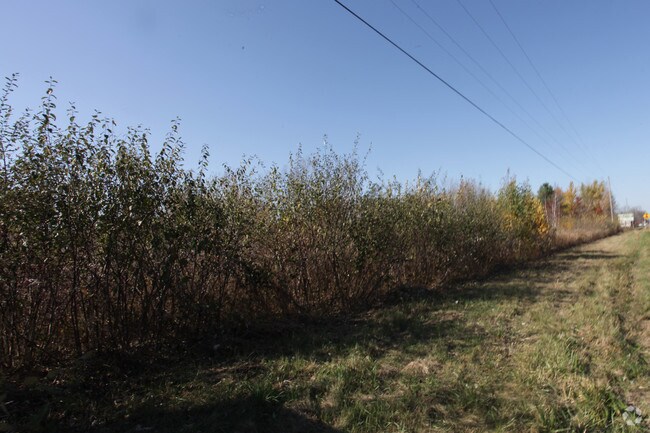
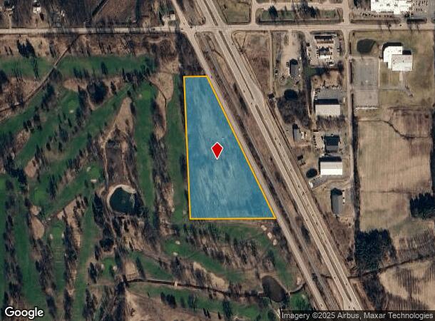
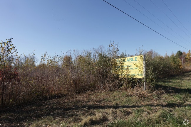
Property Record
W Olive Rd, Holland, MI 49424
NEARBY LISTINGS FOR SALE OR LEASE
Property Detail
W Olive Rd
70-12-30-200-004
COM 240 RDS E OF NW COR, TH S 1501 FT, E 685 FT, TH NW'LY 1665 FT TO PT ON N SEC LI 240 RDS 17 FT E OF NW COR, TH 17 FT TO
Commercialacreage
Ottawa
X
Michigan
26139C0225E
11.42 AC
2024
Holland North
2025
West Michigan
025102
Grand Rapids-Wyoming, MI
DEMOGRAPHICS near W Olive Rd
1 Mile
3 Mile
5 Mile
2024 Total Population
233
4,178
36,825
2029 Population
249
4,434
38,720
Pop Growth 2024-2029
+ 6.87%
+ 6.13%
+ 5.15%
Average Age
39
38
38
2024 Total Households
77
1,431
13,249
HH Growth 2024-2029
+ 6.49%
+ 6.29%
+ 5.35%
Median Household Inc
$88,020
$87,288
$72,329
Avg Household Size
2.90
2.80
2.70
2024 Avg HH Vehicles
2.00
2.00
2.00
Median Home Value
$306,667
$305,987
$244,265
Median Year Built
1974
1990
1992
Nearby Places
Map Layers
Map Styles
 Street
 Aerial
- Restaurants
- Banks
- Shops
- Fitness
- Groceries
PUBLIC TRANSPORTATION
COMMUTER RAIL
DRIVE
WALK
Distance
13 min
7.4 mi
AIRPORT
Gerald R Ford International
DRIVE
WALK
Distance
Gerald R Ford International
53 min
39.1 mi
Nearby Properties
Address
Land Use
TOTAL SIZE
Lot Size
Zoning
Address
Land Use
TOTAL SIZE
Lot Size
Zoning
1,040 SF
32.85 AC
I-2
Address
Land Use
TOTAL SIZE
Lot Size
Zoning
137,917 SF
I-2
Address
Land Use
TOTAL SIZE
Lot Size
Zoning
222,767 SF
26.59 AC
I-2
Address
Land Use
TOTAL SIZE
Lot Size
Zoning
144,764 SF
16.32 AC
R-3
Address
Land Use
TOTAL SIZE
Lot Size
Zoning
195,000 SF
13.70 AC
I-1
Address
Land Use
TOTAL SIZE
Lot Size
Zoning
177,200 SF
38.01 AC
I-2
Address
Land Use
TOTAL SIZE
Lot Size
Zoning
198,150 SF
10.26 AC
I-2
Address
Land Use
TOTAL SIZE
Lot Size
Zoning
108,100 SF
14.08 AC
I-2
Address
Land Use
TOTAL SIZE
Lot Size
Zoning
118,480 SF
12.63 AC
I-1
Address
Land Use
TOTAL SIZE
Lot Size
Zoning
75,134 SF
16.14 AC
I-2
Address
Land Use
TOTAL SIZE
Lot Size
Zoning
83,647 SF
Address
Land Use
TOTAL SIZE
Lot Size
Zoning
159,275 SF
21.05 AC
I-2
Address
Land Use
TOTAL SIZE
Lot Size
Zoning
80,000 SF
9.73 AC
I-2
Address
Land Use
TOTAL SIZE
Lot Size
Zoning
90,091 SF
10.54 AC
PUD
Address
Land Use
TOTAL SIZE
Lot Size
Zoning
79,500 SF
Address
Land Use
TOTAL SIZE
Lot Size
Zoning
100,000 SF
16.01 AC
I-2
Address
Land Use
TOTAL SIZE
Lot Size
Zoning
122,739 SF
9.61 AC
I-2
Address
Land Use
TOTAL SIZE
Lot Size
Zoning
69,220 SF
14.89 AC
I-2
Address
Land Use
TOTAL SIZE
Lot Size
Zoning
58,436 SF
5.24 AC
I-2
Address
Land Use
TOTAL SIZE
Lot Size
Zoning
45,738 SF
8.38 AC
I-1
Address
Land Use
TOTAL SIZE
Lot Size
Zoning
90,053 SF
11.91 AC
I-1
Address
Land Use
TOTAL SIZE
Lot Size
Zoning
59,229 SF
4.85 AC
I-2
Address
Land Use
TOTAL SIZE
Lot Size
Zoning
35,128 SF
16.15 AC
I-2
Address
Land Use
TOTAL SIZE
Lot Size
Zoning
24,638 SF
142 AC
Address
Land Use
TOTAL SIZE
Lot Size
Zoning
40,000 SF
Address
Land Use
TOTAL SIZE
Lot Size
Zoning
70,370 SF
11.72 AC
LDR
Address
Land Use
TOTAL SIZE
Lot Size
Zoning
77,235 SF
8.71 AC
PUD
Address
Land Use
TOTAL SIZE
Lot Size
Zoning
36,400 SF
Address
Land Use
TOTAL SIZE
Lot Size
Zoning
67,200 SF
5.09 AC
I-1
Address
Land Use
TOTAL SIZE
Lot Size
Zoning
The World's #1 Commercial Real Estate Marketplace
Connect with us
© 2025 CoStar Group
The information above has been obtained from sources believed reliable. While we do not doubt its accuracy we have not verified it and make no guarantee, warranty or representation about it. It is your responsibility to independently confirm its accuracy and completeness. Any projections, opinions, assumptions, or estimates used are for example only and do not represent the current or future performance of the property. The value of this transaction to you depends on tax and other factors which should be evaluated by your tax, financial, and legal advisors. You and your advisors should conduct a careful, independent investigation of the property to determine to your satisfaction the suitability of the property for your needs.