Property Record
W School Ln, Smithsburg, MD 21783
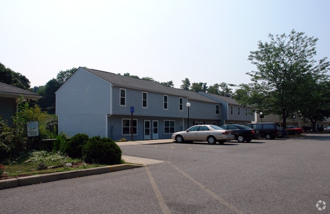


Property Detail
W School Ln
07-002971
5.86 AC ALLEY / W SCHOOL LANE SMITHSBURG
Multifamilydwelling
WASHINGTON
TR
Maryland
B and X Area of moderate flood hazard, usually the area between the limits of the 100-year and 500-year floods.
5.86 AC
2024
Outer Robinwood/Paramnt/Fountain Head
2025
Washington, DC
011301
Hagerstown-Martinsburg, MD-WV
NEARBY LISTINGS FOR SALE OR LEASE
-
-
View all Smithsburg listings for sale on LoopNet.com
DEMOGRAPHICS near W School Ln
1 mile
3 mile
5 mile
2025 Total Population
3,484
7,082
15,983
2030 Population
3,468
7,081
16,211
Pop Growth 2025-2030
(0.46%)
(0.01%)
+ 1.43%
Average Age
38
41
42
2025 Total Households
1,234
2,566
5,877
HH Growth 2025-2030
(0.57%)
(0.04%)
+ 1.46%
Median Household Inc
$91,985
$91,621
$93,802
Avg Household Size
2.80
2.70
2.70
2025 Avg HH Vehicles
2.00
2.00
2.00
Median Home Value
$325,000
$331,968
$344,016
Median Year Built
1991
1979
1980
Nearby Places
Map Layers
Map Styles
 Street
 Aerial
Layers
 Traffic
 Biking
Places
Listings with unknown addresses are not visible on the map
- Restaurants
- Banks
- Shops
- Fitness
- Groceries
PUBLIC TRANSPORTATION
AIRPORT
Hagerstown Regional/Richard A Henson Field
Drive
Walk
Distance
Hagerstown Regional/Richard A Henson Field
24 min
11.2 mi
Freight Ports
Port of Baltimore
Drive
Walk
Distance
Port of Baltimore
93 min
74.9 mi
Nearby Properties
Address
Land Use
TOTAL SIZE
Lot Size
Zoning
Address
Land Use
TOTAL SIZE
Lot Size
Zoning
9,340 SF
69.58 AC
U
Address
Land Use
TOTAL SIZE
Lot Size
Zoning
1,152 SF
27.83 AC
U
Address
Land Use
TOTAL SIZE
Lot Size
Zoning
7,896 SF
10.94 AC
U
Address
Land Use
TOTAL SIZE
Lot Size
Zoning
40,777 SF
14.41 AC
A(R)
Address
Land Use
TOTAL SIZE
Lot Size
Zoning
17,732 SF
5.71 AC
BL
Address
Land Use
TOTAL SIZE
Lot Size
Zoning
48,277 SF
5.77 AC
IR
Address
Land Use
TOTAL SIZE
Lot Size
Zoning
32,759 SF
7 AC
A
Address
Land Use
TOTAL SIZE
Lot Size
Zoning
3,500 SF
2.03 AC
BL
Address
Land Use
TOTAL SIZE
Lot Size
Zoning
5.19 AC
U
Address
Land Use
TOTAL SIZE
Lot Size
Zoning
8,700 SF
37.83 AC
RV
Address
Land Use
TOTAL SIZE
Lot Size
Zoning
4,558 SF
9.06 AC
U
Address
Land Use
TOTAL SIZE
Lot Size
Zoning
36,000 SF
4.98 AC
IR
Address
Land Use
TOTAL SIZE
Lot Size
Zoning
490 SF
19.97 AC
RR
Address
Land Use
TOTAL SIZE
Lot Size
Zoning
2,134 SF
0.99 AC
BL
Address
Land Use
TOTAL SIZE
Lot Size
Zoning
6,580 SF
30.71 AC
U
Address
Land Use
TOTAL SIZE
Lot Size
Zoning
8,715 SF
2 AC
TR
Address
Land Use
TOTAL SIZE
Lot Size
Zoning
7,470 SF
1.10 AC
BL
Address
Land Use
TOTAL SIZE
Lot Size
Zoning
1,650 SF
2 AC
BL
Address
Land Use
TOTAL SIZE
Lot Size
Zoning
9,185 SF
1.81 AC
BT
Address
Land Use
TOTAL SIZE
Lot Size
Zoning
30,296 SF
3.02 AC
U
Address
Land Use
TOTAL SIZE
Lot Size
Zoning
2,748 SF
6.07 AC
EC
Address
Land Use
TOTAL SIZE
Lot Size
Zoning
4,814 SF
3 AC
RV
Address
Land Use
TOTAL SIZE
Lot Size
Zoning
12,315 SF
8.60 AC
U
Address
Land Use
TOTAL SIZE
Lot Size
Zoning
3,298 SF
3.50 AC
EC(T)
Address
Land Use
TOTAL SIZE
Lot Size
Zoning
42,784 SF
1.14 AC
TC
Address
Land Use
TOTAL SIZE
Lot Size
Zoning
2,480 SF
4.72 AC
A
Address
Land Use
TOTAL SIZE
Lot Size
Zoning
6,598 SF
4 AC
RR
Address
Land Use
TOTAL SIZE
Lot Size
Zoning
18,248 SF
2.98 AC
A
Address
Land Use
TOTAL SIZE
Lot Size
Zoning
1,008 SF
0.45 AC
TC
The World's #1 Commercial Real Estate Marketplace
Connect with us
© 2026 CoStar Group
The information above has been obtained from sources believed reliable. While we do not doubt its accuracy we have not verified it and make no guarantee, warranty or representation about it. It is your responsibility to independently confirm its accuracy and completeness. Any projections, opinions, assumptions, or estimates used are for example only and do not represent the current or future performance of the property. The value of this transaction to you depends on tax and other factors which should be evaluated by your tax, financial, and legal advisors. You and your advisors should conduct a careful, independent investigation of the property to determine to your satisfaction the suitability of the property for your needs.