Property Record
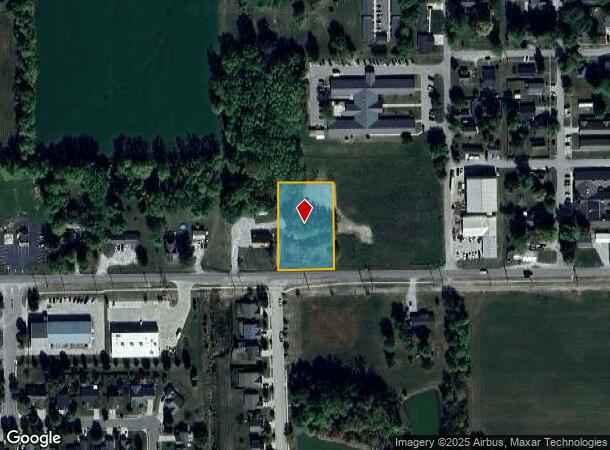
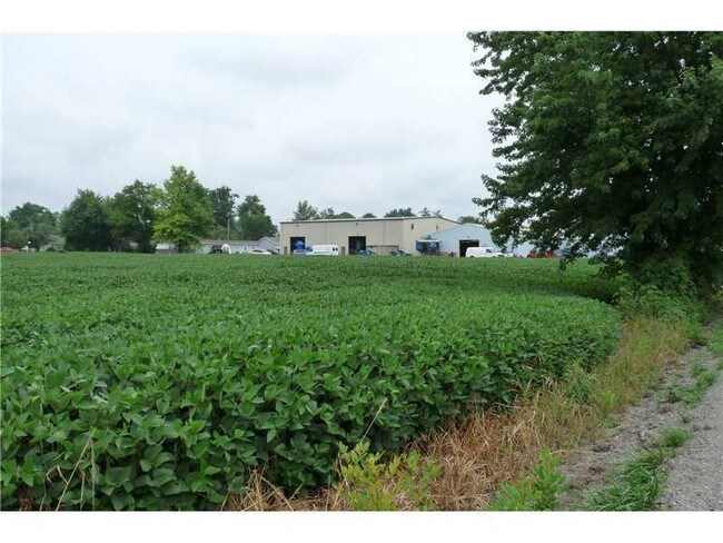
W State Road 47, Sheridan, IN 46069

NEARBY LISTINGS FOR SALE OR LEASE
Property Detail
W State Road 47
Indianapolis-Carmel-Anderson, IN
White & Morris
29-01-31-411-010.000-002
ACREAGE 1.08, SECTION 31, TOWNSHIP 20, RANGE 3, WHITE & MORRIS, LOT PT 18 & PT 19
Agriculturalland
Hamilton
X
Indiana
18057C0015G
18
2023
1.08 AC
2024
Far North Hamilton Cnty
110303
Indianapolis
2,400 SF
DEMOGRAPHICS near W State Road 47
1 Mile
3 Mile
5 Mile
2024 Total Population
3,916
5,218
8,061
2029 Population
4,465
5,929
9,189
Pop Growth 2024-2029
+ 14.02%
+ 13.63%
+ 13.99%
Average Age
40
40
40
2024 Total Households
1,550
2,041
3,067
HH Growth 2024-2029
+ 13.94%
+ 13.62%
+ 13.92%
Median Household Inc
$60,992
$63,813
$68,786
Avg Household Size
2.50
2.50
2.60
2024 Avg HH Vehicles
2.00
2.00
2.00
Median Home Value
$192,235
$226,132
$267,965
Median Year Built
1972
1973
1978
Nearby Places
Map Layers
Map Styles
 Street
 Aerial
- Restaurants
- Banks
- Shops
- Fitness
- Groceries
PUBLIC TRANSPORTATION
AIRPORT
Indianapolis International
DRIVE
WALK
Distance
Indianapolis International
67 min
41.0 mi
Freight Ports
Port of Toledo
DRIVE
WALK
Distance
Port of Toledo
269 min
221.5 mi
SALE & LEASE HISTORY
LISTING DATE
SALE/LEASE

Sep 24, 2016
For Sale
Feb 28, 2018
For Sale
Nearby Properties
Address
Land Use
TOTAL SIZE
Lot Size
Zoning
Address
Land Use
TOTAL SIZE
Lot Size
Zoning
172,610 SF
15.51 AC
Address
Land Use
TOTAL SIZE
Lot Size
Zoning
48,276 SF
22.85 AC
Address
Land Use
TOTAL SIZE
Lot Size
Zoning
66,104 SF
1.05 AC
Address
Land Use
TOTAL SIZE
Lot Size
Zoning
25,908 SF
2.98 AC
Address
Land Use
TOTAL SIZE
Lot Size
Zoning
9,308 SF
9.57 AC
Address
Land Use
TOTAL SIZE
Lot Size
Zoning
13,800 SF
16.92 AC
Address
Land Use
TOTAL SIZE
Lot Size
Zoning
15,591 SF
2 AC
Address
Land Use
TOTAL SIZE
Lot Size
Zoning
1,200 SF
21.87 AC
Address
Land Use
TOTAL SIZE
Lot Size
Zoning
27,840 SF
2.38 AC
Address
Land Use
TOTAL SIZE
Lot Size
Zoning
8,563 SF
20 AC
Address
Land Use
TOTAL SIZE
Lot Size
Zoning
4,382 SF
1 AC
Address
Land Use
TOTAL SIZE
Lot Size
Zoning
107,861 SF
2.65 AC
Address
Land Use
TOTAL SIZE
Lot Size
Zoning
8,508 SF
68.22 AC
Address
Land Use
TOTAL SIZE
Lot Size
Zoning
11,800 SF
20 AC
ZO01
Address
Land Use
TOTAL SIZE
Lot Size
Zoning
28,412 SF
5.26 AC
Address
Land Use
TOTAL SIZE
Lot Size
Zoning
10,900 SF
1.84 AC
Address
Land Use
TOTAL SIZE
Lot Size
Zoning
4,801 SF
3.34 AC
Address
Land Use
TOTAL SIZE
Lot Size
Zoning
5,678 SF
10.70 AC
Address
Land Use
TOTAL SIZE
Lot Size
Zoning
6,596 SF
12.43 AC
Address
Land Use
TOTAL SIZE
Lot Size
Zoning
5,881 SF
11.76 AC
Address
Land Use
TOTAL SIZE
Lot Size
Zoning
22,392 SF
2.77 AC
Address
Land Use
TOTAL SIZE
Lot Size
Zoning
5,892 SF
6.39 AC
Address
Land Use
TOTAL SIZE
Lot Size
Zoning
29,690 SF
10 AC
Address
Land Use
TOTAL SIZE
Lot Size
Zoning
12,000 SF
1.50 AC
Address
Land Use
TOTAL SIZE
Lot Size
Zoning
924 SF
18.79 AC
Address
Land Use
TOTAL SIZE
Lot Size
Zoning
5,662 SF
10 AC
Address
Land Use
TOTAL SIZE
Lot Size
Zoning
8,000 SF
1.52 AC
Address
Land Use
TOTAL SIZE
Lot Size
Zoning
62,145 SF
6 AC
Address
Land Use
TOTAL SIZE
Lot Size
Zoning
4,734 SF
90.58 AC
Address
Land Use
TOTAL SIZE
Lot Size
Zoning
26,608 SF
5.43 AC
The World's #1 Commercial Real Estate Marketplace
Connect with us
© 2025 CoStar Group
The information above has been obtained from sources believed reliable. While we do not doubt its accuracy we have not verified it and make no guarantee, warranty or representation about it. It is your responsibility to independently confirm its accuracy and completeness. Any projections, opinions, assumptions, or estimates used are for example only and do not represent the current or future performance of the property. The value of this transaction to you depends on tax and other factors which should be evaluated by your tax, financial, and legal advisors. You and your advisors should conduct a careful, independent investigation of the property to determine to your satisfaction the suitability of the property for your needs.