Property Record
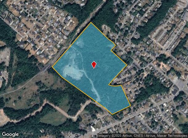
W State St At Margaret Ave, Archbald, PA 18403
NEARBY LISTINGS FOR SALE OR LEASE
Property Detail
W State St At Margaret Ave
Scranton--Wilkes-Barre--Hazelton, PA
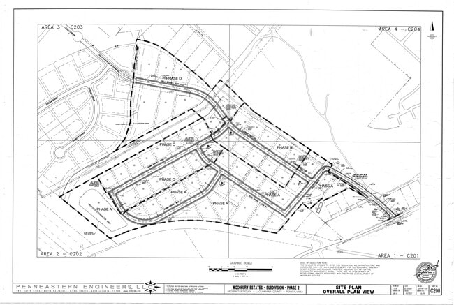
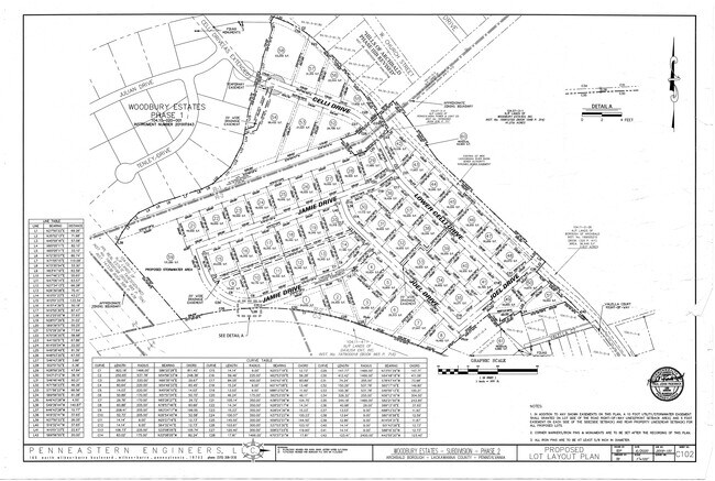
30.62A W-01 B-998 L-696
10407030001
Lackawanna
Agriculturalland
Pennsylvania
A
696
42069C0231D
30.62 AC
2025
I-81 Corridor
2025
Philadelphia
111100
DEMOGRAPHICS near W State St At Margaret Ave
1 Mile
3 Mile
5 Mile
2024 Total Population
7,698
24,735
40,985
2029 Population
7,582
24,358
40,534
Pop Growth 2024-2029
(1.51%)
(1.52%)
(1.10%)
Average Age
43
43
43
2024 Total Households
3,262
10,738
17,790
HH Growth 2024-2029
(1.47%)
(1.53%)
(1.12%)
Median Household Inc
$60,256
$61,109
$62,090
Avg Household Size
2.30
2.30
2.30
2024 Avg HH Vehicles
2.00
2.00
2.00
Median Home Value
$179,738
$166,219
$169,769
Median Year Built
1960
1953
1953
Nearby Places
Map Layers
Map Styles
 Street
 Aerial
- Restaurants
- Banks
- Shops
- Fitness
- Groceries
PUBLIC TRANSPORTATION
AIRPORT
Wilkes-Barre/Scranton International
DRIVE
WALK
Distance
Wilkes-Barre/Scranton International
29 min
17.8 mi
Freight Ports
Maher Terminal
DRIVE
WALK
Distance
Maher Terminal
151 min
118.9 mi
SALE & LEASE HISTORY
LISTING DATE
SALE/LEASE

Oct 03, 2023
For Sale
Dec 23, 2022
For Sale
Nearby Properties
Address
Land Use
TOTAL SIZE
Lot Size
Zoning
Address
Land Use
TOTAL SIZE
Lot Size
Zoning
65.35 AC
Address
Land Use
TOTAL SIZE
Lot Size
Zoning
112.27 AC
Address
Land Use
TOTAL SIZE
Lot Size
Zoning
92.02 AC
Address
Land Use
TOTAL SIZE
Lot Size
Zoning
70.21 AC
Address
Land Use
TOTAL SIZE
Lot Size
Zoning
26.40 AC
Address
Land Use
TOTAL SIZE
Lot Size
Zoning
59.07 AC
Address
Land Use
TOTAL SIZE
Lot Size
Zoning
43.89 AC
Address
Land Use
TOTAL SIZE
Lot Size
Zoning
6.89 AC
Address
Land Use
TOTAL SIZE
Lot Size
Zoning
135.22 AC
Address
Land Use
TOTAL SIZE
Lot Size
Zoning
14.57 AC
Address
Land Use
TOTAL SIZE
Lot Size
Zoning
38.12 AC
Address
Land Use
TOTAL SIZE
Lot Size
Zoning
29.58 AC
Address
Land Use
TOTAL SIZE
Lot Size
Zoning
99.18 AC
Address
Land Use
TOTAL SIZE
Lot Size
Zoning
10.10 AC
Address
Land Use
TOTAL SIZE
Lot Size
Zoning
30.06 AC
Address
Land Use
TOTAL SIZE
Lot Size
Zoning
197.82 AC
Address
Land Use
TOTAL SIZE
Lot Size
Zoning
7.30 AC
Address
Land Use
TOTAL SIZE
Lot Size
Zoning
27.39 AC
Address
Land Use
TOTAL SIZE
Lot Size
Zoning
4.96 AC
Address
Land Use
TOTAL SIZE
Lot Size
Zoning
18.30 AC
Address
Land Use
TOTAL SIZE
Lot Size
Zoning
1.68 AC
Address
Land Use
TOTAL SIZE
Lot Size
Zoning
10.59 AC
Address
Land Use
TOTAL SIZE
Lot Size
Zoning
5.35 AC
Address
Land Use
TOTAL SIZE
Lot Size
Zoning
10.34 AC
Address
Land Use
TOTAL SIZE
Lot Size
Zoning
9.70 AC
Address
Land Use
TOTAL SIZE
Lot Size
Zoning
14.41 AC
Address
Land Use
TOTAL SIZE
Lot Size
Zoning
10.38 AC
Address
Land Use
TOTAL SIZE
Lot Size
Zoning
18.61 AC
Address
Land Use
TOTAL SIZE
Lot Size
Zoning
1.80 AC
Address
Land Use
TOTAL SIZE
Lot Size
Zoning
2,428 SF
357.58 AC
The World's #1 Commercial Real Estate Marketplace
Connect with us
© 2025 CoStar Group
The information above has been obtained from sources believed reliable. While we do not doubt its accuracy we have not verified it and make no guarantee, warranty or representation about it. It is your responsibility to independently confirm its accuracy and completeness. Any projections, opinions, assumptions, or estimates used are for example only and do not represent the current or future performance of the property. The value of this transaction to you depends on tax and other factors which should be evaluated by your tax, financial, and legal advisors. You and your advisors should conduct a careful, independent investigation of the property to determine to your satisfaction the suitability of the property for your needs.