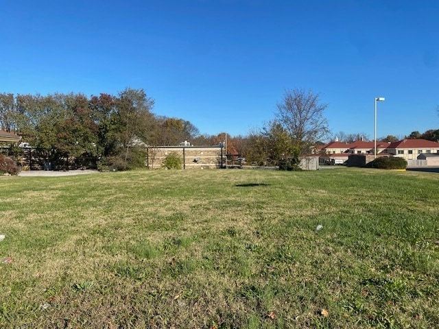
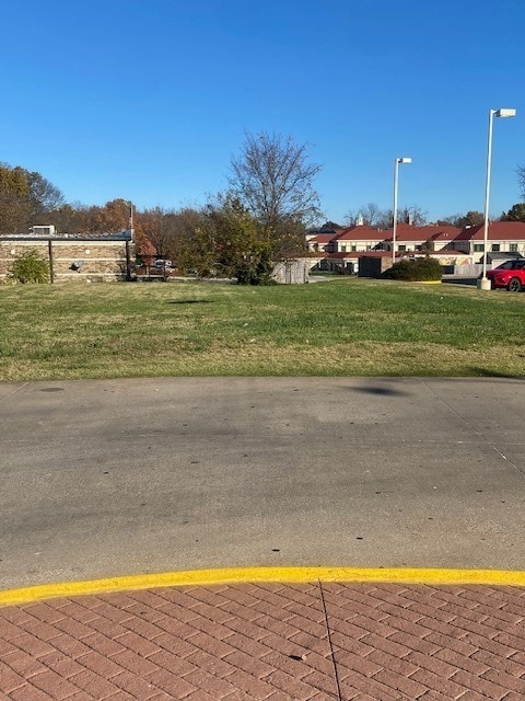
Property Record
W Sunshine St, Springfield, MO 65807

Property Detail
W Sunshine St
Springfield, MO
BEGIN 192.72FT W OF SE COR LOT 12 ELFINDALE 1ST ADD: THEN CONTINUE WEST 104.68FT; NTHLY 206FT; ESTLY 108.95'; THEN SOUTHERLY 210.95 TO POINT OF BEGINNING
13-26-305-038
GREENE
Commercialacreage
Missouri
INC
12
B and X Area of moderate flood hazard, usually the area between the limits of the 100-year and 500-year floods.
0.51 AC
2025
Northwest
2025
Springfield
001401
NEARBY LISTINGS FOR SALE OR LEASE
DEMOGRAPHICS near W Sunshine St
1 mile
3 mile
5 mile
2025 Total Population
10,659
93,727
198,493
2030 Population
11,099
96,110
203,481
Pop Growth 2025-2030
+ 4.13%
+ 2.54%
+ 2.51%
Average Age
36
37
38
2025 Total Households
5,086
42,726
87,285
HH Growth 2025-2030
+ 4.68%
+ 2.77%
+ 2.68%
Median Household Inc
$50,114
$46,006
$52,210
Avg Household Size
2.00
2.00
2.10
2025 Avg HH Vehicles
2.00
2.00
2.00
Median Home Value
$151,160
$175,611
$200,421
Median Year Built
1982
1977
1979
Nearby Places
Map Layers
Map Styles
 Street
 Aerial
Transit
 Traffic
 Biking
Places
Listings with unknown addresses are not visible on the map
- Restaurants
- Banks
- Shops
- Fitness
- Groceries
PUBLIC TRANSPORTATION
AIRPORT
Springfield-Branson Ntl
Drive
Walk
Distance
Springfield-Branson Ntl
20 min
11.5 mi
Freight Ports
Port of Shreveport
Drive
Walk
Distance
Port of Shreveport
1 min
333.9 mi
SALE & LEASE HISTORY
LISTING DATE
SALE/LEASE

Sep 24, 2016
For Sale
Mar 03, 2017
For Sale
Dec 26, 2024
For Sale
Nearby Properties
Address
Land Use
TOTAL SIZE
Lot Size
Zoning
Address
Land Use
TOTAL SIZE
Lot Size
Zoning
11.54 AC
Address
Land Use
TOTAL SIZE
Lot Size
Zoning
2,981,315 SF
76.43 AC
INC
Address
Land Use
TOTAL SIZE
Lot Size
Zoning
297,760 SF
4.22 AC
INC
Address
Land Use
TOTAL SIZE
Lot Size
Zoning
299,725 SF
18.80 AC
INC
Address
Land Use
TOTAL SIZE
Lot Size
Zoning
233,445 SF
8.17 AC
INC
Address
Land Use
TOTAL SIZE
Lot Size
Zoning
376,072 SF
17.67 AC
INC
Address
Land Use
TOTAL SIZE
Lot Size
Zoning
12.74 AC
Address
Land Use
TOTAL SIZE
Lot Size
Zoning
12.35 AC
INC
Address
Land Use
TOTAL SIZE
Lot Size
Zoning
180,665 SF
6.36 AC
INC
Address
Land Use
TOTAL SIZE
Lot Size
Zoning
23.75 AC
Address
Land Use
TOTAL SIZE
Lot Size
Zoning
22.64 AC
INC
Address
Land Use
TOTAL SIZE
Lot Size
Zoning
2.31 AC
INC
Address
Land Use
TOTAL SIZE
Lot Size
Zoning
312,092 SF
38 AC
INC
Address
Land Use
TOTAL SIZE
Lot Size
Zoning
224,730 SF
19.99 AC
INC
Address
Land Use
TOTAL SIZE
Lot Size
Zoning
355,759 SF
2.23 AC
INC
Address
Land Use
TOTAL SIZE
Lot Size
Zoning
2.76 AC
INC.
Address
Land Use
TOTAL SIZE
Lot Size
Zoning
614,588 SF
57.27 AC
INC
Address
Land Use
TOTAL SIZE
Lot Size
Zoning
26.03 AC
INC
Address
Land Use
TOTAL SIZE
Lot Size
Zoning
129,652 SF
16.40 AC
INC
Address
Land Use
TOTAL SIZE
Lot Size
Zoning
51.65 AC
INC
Address
Land Use
TOTAL SIZE
Lot Size
Zoning
334,594 SF
17.75 AC
INC
Address
Land Use
TOTAL SIZE
Lot Size
Zoning
253,781 SF
9.65 AC
INC
Address
Land Use
TOTAL SIZE
Lot Size
Zoning
9.82 AC
INC
Address
Land Use
TOTAL SIZE
Lot Size
Zoning
1.99 AC
INC
Address
Land Use
TOTAL SIZE
Lot Size
Zoning
159,007 SF
16.05 AC
INC
Address
Land Use
TOTAL SIZE
Lot Size
Zoning
30,400 SF
9.05 AC
INC
Address
Land Use
TOTAL SIZE
Lot Size
Zoning
16.41 AC
INC
Address
Land Use
TOTAL SIZE
Lot Size
Zoning
116,085 SF
3.45 AC
INC
Address
Land Use
TOTAL SIZE
Lot Size
Zoning
2.92 AC
INC
Address
Land Use
TOTAL SIZE
Lot Size
Zoning
27.78 AC
INC
The World's #1 Commercial Real Estate Marketplace
Connect with us
© 2026 CoStar Group
The information above has been obtained from sources believed reliable. While we do not doubt its accuracy we have not verified it and make no guarantee, warranty or representation about it. It is your responsibility to independently confirm its accuracy and completeness. Any projections, opinions, assumptions, or estimates used are for example only and do not represent the current or future performance of the property. The value of this transaction to you depends on tax and other factors which should be evaluated by your tax, financial, and legal advisors. You and your advisors should conduct a careful, independent investigation of the property to determine to your satisfaction the suitability of the property for your needs.