Property Record
W Us Highway 79, Rockdale, TX 76567
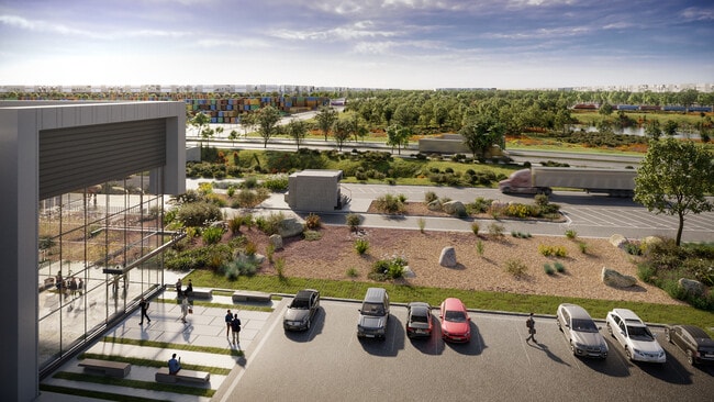


Property Detail
W Us Highway 79
Other Market Areas
A1960 HUGHES, THOMAS M.,77.191 ACRES,(PT IN A119, A340, A261, A339, A223, A238, A413, A228, A253, A348
R20523976
MILAM
Industrialgeneral
Texas
2025
77.19 AC
2025
Central Texas Area
950700
NEARBY LISTINGS FOR SALE OR LEASE
-
-
View all Rockdale listings for sale on LoopNet.com
DEMOGRAPHICS near W Us Highway 79
1 mile
3 mile
5 mile
2025 Total Population
126
742
5,636
2030 Population
131
768
5,866
Pop Growth 2025-2030
+ 3.97%
+ 3.50%
+ 4.08%
Average Age
44
44
41
2025 Total Households
48
287
2,226
HH Growth 2025-2030
+ 4.17%
+ 3.83%
+ 4.18%
Median Household Inc
$79,687
$79,255
$59,639
Avg Household Size
2.60
2.60
2.50
2025 Avg HH Vehicles
2.00
2.00
2.00
Median Home Value
$241,666
$251,162
$223,913
Median Year Built
1992
1988
1977
Nearby Places
Map Layers
Map Styles
 Street
 Aerial
Transit
 Traffic
 Biking
Places
Listings with unknown addresses are not visible on the map
- Restaurants
- Banks
- Shops
- Fitness
- Groceries
Nearby Properties
Address
Land Use
TOTAL SIZE
Lot Size
Zoning
Address
Land Use
TOTAL SIZE
Lot Size
Zoning
4,460 SF
989.96 AC
Address
Land Use
TOTAL SIZE
Lot Size
Zoning
45,463 SF
22.50 AC
Address
Land Use
TOTAL SIZE
Lot Size
Zoning
41,956 SF
5.48 AC
Address
Land Use
TOTAL SIZE
Lot Size
Zoning
510.88 AC
Address
Land Use
TOTAL SIZE
Lot Size
Zoning
61,360 SF
264.46 AC
Address
Land Use
TOTAL SIZE
Lot Size
Zoning
279 SF
239.20 AC
Address
Land Use
TOTAL SIZE
Lot Size
Zoning
211.45 AC
Address
Land Use
TOTAL SIZE
Lot Size
Zoning
6,004 SF
206.50 AC
Address
Land Use
TOTAL SIZE
Lot Size
Zoning
1,560 SF
162.69 AC
Address
Land Use
TOTAL SIZE
Lot Size
Zoning
194.19 AC
Address
Land Use
TOTAL SIZE
Lot Size
Zoning
1,620 SF
156.43 AC
Address
Land Use
TOTAL SIZE
Lot Size
Zoning
408 SF
89.18 AC
Address
Land Use
TOTAL SIZE
Lot Size
Zoning
156.15 AC
Address
Land Use
TOTAL SIZE
Lot Size
Zoning
2,560 SF
150 AC
Address
Land Use
TOTAL SIZE
Lot Size
Zoning
4,030 SF
104.80 AC
Address
Land Use
TOTAL SIZE
Lot Size
Zoning
2,000 SF
100.05 AC
Address
Land Use
TOTAL SIZE
Lot Size
Zoning
6,016 SF
50 AC
Address
Land Use
TOTAL SIZE
Lot Size
Zoning
17,500 SF
3.11 AC
Address
Land Use
TOTAL SIZE
Lot Size
Zoning
1,620 SF
102.73 AC
Address
Land Use
TOTAL SIZE
Lot Size
Zoning
316 SF
128.71 AC
Address
Land Use
TOTAL SIZE
Lot Size
Zoning
125.08 AC
Address
Land Use
TOTAL SIZE
Lot Size
Zoning
2,999 SF
82 AC
Address
Land Use
TOTAL SIZE
Lot Size
Zoning
1,816 SF
114.66 AC
Address
Land Use
TOTAL SIZE
Lot Size
Zoning
1,426 SF
100 AC
Address
Land Use
TOTAL SIZE
Lot Size
Zoning
560 SF
43.34 AC
Address
Land Use
TOTAL SIZE
Lot Size
Zoning
856 SF
97.58 AC
Address
Land Use
TOTAL SIZE
Lot Size
Zoning
3,780 SF
90.52 AC
The World's #1 Commercial Real Estate Marketplace
Connect with us
© 2026 CoStar Group
The information above has been obtained from sources believed reliable. While we do not doubt its accuracy we have not verified it and make no guarantee, warranty or representation about it. It is your responsibility to independently confirm its accuracy and completeness. Any projections, opinions, assumptions, or estimates used are for example only and do not represent the current or future performance of the property. The value of this transaction to you depends on tax and other factors which should be evaluated by your tax, financial, and legal advisors. You and your advisors should conduct a careful, independent investigation of the property to determine to your satisfaction the suitability of the property for your needs.