Property Record
W Us Hy 290, Austin, TX 78736
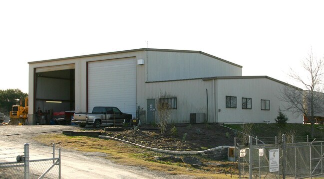

Property Detail
W Us Hy 290
Austin-Round Rock-San Marcos, TX
ABS 403 SUR 525 HEISSNER G ABS 2117 SUR 44 OLIVER J M ACR 2.961 (TOTAL)
553514
TRAVIS
Vacantlandnec
Texas
B and X Area of moderate flood hazard, usually the area between the limits of the 100-year and 500-year floods.
2.96 AC
2025
Southwest
2025
Austin
036600
NEARBY LISTINGS FOR SALE OR LEASE
DEMOGRAPHICS near W Us Hy 290
1 mile
3 mile
5 mile
2025 Total Population
958
16,144
72,628
2030 Population
999
17,043
77,084
Pop Growth 2025-2030
+ 4.28%
+ 5.57%
+ 6.14%
Average Age
45
42
40
2025 Total Households
362
5,988
26,787
HH Growth 2025-2030
+ 4.97%
+ 6.30%
+ 6.83%
Median Household Inc
$140,725
$140,457
$150,758
Avg Household Size
2.60
2.70
2.70
2025 Avg HH Vehicles
2.00
2.00
2.00
Median Home Value
$812,121
$755,538
$753,501
Median Year Built
1998
2002
2003
Nearby Places
Map Layers
Map Styles
 Street
 Aerial
Layers
 Traffic
 Biking
Places
Listings with unknown addresses are not visible on the map
- Restaurants
- Banks
- Shops
- Fitness
- Groceries
PUBLIC TRANSPORTATION
AIRPORT
Austin-Bergstrom International
Drive
Walk
Distance
Austin-Bergstrom International
33 min
19.6 mi
Freight Ports
Calhoun Port
Drive
Walk
Distance
Calhoun Port
198 min
163.1 mi
Nearby Properties
Address
Land Use
TOTAL SIZE
Lot Size
Zoning
Address
Land Use
TOTAL SIZE
Lot Size
Zoning
355,651 SF
31.86 AC
Address
Land Use
TOTAL SIZE
Lot Size
Zoning
339,456 SF
32.70 AC
Address
Land Use
TOTAL SIZE
Lot Size
Zoning
240,640 SF
14.36 AC
Address
Land Use
TOTAL SIZE
Lot Size
Zoning
262,421 SF
33.65 AC
Address
Land Use
TOTAL SIZE
Lot Size
Zoning
82,326 SF
53.78 AC
Address
Land Use
TOTAL SIZE
Lot Size
Zoning
199,816 SF
20.10 AC
Address
Land Use
TOTAL SIZE
Lot Size
Zoning
191,928 SF
4.79 AC
Address
Land Use
TOTAL SIZE
Lot Size
Zoning
82,730 SF
53.28 AC
Address
Land Use
TOTAL SIZE
Lot Size
Zoning
119,556 SF
16.84 AC
Address
Land Use
TOTAL SIZE
Lot Size
Zoning
103,045 SF
59.39 AC
Address
Land Use
TOTAL SIZE
Lot Size
Zoning
88,556 SF
23.15 AC
Address
Land Use
TOTAL SIZE
Lot Size
Zoning
42.18 AC
Address
Land Use
TOTAL SIZE
Lot Size
Zoning
308,500 SF
40 AC
Address
Land Use
TOTAL SIZE
Lot Size
Zoning
80,750 SF
22.76 AC
Address
Land Use
TOTAL SIZE
Lot Size
Zoning
59,133 SF
13.33 AC
Address
Land Use
TOTAL SIZE
Lot Size
Zoning
84,970 SF
7.19 AC
Address
Land Use
TOTAL SIZE
Lot Size
Zoning
110,760 SF
11.75 AC
Address
Land Use
TOTAL SIZE
Lot Size
Zoning
74,922 SF
4.30 AC
Address
Land Use
TOTAL SIZE
Lot Size
Zoning
214.72 AC
Address
Land Use
TOTAL SIZE
Lot Size
Zoning
101,453 SF
14.29 AC
Address
Land Use
TOTAL SIZE
Lot Size
Zoning
27.10 AC
Address
Land Use
TOTAL SIZE
Lot Size
Zoning
47,530 SF
16.08 AC
Address
Land Use
TOTAL SIZE
Lot Size
Zoning
33,145 SF
2.70 AC
Address
Land Use
TOTAL SIZE
Lot Size
Zoning
70,194 SF
2.71 AC
Address
Land Use
TOTAL SIZE
Lot Size
Zoning
208.60 AC
Address
Land Use
TOTAL SIZE
Lot Size
Zoning
181 AC
Address
Land Use
TOTAL SIZE
Lot Size
Zoning
18.29 AC
Address
Land Use
TOTAL SIZE
Lot Size
Zoning
69.12 AC
Address
Land Use
TOTAL SIZE
Lot Size
Zoning
14,090 SF
3.08 AC
Address
Land Use
TOTAL SIZE
Lot Size
Zoning
43,215 SF
3.85 AC
The World's #1 Commercial Real Estate Marketplace
Connect with us
© 2026 CoStar Group
The information above has been obtained from sources believed reliable. While we do not doubt its accuracy we have not verified it and make no guarantee, warranty or representation about it. It is your responsibility to independently confirm its accuracy and completeness. Any projections, opinions, assumptions, or estimates used are for example only and do not represent the current or future performance of the property. The value of this transaction to you depends on tax and other factors which should be evaluated by your tax, financial, and legal advisors. You and your advisors should conduct a careful, independent investigation of the property to determine to your satisfaction the suitability of the property for your needs.