No Photo
Property Record
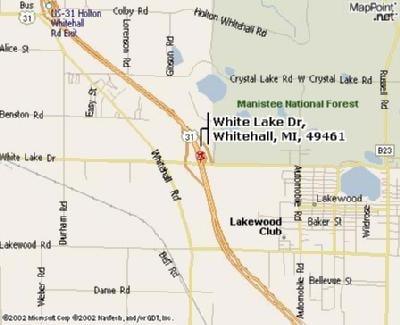
W White Lake Dr, Whitehall, MI 49461

NEARBY LISTINGS FOR SALE OR LEASE
-
-
View all Whitehall listings for sale on LoopNet.com
Property Detail
W White Lake Dr
06-101-200-0001-00
FRUITLAND TOWNSHIP SEC 1 T11N R17W NE FRL 1/4, EXC NEW US-31 ALSO EXC WHITEHALL ROAD ALSO EXC THAT PART OF NW 1/4 OF NE
Residentialacreage
Muskegon
X
Michigan
26121C0050D
110.20 AC
2024
Northern Muskegon County
2025
West Michigan
003702
Muskegon, MI
DEMOGRAPHICS near W White Lake Dr
1 Mile
3 Mile
5 Mile
2024 Total Population
651
5,868
16,959
2029 Population
662
5,943
17,315
Pop Growth 2024-2029
+ 1.69%
+ 1.28%
+ 2.10%
Average Age
40
40
42
2024 Total Households
236
2,154
6,595
HH Growth 2024-2029
+ 1.27%
+ 1.30%
+ 2.14%
Median Household Inc
$58,918
$58,798
$64,791
Avg Household Size
2.60
2.60
2.50
2024 Avg HH Vehicles
2.00
2.00
2.00
Median Home Value
$172,580
$168,697
$188,459
Median Year Built
1992
1989
1980
Nearby Places
Map Layers
Map Styles
 Street
 Aerial
- Restaurants
- Banks
- Shops
- Fitness
- Groceries
Nearby Properties
Address
Land Use
TOTAL SIZE
Lot Size
Zoning
Address
Land Use
TOTAL SIZE
Lot Size
Zoning
114,654 SF
83.75 AC
AP AMUS
Address
Land Use
TOTAL SIZE
Lot Size
Zoning
126,901 SF
30.35 AC
B COM
Address
Land Use
TOTAL SIZE
Lot Size
Zoning
117,661 SF
14.70 AC
M-1 LIM
Address
Land Use
TOTAL SIZE
Lot Size
Zoning
44,844 SF
7.83 AC
NC
Address
Land Use
TOTAL SIZE
Lot Size
Zoning
52,111 SF
R - 1
Address
Land Use
TOTAL SIZE
Lot Size
Zoning
14,418 SF
2.50 AC
MI LIMI
Address
Land Use
TOTAL SIZE
Lot Size
Zoning
32,945 SF
14.70 AC
Address
Land Use
TOTAL SIZE
Lot Size
Zoning
75,575 SF
5 AC
M-1 LIM
Address
Land Use
TOTAL SIZE
Lot Size
Zoning
41,187 SF
1.50 AC
B COM
Address
Land Use
TOTAL SIZE
Lot Size
Zoning
37,041 SF
12.18 AC
R-1 RES
Address
Land Use
TOTAL SIZE
Lot Size
Zoning
27,205 SF
3.68 AC
B COM
Address
Land Use
TOTAL SIZE
Lot Size
Zoning
41,390 SF
9.54 AC
MI LIMI
Address
Land Use
TOTAL SIZE
Lot Size
Zoning
37,368 SF
2.80 AC
B COM
Address
Land Use
TOTAL SIZE
Lot Size
Zoning
78,066 SF
15.24 AC
B COM
Address
Land Use
TOTAL SIZE
Lot Size
Zoning
34,825 SF
6.77 AC
M-1 LIM
Address
Land Use
TOTAL SIZE
Lot Size
Zoning
30,300 SF
R - 1
Address
Land Use
TOTAL SIZE
Lot Size
Zoning
5,232 SF
118.84 AC
C2-REG COM
Address
Land Use
TOTAL SIZE
Lot Size
Zoning
14,418 SF
2.79 AC
R - 1
Address
Land Use
TOTAL SIZE
Lot Size
Zoning
9,487 SF
2.66 AC
M-1 LIM
Address
Land Use
TOTAL SIZE
Lot Size
Zoning
30,300 SF
2.52 AC
Address
Land Use
TOTAL SIZE
Lot Size
Zoning
5,136 SF
2.90 AC
NC
Address
Land Use
TOTAL SIZE
Lot Size
Zoning
3,923 SF
1.11 AC
Address
Land Use
TOTAL SIZE
Lot Size
Zoning
45,243 SF
4.86 AC
B COM
Address
Land Use
TOTAL SIZE
Lot Size
Zoning
17,216 SF
11.85 AC
Address
Land Use
TOTAL SIZE
Lot Size
Zoning
4,513 SF
0.71 AC
AM MOBI
Address
Land Use
TOTAL SIZE
Lot Size
Zoning
4,888 SF
1.37 AC
B COM
Address
Land Use
TOTAL SIZE
Lot Size
Zoning
13.47 AC
AM MOBI
Address
Land Use
TOTAL SIZE
Lot Size
Zoning
22,017 SF
1.06 AC
MI LIMI
Address
Land Use
TOTAL SIZE
Lot Size
Zoning
13,272 SF
218.44 AC
FR FOR
Address
Land Use
TOTAL SIZE
Lot Size
Zoning
4,180 SF
2.33 AC
B COM
The World's #1 Commercial Real Estate Marketplace
Connect with us
© 2025 CoStar Group
The information above has been obtained from sources believed reliable. While we do not doubt its accuracy we have not verified it and make no guarantee, warranty or representation about it. It is your responsibility to independently confirm its accuracy and completeness. Any projections, opinions, assumptions, or estimates used are for example only and do not represent the current or future performance of the property. The value of this transaction to you depends on tax and other factors which should be evaluated by your tax, financial, and legal advisors. You and your advisors should conduct a careful, independent investigation of the property to determine to your satisfaction the suitability of the property for your needs.