Property Record
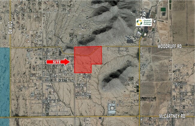
W Woodruff Rd, Casa Grande, AZ 85194

NEARBY LISTINGS FOR SALE OR LEASE
Property Detail
W Woodruff Rd
Phoenix-Mesa-Scottsdale, AZ
Portion Of
509-75-036
NW OF SEC 32 5S 7E EXCEPT E 331.49' OF NE NW; EXCEPT S/2 SW NW; E XCEPT SE NW; & EXCEPT ANY PORTION OF 80' R/W IN N/2 NW OF SAID SE CTION DESCRIBED IN DKT 968 PG 911, 84.30 AC
Vacantlandnec
Pinal
X
Arizona
04021C1200E
84.30 AC
2024
Pinal County
2025
Phoenix
001200
DEMOGRAPHICS near W Woodruff Rd
1 Mile
3 Mile
5 Mile
2024 Total Population
927
3,508
21,667
2029 Population
1,178
4,482
27,603
Pop Growth 2024-2029
+ 27.08%
+ 27.77%
+ 27.40%
Average Age
43
41
39
2024 Total Households
320
1,196
7,418
HH Growth 2024-2029
+ 26.25%
+ 27.01%
+ 27.12%
Median Household Inc
$84,318
$81,841
$76,475
Avg Household Size
2.80
2.80
2.80
2024 Avg HH Vehicles
3.00
2.00
2.00
Median Home Value
$364,028
$397,221
$325,242
Median Year Built
2000
2003
2005
Nearby Places
Map Layers
Map Styles
 Street
 Aerial
- Restaurants
- Banks
- Shops
- Fitness
- Groceries
PUBLIC TRANSPORTATION
AIRPORT
Phoenix-Mesa Gateway
DRIVE
WALK
Distance
Phoenix-Mesa Gateway
59 min
40.9 mi
Freight Ports
Port of San Diego
DRIVE
WALK
Distance
Port of San Diego
387 min
360.2 mi
SALE & LEASE HISTORY
LISTING DATE
SALE/LEASE

Mar 19, 2020
For Sale
Nearby Properties
Address
Land Use
TOTAL SIZE
Lot Size
Zoning
Address
Land Use
TOTAL SIZE
Lot Size
Zoning
80 AC
GR
Address
Land Use
TOTAL SIZE
Lot Size
Zoning
49,634 SF
14.10 AC
Address
Land Use
TOTAL SIZE
Lot Size
Zoning
1,481 SF
560 AC
GR
Address
Land Use
TOTAL SIZE
Lot Size
Zoning
3.23 AC
UNDESIGNAT
Address
Land Use
TOTAL SIZE
Lot Size
Zoning
Address
Land Use
TOTAL SIZE
Lot Size
Zoning
50.60 AC
CR1A
Address
Land Use
TOTAL SIZE
Lot Size
Zoning
16,709 SF
153.88 AC
Address
Land Use
TOTAL SIZE
Lot Size
Zoning
160.33 AC
UNDESIGNAT
Address
Land Use
TOTAL SIZE
Lot Size
Zoning
14,100 SF
40 AC
GR
Address
Land Use
TOTAL SIZE
Lot Size
Zoning
163.16 AC
Address
Land Use
TOTAL SIZE
Lot Size
Zoning
161.76 AC
UNDESIGNAT
Address
Land Use
TOTAL SIZE
Lot Size
Zoning
192.87 AC
GR
Address
Land Use
TOTAL SIZE
Lot Size
Zoning
20,083 SF
80 AC
UNDESIGNAT
Address
Land Use
TOTAL SIZE
Lot Size
Zoning
17,030 SF
80 AC
UNDESIGNAT
Address
Land Use
TOTAL SIZE
Lot Size
Zoning
19.74 AC
UNDESIGNAT
Address
Land Use
TOTAL SIZE
Lot Size
Zoning
62.54 AC
CR1A
Address
Land Use
TOTAL SIZE
Lot Size
Zoning
7,454 SF
1.25 AC
GR
Address
Land Use
TOTAL SIZE
Lot Size
Zoning
16.75 AC
UNDESIGNAT
Address
Land Use
TOTAL SIZE
Lot Size
Zoning
6,081 SF
160 AC
Address
Land Use
TOTAL SIZE
Lot Size
Zoning
77 AC
CR1A
The World's #1 Commercial Real Estate Marketplace
Connect with us
© 2025 CoStar Group
The information above has been obtained from sources believed reliable. While we do not doubt its accuracy we have not verified it and make no guarantee, warranty or representation about it. It is your responsibility to independently confirm its accuracy and completeness. Any projections, opinions, assumptions, or estimates used are for example only and do not represent the current or future performance of the property. The value of this transaction to you depends on tax and other factors which should be evaluated by your tax, financial, and legal advisors. You and your advisors should conduct a careful, independent investigation of the property to determine to your satisfaction the suitability of the property for your needs.