Property Record
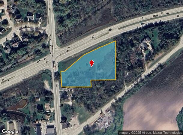
W125s9782 N North Cpe, Muskego, WI 53150
NEARBY LISTINGS FOR SALE OR LEASE
Property Detail
W125s9782 N North Cpe
Milwaukee-Waukesha-West Allis, WI
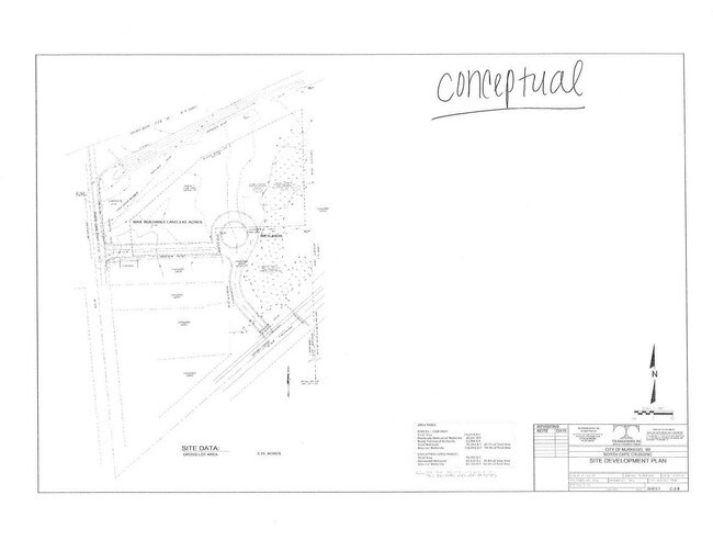
Certified Surv Map 8863
MSKC-2257-978-005
PARCEL 1 CERT SURV 8863 VOL 79/96 REC AS DOC# 2511717 REDIV OF PARCEL 2 CERT SURV 5376 & LOT 1 CERT SURV 5306 PT SE1/4 NE1/4 SEC 25 T5N R20E :: DOC# 4322663
Commercialnec
Waukesha
X
Wisconsin
55133C0477H
1
2024
3.35 AC
2024
SE/Muskego
201703
Milwaukee/Madison
DEMOGRAPHICS near W125s9782 N North Cpe
1 Mile
3 Mile
5 Mile
2024 Total Population
1,641
11,700
49,387
2029 Population
1,676
11,553
49,020
Pop Growth 2024-2029
+ 2.13%
(1.26%)
(0.74%)
Average Age
40
44
44
2024 Total Households
563
4,624
19,479
HH Growth 2024-2029
+ 2.13%
(1.51%)
(0.88%)
Median Household Inc
$152,756
$110,465
$100,555
Avg Household Size
2.90
2.50
2.40
2024 Avg HH Vehicles
2.00
2.00
2.00
Median Home Value
$480,596
$334,679
$337,031
Median Year Built
2005
1990
1987
Nearby Places
Map Layers
Map Styles
 Street
 Aerial
- Restaurants
- Banks
- Shops
- Fitness
- Groceries
PUBLIC TRANSPORTATION
AIRPORT
General Mitchell International
DRIVE
WALK
Distance
General Mitchell International
22 min
11.8 mi
Freight Ports
Port Milwaukee
DRIVE
WALK
Distance
Port Milwaukee
22 min
14.7 mi
SALE & LEASE HISTORY
LISTING DATE
SALE/LEASE

Apr 04, 2017
For Sale
Nearby Properties
Address
Land Use
TOTAL SIZE
Lot Size
Zoning
Address
Land Use
TOTAL SIZE
Lot Size
Zoning
33.48 AC
Address
Land Use
TOTAL SIZE
Lot Size
Zoning
Address
Land Use
TOTAL SIZE
Lot Size
Zoning
9.13 AC
Address
Land Use
TOTAL SIZE
Lot Size
Zoning
8.83 AC
Address
Land Use
TOTAL SIZE
Lot Size
Zoning
125,028 SF
9.69 AC
Address
Land Use
TOTAL SIZE
Lot Size
Zoning
2,912 SF
0.16 AC
Address
Land Use
TOTAL SIZE
Lot Size
Zoning
5.72 AC
Address
Land Use
TOTAL SIZE
Lot Size
Zoning
47,146 SF
3.58 AC
Address
Land Use
TOTAL SIZE
Lot Size
Zoning
74,908 SF
6.14 AC
Address
Land Use
TOTAL SIZE
Lot Size
Zoning
74,908 SF
5.12 AC
Address
Land Use
TOTAL SIZE
Lot Size
Zoning
18,522 SF
8.60 AC
Address
Land Use
TOTAL SIZE
Lot Size
Zoning
50,876 SF
4.20 AC
Address
Land Use
TOTAL SIZE
Lot Size
Zoning
118,461 SF
6.51 AC
Address
Land Use
TOTAL SIZE
Lot Size
Zoning
13.45 AC
Address
Land Use
TOTAL SIZE
Lot Size
Zoning
50,012 SF
7.42 AC
Address
Land Use
TOTAL SIZE
Lot Size
Zoning
2.58 AC
Address
Land Use
TOTAL SIZE
Lot Size
Zoning
68,562 SF
1.89 AC
Address
Land Use
TOTAL SIZE
Lot Size
Zoning
15,048 SF
2.66 AC
Address
Land Use
TOTAL SIZE
Lot Size
Zoning
2.33 AC
Address
Land Use
TOTAL SIZE
Lot Size
Zoning
32,018 SF
1.55 AC
Address
Land Use
TOTAL SIZE
Lot Size
Zoning
33,910 SF
1.46 AC
Address
Land Use
TOTAL SIZE
Lot Size
Zoning
30,408 SF
7.86 AC
Address
Land Use
TOTAL SIZE
Lot Size
Zoning
14,100 SF
2.22 AC
Address
Land Use
TOTAL SIZE
Lot Size
Zoning
3.53 AC
Address
Land Use
TOTAL SIZE
Lot Size
Zoning
6,694 SF
40 AC
Address
Land Use
TOTAL SIZE
Lot Size
Zoning
Address
Land Use
TOTAL SIZE
Lot Size
Zoning
Address
Land Use
TOTAL SIZE
Lot Size
Zoning
2,976 SF
118.50 AC
Address
Land Use
TOTAL SIZE
Lot Size
Zoning
3,531 SF
0.85 AC
Address
Land Use
TOTAL SIZE
Lot Size
Zoning
135.10 AC
The World's #1 Commercial Real Estate Marketplace
Connect with us
© 2025 CoStar Group
The information above has been obtained from sources believed reliable. While we do not doubt its accuracy we have not verified it and make no guarantee, warranty or representation about it. It is your responsibility to independently confirm its accuracy and completeness. Any projections, opinions, assumptions, or estimates used are for example only and do not represent the current or future performance of the property. The value of this transaction to you depends on tax and other factors which should be evaluated by your tax, financial, and legal advisors. You and your advisors should conduct a careful, independent investigation of the property to determine to your satisfaction the suitability of the property for your needs.