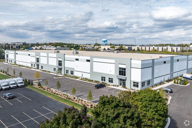
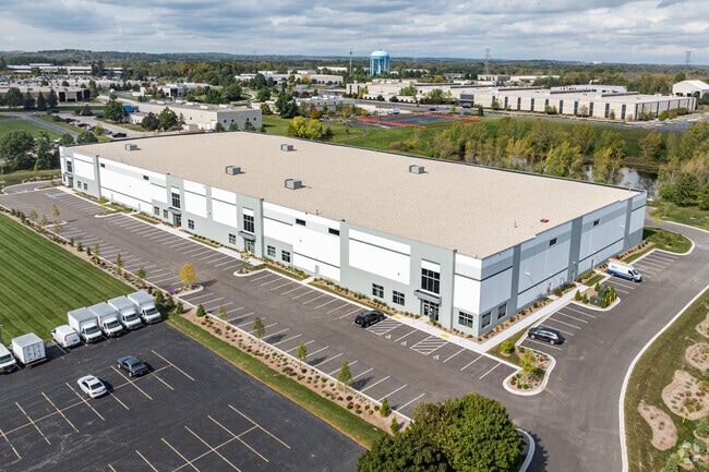
Property Record
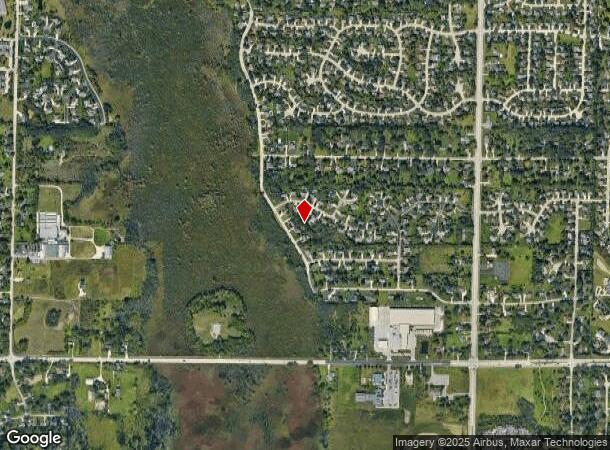
W162n5733 Davian Dr, Menomonee Falls, WI 53051
NEARBY LISTINGS FOR SALE OR LEASE
Property Detail
W162n5733 Davian Dr
Milwaukee-Waukesha, WI
Cert Surv Map 7747
MNFV-0108-992-006
LOT 1 CSM #7747 VOL 66/225 REC AS DOC# 2053568 PT SE1/4 SEC 27 T8N R20E
Commercialnec
Waukesha
X
Wisconsin
55133C0226H
1
2024
6.01 AC
2024
NE/Menomonee Falls
200201
Milwaukee/Madison
DEMOGRAPHICS near W162n5733 Davian Dr
1 Mile
3 Mile
5 Mile
2024 Total Population
1,839
34,065
122,842
2029 Population
1,887
34,909
123,502
Pop Growth 2024-2029
+ 2.61%
+ 2.48%
+ 0.54%
Average Age
42
44
41
2024 Total Households
655
13,709
49,385
HH Growth 2024-2029
+ 2.44%
+ 2.41%
+ 0.41%
Median Household Inc
$129,911
$100,617
$82,657
Avg Household Size
2.70
2.40
2.40
2024 Avg HH Vehicles
2.00
2.00
2.00
Median Home Value
$350,416
$354,267
$297,687
Median Year Built
1992
1984
1970
Nearby Places
Map Layers
Map Styles
 Street
 Aerial
- Restaurants
- Banks
- Shops
- Fitness
- Groceries
PUBLIC TRANSPORTATION
AIRPORT
General Mitchell International
DRIVE
WALK
Distance
General Mitchell International
39 min
23.7 mi
Freight Ports
Port Milwaukee
DRIVE
WALK
Distance
Port Milwaukee
33 min
19.9 mi
SALE & LEASE HISTORY
LISTING DATE
SALE/LEASE

Oct 01, 2024
For Lease
Nearby Properties
Address
Land Use
TOTAL SIZE
Lot Size
Zoning
Address
Land Use
TOTAL SIZE
Lot Size
Zoning
369,652 SF
20 AC
Address
Land Use
TOTAL SIZE
Lot Size
Zoning
145,836 SF
11 AC
Address
Land Use
TOTAL SIZE
Lot Size
Zoning
121,472 SF
8.97 AC
Address
Land Use
TOTAL SIZE
Lot Size
Zoning
294,486 SF
12.78 AC
Address
Land Use
TOTAL SIZE
Lot Size
Zoning
864,365 SF
50.22 AC
Address
Land Use
TOTAL SIZE
Lot Size
Zoning
222,355 SF
4.32 AC
Address
Land Use
TOTAL SIZE
Lot Size
Zoning
387,379 SF
20.25 AC
Address
Land Use
TOTAL SIZE
Lot Size
Zoning
145,844 SF
27.98 AC
Address
Land Use
TOTAL SIZE
Lot Size
Zoning
530,458 SF
26.32 AC
Address
Land Use
TOTAL SIZE
Lot Size
Zoning
358,699 SF
24.97 AC
Address
Land Use
TOTAL SIZE
Lot Size
Zoning
Address
Land Use
TOTAL SIZE
Lot Size
Zoning
211,754 SF
30.52 AC
Address
Land Use
TOTAL SIZE
Lot Size
Zoning
36,042 SF
4.51 AC
Address
Land Use
TOTAL SIZE
Lot Size
Zoning
292,944 SF
17.32 AC
Address
Land Use
TOTAL SIZE
Lot Size
Zoning
94,698 SF
10.67 AC
Address
Land Use
TOTAL SIZE
Lot Size
Zoning
91,708 SF
6.66 AC
Address
Land Use
TOTAL SIZE
Lot Size
Zoning
209,138 SF
14.70 AC
Address
Land Use
TOTAL SIZE
Lot Size
Zoning
204,175 SF
2.48 AC
Address
Land Use
TOTAL SIZE
Lot Size
Zoning
147,240 SF
2.53 AC
Address
Land Use
TOTAL SIZE
Lot Size
Zoning
147,240 SF
3.06 AC
Address
Land Use
TOTAL SIZE
Lot Size
Zoning
104,642 SF
7.06 AC
Address
Land Use
TOTAL SIZE
Lot Size
Zoning
302,895 SF
7.90 AC
Address
Land Use
TOTAL SIZE
Lot Size
Zoning
326,619 SF
30.69 AC
PD
Address
Land Use
TOTAL SIZE
Lot Size
Zoning
245,615 SF
15.88 AC
Address
Land Use
TOTAL SIZE
Lot Size
Zoning
160,000 SF
12.48 AC
Address
Land Use
TOTAL SIZE
Lot Size
Zoning
142,177 SF
2.60 AC
Address
Land Use
TOTAL SIZE
Lot Size
Zoning
241,880 SF
17.39 AC
Address
Land Use
TOTAL SIZE
Lot Size
Zoning
Address
Land Use
TOTAL SIZE
Lot Size
Zoning
378,511 SF
22.19 AC
Address
Land Use
TOTAL SIZE
Lot Size
Zoning
127,496 SF
2.88 AC
The World's #1 Commercial Real Estate Marketplace
Connect with us
© 2026 CoStar Group
The information above has been obtained from sources believed reliable. While we do not doubt its accuracy we have not verified it and make no guarantee, warranty or representation about it. It is your responsibility to independently confirm its accuracy and completeness. Any projections, opinions, assumptions, or estimates used are for example only and do not represent the current or future performance of the property. The value of this transaction to you depends on tax and other factors which should be evaluated by your tax, financial, and legal advisors. You and your advisors should conduct a careful, independent investigation of the property to determine to your satisfaction the suitability of the property for your needs.