No Photo
Property Record
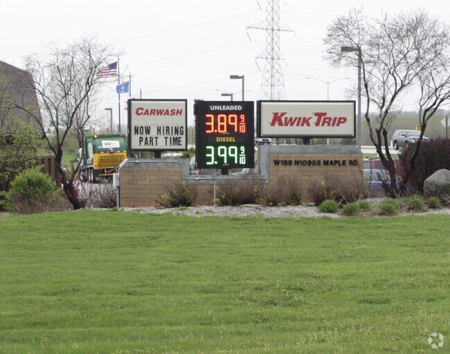
W188n10963 Maple Rd, Germantown, WI 53022

NEARBY LISTINGS FOR SALE OR LEASE
Property Detail
W188n10963 Maple Rd
Milwaukee-Waukesha-West Allis, WI
LOT 2 - CSM 2890 PT OF NW NW DOC 1357726+1357727 SEC 28-9-20 4.37 AC
GTNV-291978
Washington
Commercialnec
Wisconsin
AE
2
55133C0084G
2.49 AC
2024
Washington East
2024
Milwaukee/Madison
470100
DEMOGRAPHICS near W188n10963 Maple Rd
1 Mile
3 Mile
5 Mile
2024 Total Population
783
22,489
47,807
2029 Population
770
22,245
47,810
Pop Growth 2024-2029
(1.66%)
(1.08%)
+ 0.01%
Average Age
44
43
44
2024 Total Households
303
9,611
20,025
HH Growth 2024-2029
(1.98%)
(1.26%)
(0.08%)
Median Household Inc
$98,437
$86,692
$90,396
Avg Household Size
2.50
2.30
2.30
2024 Avg HH Vehicles
2.00
2.00
2.00
Median Home Value
$319,811
$282,189
$298,312
Median Year Built
1992
1979
1979
Nearby Places
Map Layers
Map Styles
 Street
 Aerial
- Restaurants
- Banks
- Shops
- Fitness
- Groceries
PUBLIC TRANSPORTATION
AIRPORT
General Mitchell International
DRIVE
WALK
Distance
General Mitchell International
43 min
28.5 mi
Freight Ports
Port Milwaukee
DRIVE
WALK
Distance
Port Milwaukee
37 min
24.7 mi
Nearby Properties
Address
Land Use
TOTAL SIZE
Lot Size
Zoning
Address
Land Use
TOTAL SIZE
Lot Size
Zoning
706,000 SF
39.22 AC
Address
Land Use
TOTAL SIZE
Lot Size
Zoning
244,996 SF
16.82 AC
Address
Land Use
TOTAL SIZE
Lot Size
Zoning
Address
Land Use
TOTAL SIZE
Lot Size
Zoning
240,468 SF
20.03 AC
Address
Land Use
TOTAL SIZE
Lot Size
Zoning
186,372 SF
22.16 AC
Address
Land Use
TOTAL SIZE
Lot Size
Zoning
Address
Land Use
TOTAL SIZE
Lot Size
Zoning
91,708 SF
6.66 AC
Address
Land Use
TOTAL SIZE
Lot Size
Zoning
204,175 SF
2.48 AC
Address
Land Use
TOTAL SIZE
Lot Size
Zoning
147,240 SF
2.53 AC
Address
Land Use
TOTAL SIZE
Lot Size
Zoning
147,240 SF
3.06 AC
Address
Land Use
TOTAL SIZE
Lot Size
Zoning
23.77 AC
Address
Land Use
TOTAL SIZE
Lot Size
Zoning
203,580 SF
13.52 AC
Address
Land Use
TOTAL SIZE
Lot Size
Zoning
204,373 SF
16.50 AC
Address
Land Use
TOTAL SIZE
Lot Size
Zoning
198,648 SF
16.57 AC
Address
Land Use
TOTAL SIZE
Lot Size
Zoning
24.02 AC
Address
Land Use
TOTAL SIZE
Lot Size
Zoning
127,496 SF
2.88 AC
Address
Land Use
TOTAL SIZE
Lot Size
Zoning
147,987 SF
15.23 AC
Address
Land Use
TOTAL SIZE
Lot Size
Zoning
152,006 SF
12.92 AC
Address
Land Use
TOTAL SIZE
Lot Size
Zoning
153,383 SF
17.43 AC
Address
Land Use
TOTAL SIZE
Lot Size
Zoning
104.57 AC
Address
Land Use
TOTAL SIZE
Lot Size
Zoning
Address
Land Use
TOTAL SIZE
Lot Size
Zoning
53,681 SF
38.43 AC
Address
Land Use
TOTAL SIZE
Lot Size
Zoning
130,000 SF
12.76 AC
Address
Land Use
TOTAL SIZE
Lot Size
Zoning
125,857 SF
13.99 AC
Address
Land Use
TOTAL SIZE
Lot Size
Zoning
63,916 SF
1.99 AC
Address
Land Use
TOTAL SIZE
Lot Size
Zoning
13,912 SF
10.30 AC
Address
Land Use
TOTAL SIZE
Lot Size
Zoning
62,936 SF
2.71 AC
Address
Land Use
TOTAL SIZE
Lot Size
Zoning
99,710 SF
9.55 AC
Address
Land Use
TOTAL SIZE
Lot Size
Zoning
Address
Land Use
TOTAL SIZE
Lot Size
Zoning
90,077 SF
0.95 AC
The World's #1 Commercial Real Estate Marketplace
Connect with us
© 2025 CoStar Group
The information above has been obtained from sources believed reliable. While we do not doubt its accuracy we have not verified it and make no guarantee, warranty or representation about it. It is your responsibility to independently confirm its accuracy and completeness. Any projections, opinions, assumptions, or estimates used are for example only and do not represent the current or future performance of the property. The value of this transaction to you depends on tax and other factors which should be evaluated by your tax, financial, and legal advisors. You and your advisors should conduct a careful, independent investigation of the property to determine to your satisfaction the suitability of the property for your needs.