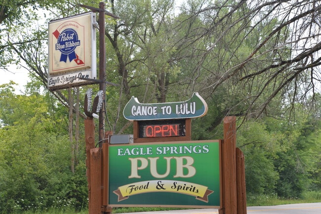
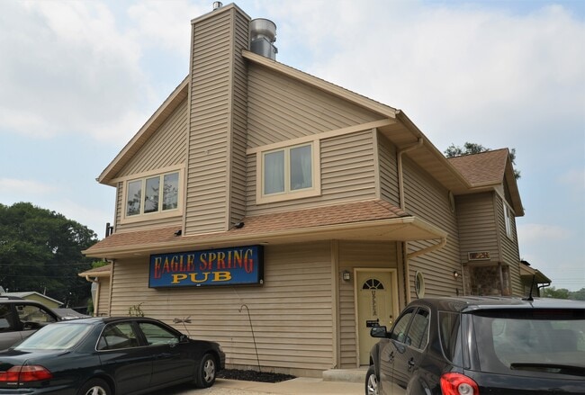
Property Record
W345s10463 Cty Hwy E, Mukwonago, WI 53149

Property Detail
W345s10463 Cty Hwy E
Milwaukee-Waukesha, WI
PT N1/2 SEC 36 T5N R17E; COM N1/4 CRNR SEC 36; S ALNG N1/4 LINE OF SEC 941.8 FT TO BGN; N3740W 267.88 FT; S2949W 215.20 FT; S567E 305.1 FT TO CNTR HWY; N3109E ALNG CNTRLNE OF HWY 109.71 FT; N3749W 65.0 FT TO BGN :: INCLUDING ACCESS EASEMENT AS REC AS
EGLT-1870-965
Waukesha
Commercialnec
Wisconsin
AE The base floodplain where base flood elevations are provided. AE Zones are now used on new format FIRMs instead of A1-A30 Zones.
5
2024
1.15 AC
2024
SW/Mukwonago
203901
Milwaukee/Madison
NEARBY LISTINGS FOR SALE OR LEASE
-
-
View all Mukwonago listings for sale on LoopNet.com
DEMOGRAPHICS near W345s10463 Cty Hwy E
1 mile
3 mile
5 mile
2025 Total Population
688
6,516
20,831
2030 Population
706
6,611
20,955
Pop Growth 2025-2030
+ 2.62%
+ 1.46%
+ 0.60%
Average Age
43
43
43
2025 Total Households
254
2,429
7,918
HH Growth 2025-2030
+ 2.36%
+ 1.48%
+ 0.40%
Median Household Inc
$128,646
$114,618
$106,623
Avg Household Size
2.60
2.60
2.60
2025 Avg HH Vehicles
2.00
2.00
2.00
Median Home Value
$440,217
$414,613
$387,085
Median Year Built
1978
1987
1983
Nearby Places
Map Layers
Map Styles
 Street
 Aerial
Transit
 Traffic
 Biking
Places
Listings with unknown addresses are not visible on the map
- Restaurants
- Banks
- Shops
- Fitness
- Groceries
PUBLIC TRANSPORTATION
AIRPORT
General Mitchell International
Drive
Walk
Distance
General Mitchell International
48 min
32.9 mi
Freight Ports
Port Milwaukee
Drive
Walk
Distance
Port Milwaukee
47 min
34.8 mi
SALE & LEASE HISTORY
LISTING DATE
SALE/LEASE

Jul 24, 2021
For Sale
Nearby Properties
Address
Land Use
TOTAL SIZE
Lot Size
Zoning
Address
Land Use
TOTAL SIZE
Lot Size
Zoning
46.70 AC
A5
Address
Land Use
TOTAL SIZE
Lot Size
Zoning
14.53 AC
Address
Land Use
TOTAL SIZE
Lot Size
Zoning
3.06 AC
Address
Land Use
TOTAL SIZE
Lot Size
Zoning
5.43 AC
Address
Land Use
TOTAL SIZE
Lot Size
Zoning
6.02 AC
Address
Land Use
TOTAL SIZE
Lot Size
Zoning
Address
Land Use
TOTAL SIZE
Lot Size
Zoning
4.14 AC
Address
Land Use
TOTAL SIZE
Lot Size
Zoning
2.98 AC
Address
Land Use
TOTAL SIZE
Lot Size
Zoning
128.10 AC
Address
Land Use
TOTAL SIZE
Lot Size
Zoning
2.04 AC
Address
Land Use
TOTAL SIZE
Lot Size
Zoning
2.02 AC
Address
Land Use
TOTAL SIZE
Lot Size
Zoning
1.02 AC
Address
Land Use
TOTAL SIZE
Lot Size
Zoning
1.09 AC
Address
Land Use
TOTAL SIZE
Lot Size
Zoning
41.41 AC
Address
Land Use
TOTAL SIZE
Lot Size
Zoning
Address
Land Use
TOTAL SIZE
Lot Size
Zoning
Address
Land Use
TOTAL SIZE
Lot Size
Zoning
Address
Land Use
TOTAL SIZE
Lot Size
Zoning
42.51 AC
C2
Address
Land Use
TOTAL SIZE
Lot Size
Zoning
Address
Land Use
TOTAL SIZE
Lot Size
Zoning
1.50 AC
Address
Land Use
TOTAL SIZE
Lot Size
Zoning
113.22 AC
Address
Land Use
TOTAL SIZE
Lot Size
Zoning
1.50 AC
Address
Land Use
TOTAL SIZE
Lot Size
Zoning
3.30 AC
Address
Land Use
TOTAL SIZE
Lot Size
Zoning
Address
Land Use
TOTAL SIZE
Lot Size
Zoning
Address
Land Use
TOTAL SIZE
Lot Size
Zoning
Address
Land Use
TOTAL SIZE
Lot Size
Zoning
63.33 AC
R6
Address
Land Use
TOTAL SIZE
Lot Size
Zoning
1.69 AC
Address
Land Use
TOTAL SIZE
Lot Size
Zoning
37.53 AC
Address
Land Use
TOTAL SIZE
Lot Size
Zoning
The World's #1 Commercial Real Estate Marketplace
Connect with us
© 2026 CoStar Group
The information above has been obtained from sources believed reliable. While we do not doubt its accuracy we have not verified it and make no guarantee, warranty or representation about it. It is your responsibility to independently confirm its accuracy and completeness. Any projections, opinions, assumptions, or estimates used are for example only and do not represent the current or future performance of the property. The value of this transaction to you depends on tax and other factors which should be evaluated by your tax, financial, and legal advisors. You and your advisors should conduct a careful, independent investigation of the property to determine to your satisfaction the suitability of the property for your needs.