Property Record
W357s8715 Chapman Ln, Eagle, WI 53119


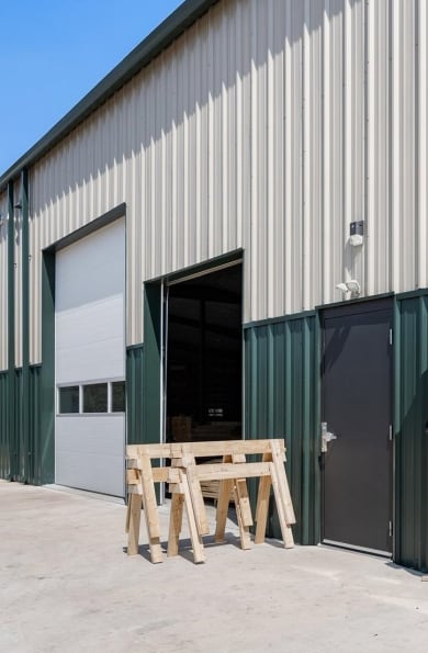
This Property Is For Sale
Property Detail
W357s8715 Chapman Ln
Milwaukee-Waukesha, WI
LOT 1 CSM #8927 VOL 80/15 REC AS DOC #2541130 PT NW1/4 SEC 23 T5N R17E
EGLT-1818-999-028
WAUKESHA
Commercialnec
Wisconsin
B and X Area of moderate flood hazard, usually the area between the limits of the 100-year and 500-year floods.
1
2024
3.06 AC
2024
SW/Mukwonago
204002
Milwaukee/Madison
NEARBY LISTINGS FOR SALE OR LEASE
-
-
View all Eagle listings for sale on LoopNet.com
DEMOGRAPHICS near W357s8715 Chapman Ln
1 mile
3 mile
5 mile
2025 Total Population
2,224
6,186
13,939
2030 Population
2,252
6,260
14,039
Pop Growth 2025-2030
+ 1.26%
+ 1.20%
+ 0.72%
Average Age
43
43
43
2025 Total Households
835
2,277
5,150
HH Growth 2025-2030
+ 1.20%
+ 1.19%
+ 0.72%
Median Household Inc
$110,906
$117,198
$123,149
Avg Household Size
2.60
2.70
2.70
2025 Avg HH Vehicles
2.00
2.00
3.00
Median Home Value
$424,745
$425,044
$423,809
Median Year Built
1986
1987
1987
Nearby Places
Map Layers
Map Styles
 Street
 Aerial
Layers
 Traffic
 Biking
Places
Listings with unknown addresses are not visible on the map
- Restaurants
- Banks
- Shops
- Fitness
- Groceries
PUBLIC TRANSPORTATION
AIRPORT
General Mitchell International
Drive
Walk
Distance
General Mitchell International
50 min
33.4 mi
Freight Ports
Port Milwaukee
Drive
Walk
Distance
Port Milwaukee
49 min
35.3 mi
Nearby Properties
Address
Land Use
TOTAL SIZE
Lot Size
Zoning
Address
Land Use
TOTAL SIZE
Lot Size
Zoning
19.35 AC
Address
Land Use
TOTAL SIZE
Lot Size
Zoning
46.70 AC
A5
Address
Land Use
TOTAL SIZE
Lot Size
Zoning
14.53 AC
Address
Land Use
TOTAL SIZE
Lot Size
Zoning
5.43 AC
Address
Land Use
TOTAL SIZE
Lot Size
Zoning
6.02 AC
Address
Land Use
TOTAL SIZE
Lot Size
Zoning
Address
Land Use
TOTAL SIZE
Lot Size
Zoning
11.29 AC
Address
Land Use
TOTAL SIZE
Lot Size
Zoning
4.14 AC
Address
Land Use
TOTAL SIZE
Lot Size
Zoning
2.98 AC
Address
Land Use
TOTAL SIZE
Lot Size
Zoning
128.10 AC
Address
Land Use
TOTAL SIZE
Lot Size
Zoning
2.04 AC
Address
Land Use
TOTAL SIZE
Lot Size
Zoning
2.02 AC
Address
Land Use
TOTAL SIZE
Lot Size
Zoning
1.02 AC
Address
Land Use
TOTAL SIZE
Lot Size
Zoning
1.09 AC
Address
Land Use
TOTAL SIZE
Lot Size
Zoning
5.13 AC
Address
Land Use
TOTAL SIZE
Lot Size
Zoning
Address
Land Use
TOTAL SIZE
Lot Size
Zoning
41.41 AC
Address
Land Use
TOTAL SIZE
Lot Size
Zoning
Address
Land Use
TOTAL SIZE
Lot Size
Zoning
216.94 AC
Address
Land Use
TOTAL SIZE
Lot Size
Zoning
Address
Land Use
TOTAL SIZE
Lot Size
Zoning
Address
Land Use
TOTAL SIZE
Lot Size
Zoning
Address
Land Use
TOTAL SIZE
Lot Size
Zoning
1.50 AC
Address
Land Use
TOTAL SIZE
Lot Size
Zoning
2.37 AC
Address
Land Use
TOTAL SIZE
Lot Size
Zoning
42.69 AC
Address
Land Use
TOTAL SIZE
Lot Size
Zoning
113.22 AC
Address
Land Use
TOTAL SIZE
Lot Size
Zoning
1.50 AC
Address
Land Use
TOTAL SIZE
Lot Size
Zoning
3.30 AC
Address
Land Use
TOTAL SIZE
Lot Size
Zoning
The World's #1 Commercial Real Estate Marketplace
Connect with us
© 2026 CoStar Group
The information above has been obtained from sources believed reliable. While we do not doubt its accuracy we have not verified it and make no guarantee, warranty or representation about it. It is your responsibility to independently confirm its accuracy and completeness. Any projections, opinions, assumptions, or estimates used are for example only and do not represent the current or future performance of the property. The value of this transaction to you depends on tax and other factors which should be evaluated by your tax, financial, and legal advisors. You and your advisors should conduct a careful, independent investigation of the property to determine to your satisfaction the suitability of the property for your needs.