Property Record
Wade Rd, Red Oak, TX 75154


Property Detail
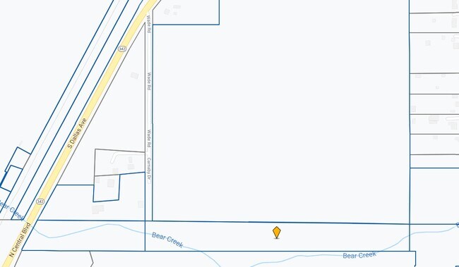
Wade Rd
Dallas-Fort Worth-Arlington, TX
1354 P KIRKLAND 16.8 ACRES
193168
ELLIS
Agriculturalland
Texas
AE The base floodplain where base flood elevations are provided. AE Zones are now used on new format FIRMs instead of A1-A30 Zones.
16.80 AC
2024
Ellis County
2025
Dallas/Ft Worth
060206
NEARBY LISTINGS FOR SALE OR LEASE
DEMOGRAPHICS near Wade Rd
1 mile
3 mile
5 mile
2025 Total Population
2,799
23,155
90,358
2030 Population
3,333
26,499
98,342
Pop Growth 2025-2030
+ 19.08%
+ 14.44%
+ 8.84%
Average Age
39
38
37
2025 Total Households
936
7,717
30,191
HH Growth 2025-2030
+ 19.23%
+ 14.59%
+ 8.83%
Median Household Inc
$76,529
$84,527
$77,690
Avg Household Size
3.00
3.00
2.90
2025 Avg HH Vehicles
2.00
2.00
2.00
Median Home Value
$341,783
$324,217
$299,828
Median Year Built
2010
2000
1995
Nearby Places
Map Layers
Map Styles
 Street
 Aerial
Layers
 Traffic
 Biking
Places
Listings with unknown addresses are not visible on the map
- Restaurants
- Banks
- Shops
- Fitness
- Groceries
PUBLIC TRANSPORTATION
AIRPORT
Dallas Love Field
Drive
Walk
Distance
Dallas Love Field
38 min
26.9 mi
Dallas-Fort Worth International
Drive
Walk
Distance
Dallas-Fort Worth International
52 min
41.0 mi
Nearby Properties
Address
Land Use
TOTAL SIZE
Lot Size
Zoning
Address
Land Use
TOTAL SIZE
Lot Size
Zoning
268,416 SF
33.28 AC
Address
Land Use
TOTAL SIZE
Lot Size
Zoning
268,416 SF
19.04 AC
Address
Land Use
TOTAL SIZE
Lot Size
Zoning
268,416 SF
20.02 AC
Address
Land Use
TOTAL SIZE
Lot Size
Zoning
268,416 SF
19.18 AC
Address
Land Use
TOTAL SIZE
Lot Size
Zoning
288,368 SF
86.46 AC
Address
Land Use
TOTAL SIZE
Lot Size
Zoning
316,312 SF
17.09 AC
Address
Land Use
TOTAL SIZE
Lot Size
Zoning
268,416 SF
22.11 AC
Address
Land Use
TOTAL SIZE
Lot Size
Zoning
345,348 SF
19.22 AC
Address
Land Use
TOTAL SIZE
Lot Size
Zoning
80,000 SF
8.37 AC
Address
Land Use
TOTAL SIZE
Lot Size
Zoning
268,416 SF
18.38 AC
Address
Land Use
TOTAL SIZE
Lot Size
Zoning
276,880 SF
14.17 AC
Address
Land Use
TOTAL SIZE
Lot Size
Zoning
327,382 SF
15.68 AC
Address
Land Use
TOTAL SIZE
Lot Size
Zoning
5,760 SF
291.95 AC
Address
Land Use
TOTAL SIZE
Lot Size
Zoning
41,390 SF
90.38 AC
Address
Land Use
TOTAL SIZE
Lot Size
Zoning
111,715 SF
4.81 AC
Address
Land Use
TOTAL SIZE
Lot Size
Zoning
268,416 SF
18.32 AC
Address
Land Use
TOTAL SIZE
Lot Size
Zoning
268,416 SF
91.89 AC
Address
Land Use
TOTAL SIZE
Lot Size
Zoning
110,065 SF
8.29 AC
Address
Land Use
TOTAL SIZE
Lot Size
Zoning
40,071 SF
15.96 AC
Address
Land Use
TOTAL SIZE
Lot Size
Zoning
159,860 SF
24.03 AC
Address
Land Use
TOTAL SIZE
Lot Size
Zoning
268,416 SF
19.64 AC
Address
Land Use
TOTAL SIZE
Lot Size
Zoning
43,164 SF
17.44 AC
Address
Land Use
TOTAL SIZE
Lot Size
Zoning
272,000 SF
38.53 AC
Address
Land Use
TOTAL SIZE
Lot Size
Zoning
268,416 SF
40.26 AC
Address
Land Use
TOTAL SIZE
Lot Size
Zoning
51,744 SF
1.88 AC
Address
Land Use
TOTAL SIZE
Lot Size
Zoning
87,433 SF
102.12 AC
Z125
Address
Land Use
TOTAL SIZE
Lot Size
Zoning
49,015 SF
30.05 AC
Address
Land Use
TOTAL SIZE
Lot Size
Zoning
20,695 SF
2.10 AC
Address
Land Use
TOTAL SIZE
Lot Size
Zoning
80,839 SF
17.71 AC
Address
Land Use
TOTAL SIZE
Lot Size
Zoning
852,500 SF
90.61 AC
The World's #1 Commercial Real Estate Marketplace
Connect with us
© 2026 CoStar Group
The information above has been obtained from sources believed reliable. While we do not doubt its accuracy we have not verified it and make no guarantee, warranty or representation about it. It is your responsibility to independently confirm its accuracy and completeness. Any projections, opinions, assumptions, or estimates used are for example only and do not represent the current or future performance of the property. The value of this transaction to you depends on tax and other factors which should be evaluated by your tax, financial, and legal advisors. You and your advisors should conduct a careful, independent investigation of the property to determine to your satisfaction the suitability of the property for your needs.