Property Record
Wagon Wheel Rd, Springdale, AR 72762


NEARBY LISTINGS FOR SALE OR LEASE
Property Detail
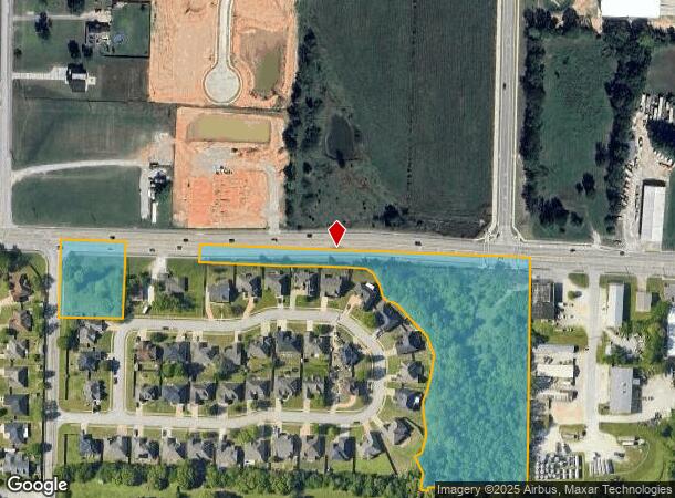
Wagon Wheel Rd
Fayetteville-Springdale-Rogers, AR
Springdale
21-00200-020
PT NW NE BEG NW/C S86*E202.71 S3*W206 S86*E211.46 N3*E206 S86*E931.51 S2*W665.84 N86*W1345.67 N2*E660.18 POB WITH/EXCP
Residentialacreage
Benton
X
Arkansas
05143C0060G
6.18 AC
2025
Greater Springdale
2025
Fayetteville/Springdale/Rogers
021314
DEMOGRAPHICS near Wagon Wheel Rd
1 Mile
3 Mile
5 Mile
2024 Total Population
3,793
41,616
109,760
2029 Population
4,291
46,134
122,598
Pop Growth 2024-2029
+ 13.13%
+ 10.86%
+ 11.70%
Average Age
37
35
35
2024 Total Households
1,207
12,858
35,371
HH Growth 2024-2029
+ 13.17%
+ 10.99%
+ 12.00%
Median Household Inc
$94,342
$68,343
$70,325
Avg Household Size
3.10
3.10
3.00
2024 Avg HH Vehicles
3.00
2.00
2.00
Median Home Value
$286,625
$189,631
$227,468
Median Year Built
2001
1992
1997
Nearby Places
Map Layers
Map Styles
 Street
 Aerial
- Restaurants
- Banks
- Shops
- Fitness
- Groceries
PUBLIC TRANSPORTATION
AIRPORT
Northwest Arkansas Ntl
DRIVE
WALK
Distance
Northwest Arkansas Ntl
29 min
14.4 mi
Freight Ports
Tulsa Port of Inola
DRIVE
WALK
Distance
Tulsa Port of Inola
105 min
89.4 mi
SALE & LEASE HISTORY
LISTING DATE
SALE/LEASE

Jul 24, 2024
For Sale
Nearby Properties
Address
Land Use
TOTAL SIZE
Lot Size
Zoning
Address
Land Use
TOTAL SIZE
Lot Size
Zoning
367,076 SF
57.31 AC
Address
Land Use
TOTAL SIZE
Lot Size
Zoning
58,764 SF
1.56 AC
Address
Land Use
TOTAL SIZE
Lot Size
Zoning
251,508 SF
30 AC
Address
Land Use
TOTAL SIZE
Lot Size
Zoning
132,494 SF
21.56 AC
Address
Land Use
TOTAL SIZE
Lot Size
Zoning
306,148 SF
48.89 AC
Address
Land Use
TOTAL SIZE
Lot Size
Zoning
191,100 SF
10.03 AC
Address
Land Use
TOTAL SIZE
Lot Size
Zoning
75,610 SF
5.62 AC
Address
Land Use
TOTAL SIZE
Lot Size
Zoning
249,393 SF
10.70 AC
Address
Land Use
TOTAL SIZE
Lot Size
Zoning
292,470 SF
17.27 AC
Address
Land Use
TOTAL SIZE
Lot Size
Zoning
174,333 SF
25 AC
I1I2
Address
Land Use
TOTAL SIZE
Lot Size
Zoning
16,698 SF
1.11 AC
Address
Land Use
TOTAL SIZE
Lot Size
Zoning
348,916 SF
24.69 AC
Address
Land Use
TOTAL SIZE
Lot Size
Zoning
224,408 SF
9.80 AC
I1
Address
Land Use
TOTAL SIZE
Lot Size
Zoning
127,043 SF
6.82 AC
Address
Land Use
TOTAL SIZE
Lot Size
Zoning
206,446 SF
17.14 AC
Address
Land Use
TOTAL SIZE
Lot Size
Zoning
12,882 SF
12.33 AC
Address
Land Use
TOTAL SIZE
Lot Size
Zoning
31,150 SF
3.74 AC
C1
Address
Land Use
TOTAL SIZE
Lot Size
Zoning
182,415 SF
68.93 AC
Address
Land Use
TOTAL SIZE
Lot Size
Zoning
182,415 SF
12.04 AC
Address
Land Use
TOTAL SIZE
Lot Size
Zoning
80,475 SF
0.45 AC
C3
Address
Land Use
TOTAL SIZE
Lot Size
Zoning
73,711 SF
3.59 AC
Address
Land Use
TOTAL SIZE
Lot Size
Zoning
147,762 SF
Address
Land Use
TOTAL SIZE
Lot Size
Zoning
123,740 SF
13.96 AC
Address
Land Use
TOTAL SIZE
Lot Size
Zoning
170,442 SF
12.62 AC
Address
Land Use
TOTAL SIZE
Lot Size
Zoning
160,570 SF
20.31 AC
Address
Land Use
TOTAL SIZE
Lot Size
Zoning
54,460 SF
6.38 AC
Address
Land Use
TOTAL SIZE
Lot Size
Zoning
40,456 SF
14.17 AC
Address
Land Use
TOTAL SIZE
Lot Size
Zoning
364,696 SF
4.49 AC
Address
Land Use
TOTAL SIZE
Lot Size
Zoning
65,200 SF
9.26 AC
Address
Land Use
TOTAL SIZE
Lot Size
Zoning
189,244 SF
11.16 AC
I2
The World's #1 Commercial Real Estate Marketplace
Connect with us
© 2026 CoStar Group
The information above has been obtained from sources believed reliable. While we do not doubt its accuracy we have not verified it and make no guarantee, warranty or representation about it. It is your responsibility to independently confirm its accuracy and completeness. Any projections, opinions, assumptions, or estimates used are for example only and do not represent the current or future performance of the property. The value of this transaction to you depends on tax and other factors which should be evaluated by your tax, financial, and legal advisors. You and your advisors should conduct a careful, independent investigation of the property to determine to your satisfaction the suitability of the property for your needs.