Property Record
Walerga Rd, Sacramento, CA 95842
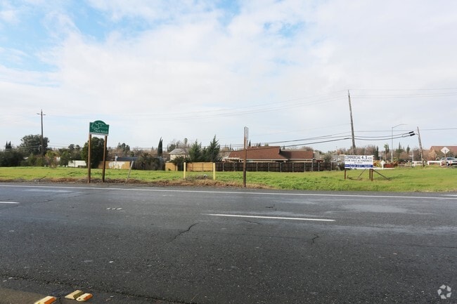

This Property Is For Sale
NEARBY LISTINGS FOR SALE OR LEASE
-
-
-
-
-
No Photo
-
-
-
-
-
-
-
View all Sacramento listings for sale on LoopNet.com
Property Detail
Walerga Rd
219-0042-016
ALL THAT POR OF SEC J OF RANCHO DEL PASO LYING WESTOF WALERGA RD AND NORTH OF BAINBRIDGE DR, EXC POR DEEDED TO COFOR R/W DESC IN 910612/1245. CONTG 4.42 N AC M/L.
Commercialacreage
Sacramento
X
California
06067C0078H
4.74 AC
2024
Rio Linda/N Highlands
2025
Sacramento
007416
Sacramento-Roseville-Folsom, CA
DEMOGRAPHICS near Walerga Rd
1 Mile
3 Mile
5 Mile
2024 Total Population
28,827
143,027
299,753
2029 Population
28,851
143,777
304,466
Pop Growth 2024-2029
+ 0.08%
+ 0.52%
+ 1.57%
Average Age
36
37
39
2024 Total Households
9,325
47,360
106,624
HH Growth 2024-2029
+ 0.02%
+ 0.46%
+ 1.57%
Median Household Inc
$67,948
$72,578
$75,886
Avg Household Size
3.00
2.90
2.70
2024 Avg HH Vehicles
2.00
2.00
2.00
Median Home Value
$352,142
$376,092
$424,782
Median Year Built
1983
1980
1979
Nearby Places
Map Layers
Map Styles
 Street
 Aerial
- Restaurants
- Banks
- Shops
- Fitness
- Groceries
PUBLIC TRANSPORTATION
COMMUTER RAIL
Roseville (California Zephyr - Amtrak, Capitol Corridor - Amtrak)
DRIVE
WALK
Distance
Roseville (California Zephyr - Amtrak, Capitol Corridor - Amtrak)
12 min
6.6 mi
AIRPORT
Sacramento International
DRIVE
WALK
Distance
Sacramento International
25 min
15.9 mi
Freight Ports
Port of Stockton
DRIVE
WALK
Distance
Port of Stockton
72 min
60.4 mi
Nearby Properties
Address
Land Use
TOTAL SIZE
Lot Size
Zoning
Address
Land Use
TOTAL SIZE
Lot Size
Zoning
430,406 SF
24.45 AC
RD-20
Address
Land Use
TOTAL SIZE
Lot Size
Zoning
173,174 SF
8.89 AC
RD-30
Address
Land Use
TOTAL SIZE
Lot Size
Zoning
180,595 SF
10.74 AC
RD-30
Address
Land Use
TOTAL SIZE
Lot Size
Zoning
183,000 SF
12.49 AC
RD-20
Address
Land Use
TOTAL SIZE
Lot Size
Zoning
14.88 AC
RD-20
Address
Land Use
TOTAL SIZE
Lot Size
Zoning
58.14 AC
RD-2
Address
Land Use
TOTAL SIZE
Lot Size
Zoning
4.40 AC
RD20
Address
Land Use
TOTAL SIZE
Lot Size
Zoning
217,550 SF
21.31 AC
SPA
Address
Land Use
TOTAL SIZE
Lot Size
Zoning
4.90 AC
RD30
Address
Land Use
TOTAL SIZE
Lot Size
Zoning
217,380 SF
10 AC
SPA
Address
Land Use
TOTAL SIZE
Lot Size
Zoning
2,080 SF
136.17 AC
FDR
Address
Land Use
TOTAL SIZE
Lot Size
Zoning
200,104 SF
13.85 AC
RD-20
Address
Land Use
TOTAL SIZE
Lot Size
Zoning
4.02 AC
RD20
Address
Land Use
TOTAL SIZE
Lot Size
Zoning
263,792 SF
7.27 AC
SPA
Address
Land Use
TOTAL SIZE
Lot Size
Zoning
98,508 SF
5.33 AC
RD20
Address
Land Use
TOTAL SIZE
Lot Size
Zoning
130,507 SF
8.97 AC
RD-20
Address
Land Use
TOTAL SIZE
Lot Size
Zoning
146,283 SF
8.73 AC
RD-20
Address
Land Use
TOTAL SIZE
Lot Size
Zoning
244,048 SF
13.38 AC
RD-30
Address
Land Use
TOTAL SIZE
Lot Size
Zoning
160,497 SF
6.85 AC
RD-30
Address
Land Use
TOTAL SIZE
Lot Size
Zoning
0.16 AC
RD-5
Address
Land Use
TOTAL SIZE
Lot Size
Zoning
280,864 SF
14.94 AC
RD-20
Address
Land Use
TOTAL SIZE
Lot Size
Zoning
288,524 SF
11.64 AC
M-1
Address
Land Use
TOTAL SIZE
Lot Size
Zoning
141,274 SF
7.06 AC
RD-20
Address
Land Use
TOTAL SIZE
Lot Size
Zoning
185,342 SF
11.13 AC
RD-20
Address
Land Use
TOTAL SIZE
Lot Size
Zoning
0.13 AC
RD-7
Address
Land Use
TOTAL SIZE
Lot Size
Zoning
81,124 SF
4.81 AC
RD-20
Address
Land Use
TOTAL SIZE
Lot Size
Zoning
100,529 SF
13.65 AC
RD-10 BP
Address
Land Use
TOTAL SIZE
Lot Size
Zoning
106,437 SF
4.73 AC
RD-30
Address
Land Use
TOTAL SIZE
Lot Size
Zoning
124,819 SF
13.10 AC
SC
Address
Land Use
TOTAL SIZE
Lot Size
Zoning
89,016 SF
3.55 AC
GC
The World's #1 Commercial Real Estate Marketplace
Connect with us
© 2026 CoStar Group
The information above has been obtained from sources believed reliable. While we do not doubt its accuracy we have not verified it and make no guarantee, warranty or representation about it. It is your responsibility to independently confirm its accuracy and completeness. Any projections, opinions, assumptions, or estimates used are for example only and do not represent the current or future performance of the property. The value of this transaction to you depends on tax and other factors which should be evaluated by your tax, financial, and legal advisors. You and your advisors should conduct a careful, independent investigation of the property to determine to your satisfaction the suitability of the property for your needs.