Property Record
Walnut Creek Pike, , OH
Property Detail
Walnut Creek Pike
Columbus, OH
S SIDE S 1/2
F16-0-001-00-059-00
PICKAWAY
Agriculturalland
Ohio
B and X Area of moderate flood hazard, usually the area between the limits of the 100-year and 500-year floods.
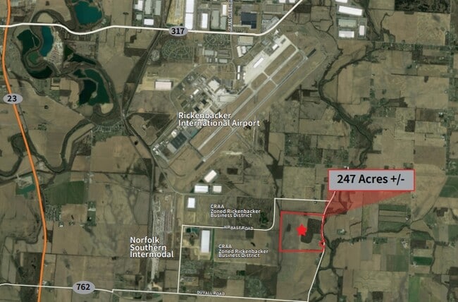
239.24 AC
2025
Pickaway County
2025
Columbus
021101
NEARBY LISTINGS FOR SALE OR LEASE
DEMOGRAPHICS near Walnut Creek Pike
1 mile
3 mile
5 mile
2025 Total Population
661
2,304
13,616
2030 Population
694
2,453
14,329
Pop Growth 2025-2030
+ 4.99%
+ 6.47%
+ 5.24%
Average Age
39
40
38
2025 Total Households
229
857
5,049
HH Growth 2025-2030
+ 5.24%
+ 6.65%
+ 5.35%
Median Household Inc
$85,416
$57,295
$72,597
Avg Household Size
2.80
2.70
2.70
2025 Avg HH Vehicles
3.00
2.00
2.00
Median Home Value
$321,969
$228,921
$250,968
Median Year Built
1985
1978
1978
Nearby Places
Map Layers
Map Styles
 Street
 Aerial
Layers
 Traffic
 Biking
Places
Listings with unknown addresses are not visible on the map
- Restaurants
- Banks
- Shops
- Fitness
- Groceries
PUBLIC TRANSPORTATION
AIRPORT
Rickenbacker International
Drive
Walk
Distance
Rickenbacker International
13 min
7.6 mi
John Glenn Columbus International
Drive
Walk
Distance
John Glenn Columbus International
28 min
18.4 mi
Freight Ports
Port of Toledo
Drive
Walk
Distance
Port of Toledo
207 min
166.5 mi
SALE & LEASE HISTORY
LISTING DATE
SALE/LEASE

Sep 17, 2020
For Sale
Nearby Properties
Address
Land Use
TOTAL SIZE
Lot Size
Zoning
Address
Land Use
TOTAL SIZE
Lot Size
Zoning
43,254 SF
300.98 AC
Address
Land Use
TOTAL SIZE
Lot Size
Zoning
150.29 AC
Address
Land Use
TOTAL SIZE
Lot Size
Zoning
47,622 SF
167.59 AC
Address
Land Use
TOTAL SIZE
Lot Size
Zoning
156,718 SF
8.65 AC
Address
Land Use
TOTAL SIZE
Lot Size
Zoning
31.09 AC
Address
Land Use
TOTAL SIZE
Lot Size
Zoning
302,751 SF
66.25 AC
Address
Land Use
TOTAL SIZE
Lot Size
Zoning
42,066 SF
6.99 AC
Address
Land Use
TOTAL SIZE
Lot Size
Zoning
2,261 SF
138.99 AC
Address
Land Use
TOTAL SIZE
Lot Size
Zoning
43,254 SF
1.96 AC
Address
Land Use
TOTAL SIZE
Lot Size
Zoning
66,304 SF
6.44 AC
Address
Land Use
TOTAL SIZE
Lot Size
Zoning
43,254 SF
27.47 AC
Address
Land Use
TOTAL SIZE
Lot Size
Zoning
61.87 AC
Address
Land Use
TOTAL SIZE
Lot Size
Zoning
56,880 SF
4.82 AC
Address
Land Use
TOTAL SIZE
Lot Size
Zoning
Address
Land Use
TOTAL SIZE
Lot Size
Zoning
2,160 SF
104.13 AC
Address
Land Use
TOTAL SIZE
Lot Size
Zoning
41.70 AC
Address
Land Use
TOTAL SIZE
Lot Size
Zoning
2,352 SF
27.34 AC
Address
Land Use
TOTAL SIZE
Lot Size
Zoning
4,372 SF
181.30 AC
Address
Land Use
TOTAL SIZE
Lot Size
Zoning
40,000 SF
5.18 AC
Address
Land Use
TOTAL SIZE
Lot Size
Zoning
62.60 AC
Address
Land Use
TOTAL SIZE
Lot Size
Zoning
42,356 SF
34.18 AC
Address
Land Use
TOTAL SIZE
Lot Size
Zoning
3,432 SF
101.27 AC
Address
Land Use
TOTAL SIZE
Lot Size
Zoning
4,200 SF
94.66 AC
Address
Land Use
TOTAL SIZE
Lot Size
Zoning
Address
Land Use
TOTAL SIZE
Lot Size
Zoning
100 AC
Address
Land Use
TOTAL SIZE
Lot Size
Zoning
1,000 SF
79.17 AC
Address
Land Use
TOTAL SIZE
Lot Size
Zoning
4,610 SF
39.26 AC
Address
Land Use
TOTAL SIZE
Lot Size
Zoning
Address
Land Use
TOTAL SIZE
Lot Size
Zoning
153.15 AC
The World's #1 Commercial Real Estate Marketplace
Connect with us
© 2026 CoStar Group
The information above has been obtained from sources believed reliable. While we do not doubt its accuracy we have not verified it and make no guarantee, warranty or representation about it. It is your responsibility to independently confirm its accuracy and completeness. Any projections, opinions, assumptions, or estimates used are for example only and do not represent the current or future performance of the property. The value of this transaction to you depends on tax and other factors which should be evaluated by your tax, financial, and legal advisors. You and your advisors should conduct a careful, independent investigation of the property to determine to your satisfaction the suitability of the property for your needs.