Property Record
Walnut Meadow Rd, Paint Lick, KY 40461
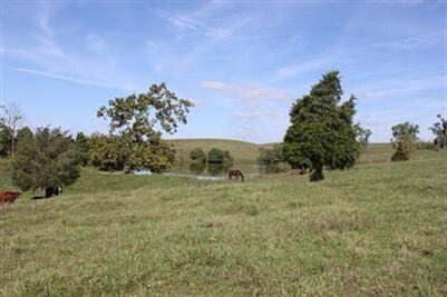

Property Detail
Walnut Meadow Rd
Richmond-Berea, KY
248.61 ACRES
0046-0000-0018
MADISON
Miscellaneous
Kentucky
B and X Area of moderate flood hazard, usually the area between the limits of the 100-year and 500-year floods.
248.61 AC
2025
Kentucky East Area
2025
Other Market Areas
970400
NEARBY LISTINGS FOR SALE OR LEASE
DEMOGRAPHICS near Walnut Meadow Rd
1 mile
3 mile
5 mile
2025 Total Population
90
3,493
17,790
2030 Population
97
3,709
18,864
Pop Growth 2025-2030
+ 7.78%
+ 6.18%
+ 6.04%
Average Age
38
37
38
2025 Total Households
33
1,328
6,879
HH Growth 2025-2030
+ 9.09%
+ 6.40%
+ 6.44%
Median Household Inc
$85,416
$75,394
$63,553
Avg Household Size
2.70
2.60
2.40
2025 Avg HH Vehicles
3.00
2.00
2.00
Median Home Value
$266,666
$279,599
$230,478
Median Year Built
1998
2001
1991
Nearby Places
Map Layers
Map Styles
 Street
 Aerial
Transit
 Traffic
 Biking
Places
Listings with unknown addresses are not visible on the map
- Restaurants
- Banks
- Shops
- Fitness
- Groceries
Nearby Properties
Address
Land Use
TOTAL SIZE
Lot Size
Zoning
Address
Land Use
TOTAL SIZE
Lot Size
Zoning
Address
Land Use
TOTAL SIZE
Lot Size
Zoning
Address
Land Use
TOTAL SIZE
Lot Size
Zoning
16,800 SF
41.52 AC
Address
Land Use
TOTAL SIZE
Lot Size
Zoning
181,450 SF
48.71 AC
Address
Land Use
TOTAL SIZE
Lot Size
Zoning
11,500 SF
53.96 AC
Address
Land Use
TOTAL SIZE
Lot Size
Zoning
Address
Land Use
TOTAL SIZE
Lot Size
Zoning
Address
Land Use
TOTAL SIZE
Lot Size
Zoning
136,786 SF
64.14 AC
Address
Land Use
TOTAL SIZE
Lot Size
Zoning
18,056 SF
2.71 AC
Address
Land Use
TOTAL SIZE
Lot Size
Zoning
Address
Land Use
TOTAL SIZE
Lot Size
Zoning
288,350 SF
27.61 AC
Address
Land Use
TOTAL SIZE
Lot Size
Zoning
3.10 AC
Address
Land Use
TOTAL SIZE
Lot Size
Zoning
129,090 SF
11.95 AC
Address
Land Use
TOTAL SIZE
Lot Size
Zoning
41,418 SF
7.16 AC
Address
Land Use
TOTAL SIZE
Lot Size
Zoning
4.91 AC
Address
Land Use
TOTAL SIZE
Lot Size
Zoning
25,270 SF
2.80 AC
Address
Land Use
TOTAL SIZE
Lot Size
Zoning
0.86 AC
Address
Land Use
TOTAL SIZE
Lot Size
Zoning
17,600 SF
5 AC
Address
Land Use
TOTAL SIZE
Lot Size
Zoning
1,272 SF
3.11 AC
Address
Land Use
TOTAL SIZE
Lot Size
Zoning
16,425 SF
3.09 AC
Address
Land Use
TOTAL SIZE
Lot Size
Zoning
Address
Land Use
TOTAL SIZE
Lot Size
Zoning
1.41 AC
Address
Land Use
TOTAL SIZE
Lot Size
Zoning
4,223 SF
1.05 AC
Address
Land Use
TOTAL SIZE
Lot Size
Zoning
1.14 AC
Address
Land Use
TOTAL SIZE
Lot Size
Zoning
1.28 AC
Address
Land Use
TOTAL SIZE
Lot Size
Zoning
7,924 SF
0.25 AC
Address
Land Use
TOTAL SIZE
Lot Size
Zoning
1.09 AC
Address
Land Use
TOTAL SIZE
Lot Size
Zoning
9,000 SF
1.02 AC
Address
Land Use
TOTAL SIZE
Lot Size
Zoning
0.75 AC
Address
Land Use
TOTAL SIZE
Lot Size
Zoning
The World's #1 Commercial Real Estate Marketplace
Connect with us
© 2026 CoStar Group
The information above has been obtained from sources believed reliable. While we do not doubt its accuracy we have not verified it and make no guarantee, warranty or representation about it. It is your responsibility to independently confirm its accuracy and completeness. Any projections, opinions, assumptions, or estimates used are for example only and do not represent the current or future performance of the property. The value of this transaction to you depends on tax and other factors which should be evaluated by your tax, financial, and legal advisors. You and your advisors should conduct a careful, independent investigation of the property to determine to your satisfaction the suitability of the property for your needs.