Property Record
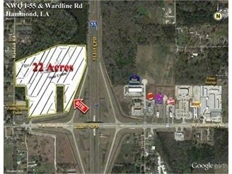
Wardline Rd, Hammond, LA 70401

Property Detail
Wardline Rd
Hammond, LA
21.98A IN SEC 16 T6SR7E 431 P738 B432 P411-413 B437 P140 B445 P423 -425 B465 P572 B537 P577 B551 P594-596 B617 P582 B621 P361
01149105
TANGIPAHOA
Residentialacreage
Louisiana
A Areas with a 1% annual chance of flooding and a 26% chance of flooding over the life of a 30-year mortgage.
21.98 AC
2025
Louisiana South Area
2025
Other Market Areas
954001
NEARBY LISTINGS FOR SALE OR LEASE
DEMOGRAPHICS near Wardline Rd
1 mile
3 mile
5 mile
2025 Total Population
2,166
27,284
54,815
2030 Population
2,208
28,248
56,770
Pop Growth 2025-2030
+ 1.94%
+ 3.53%
+ 3.57%
Average Age
35
35
37
2025 Total Households
874
10,240
21,201
HH Growth 2025-2030
+ 2.17%
+ 3.82%
+ 3.80%
Median Household Inc
$53,263
$43,777
$48,606
Avg Household Size
2.40
2.40
2.40
2025 Avg HH Vehicles
2.00
2.00
2.00
Median Home Value
$231,923
$216,199
$217,741
Median Year Built
1987
1987
1991
Nearby Places
Map Layers
Map Styles
 Street
 Aerial
Transit
 Traffic
 Biking
Places
Listings with unknown addresses are not visible on the map
- Restaurants
- Banks
- Shops
- Fitness
- Groceries
PUBLIC TRANSPORTATION
COMMUTER RAIL
Hammond Amtrak Station (City of New Orleans - Amtrak)
Drive
Walk
Distance
Hammond Amtrak Station (City of New Orleans - Amtrak)
6 min
3.4 mi
Freight Ports
Port of Greater Baton Rouge
Drive
Walk
Distance
Port of Greater Baton Rouge
59 min
48.6 mi
SALE & LEASE HISTORY
LISTING DATE
SALE/LEASE

Sep 24, 2016
For Sale
Nearby Properties
Address
Land Use
TOTAL SIZE
Lot Size
Zoning
Address
Land Use
TOTAL SIZE
Lot Size
Zoning
Address
Land Use
TOTAL SIZE
Lot Size
Zoning
1,071,740 SF
67.96 AC
Address
Land Use
TOTAL SIZE
Lot Size
Zoning
1.74 AC
Address
Land Use
TOTAL SIZE
Lot Size
Zoning
154,391 SF
12.30 AC
Address
Land Use
TOTAL SIZE
Lot Size
Zoning
0.89 AC
Address
Land Use
TOTAL SIZE
Lot Size
Zoning
432 SF
14.80 AC
Address
Land Use
TOTAL SIZE
Lot Size
Zoning
147.07 AC
Address
Land Use
TOTAL SIZE
Lot Size
Zoning
199,026 SF
33 AC
Address
Land Use
TOTAL SIZE
Lot Size
Zoning
135,524 SF
31.08 AC
Address
Land Use
TOTAL SIZE
Lot Size
Zoning
80,506 SF
13.56 AC
Address
Land Use
TOTAL SIZE
Lot Size
Zoning
4,664 SF
8.14 AC
Address
Land Use
TOTAL SIZE
Lot Size
Zoning
19,624 SF
4.66 AC
Address
Land Use
TOTAL SIZE
Lot Size
Zoning
19,845 SF
10 AC
Address
Land Use
TOTAL SIZE
Lot Size
Zoning
35,992 SF
1.99 AC
Address
Land Use
TOTAL SIZE
Lot Size
Zoning
84,150 SF
5.47 AC
Address
Land Use
TOTAL SIZE
Lot Size
Zoning
96,994 SF
4.21 AC
Address
Land Use
TOTAL SIZE
Lot Size
Zoning
14,738 SF
2.02 AC
Address
Land Use
TOTAL SIZE
Lot Size
Zoning
28,098 SF
4.61 AC
Address
Land Use
TOTAL SIZE
Lot Size
Zoning
104,140 SF
7.20 AC
Address
Land Use
TOTAL SIZE
Lot Size
Zoning
13,670 SF
5.95 AC
Address
Land Use
TOTAL SIZE
Lot Size
Zoning
49,410 SF
2.48 AC
Address
Land Use
TOTAL SIZE
Lot Size
Zoning
15,636 SF
5.15 AC
Address
Land Use
TOTAL SIZE
Lot Size
Zoning
21,450 SF
12 AC
Address
Land Use
TOTAL SIZE
Lot Size
Zoning
45.86 AC
Address
Land Use
TOTAL SIZE
Lot Size
Zoning
33,506 SF
4.20 AC
Address
Land Use
TOTAL SIZE
Lot Size
Zoning
22,062 SF
2.89 AC
Address
Land Use
TOTAL SIZE
Lot Size
Zoning
45,069 SF
4.43 AC
Address
Land Use
TOTAL SIZE
Lot Size
Zoning
9,999 SF
1 AC
Address
Land Use
TOTAL SIZE
Lot Size
Zoning
Address
Land Use
TOTAL SIZE
Lot Size
Zoning
0.97 AC
The World's #1 Commercial Real Estate Marketplace
Connect with us
© 2026 CoStar Group
The information above has been obtained from sources believed reliable. While we do not doubt its accuracy we have not verified it and make no guarantee, warranty or representation about it. It is your responsibility to independently confirm its accuracy and completeness. Any projections, opinions, assumptions, or estimates used are for example only and do not represent the current or future performance of the property. The value of this transaction to you depends on tax and other factors which should be evaluated by your tax, financial, and legal advisors. You and your advisors should conduct a careful, independent investigation of the property to determine to your satisfaction the suitability of the property for your needs.