Property Record
Warner Rd, West Point, GA 31833
Property Detail
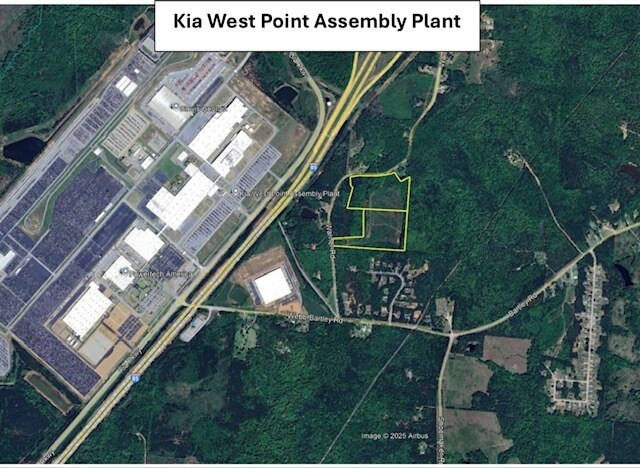
Warner Rd
LaGrange, GA-AL
WARNER RD/PT LOT 16 PB2-PG147-148
077-0-000-070
TROUP
Agriculturalland
Georgia
01-SU-R
16
B and X Area of moderate flood hazard, usually the area between the limits of the 100-year and 500-year floods.
21 AC
2025
Troup County
2025
Columbus GA
120198
NEARBY LISTINGS FOR SALE OR LEASE
DEMOGRAPHICS near Warner Rd
1 mile
3 mile
5 mile
2025 Total Population
315
1,990
7,582
2030 Population
325
2,059
7,887
Pop Growth 2025-2030
+ 3.17%
+ 3.47%
+ 4.02%
Average Age
39
40
41
2025 Total Households
112
727
2,932
HH Growth 2025-2030
+ 4.46%
+ 3.99%
+ 4.30%
Median Household Inc
$65,217
$63,848
$61,936
Avg Household Size
2.70
2.60
2.50
2025 Avg HH Vehicles
2.00
2.00
2.00
Median Home Value
$225,757
$209,358
$185,799
Median Year Built
1993
1990
1985
Nearby Places
Map Layers
Map Styles
 Street
 Aerial
Transit
 Traffic
 Biking
Places
Listings with unknown addresses are not visible on the map
- Restaurants
- Banks
- Shops
- Fitness
- Groceries
PUBLIC TRANSPORTATION
AIRPORT
Columbus
Drive
Walk
Distance
Columbus
51 min
33.2 mi
Freight Ports
Port of Panama City
Drive
Walk
Distance
Port of Panama City
287 min
221.0 mi
SALE & LEASE HISTORY
LISTING DATE
SALE/LEASE

Jun 23, 2025
For Sale
Nearby Properties
Address
Land Use
TOTAL SIZE
Lot Size
Zoning
Address
Land Use
TOTAL SIZE
Lot Size
Zoning
415,440 SF
1,989.06 AC
17-I-1
Address
Land Use
TOTAL SIZE
Lot Size
Zoning
Address
Land Use
TOTAL SIZE
Lot Size
Zoning
517,521 SF
27.03 AC
17-I-1
Address
Land Use
TOTAL SIZE
Lot Size
Zoning
255,952 SF
1 AC
17-I-1
Address
Land Use
TOTAL SIZE
Lot Size
Zoning
311,435 SF
1 AC
17-I-1
Address
Land Use
TOTAL SIZE
Lot Size
Zoning
307,800 SF
49.87 AC
17-MXD-1
Address
Land Use
TOTAL SIZE
Lot Size
Zoning
Address
Land Use
TOTAL SIZE
Lot Size
Zoning
426,400 SF
1 AC
17-I-1
Address
Land Use
TOTAL SIZE
Lot Size
Zoning
Address
Land Use
TOTAL SIZE
Lot Size
Zoning
142,270 SF
2 AC
Address
Land Use
TOTAL SIZE
Lot Size
Zoning
88.55 AC
Address
Land Use
TOTAL SIZE
Lot Size
Zoning
88.55 AC
Address
Land Use
TOTAL SIZE
Lot Size
Zoning
Address
Land Use
TOTAL SIZE
Lot Size
Zoning
132,600 SF
1 AC
Address
Land Use
TOTAL SIZE
Lot Size
Zoning
Address
Land Use
TOTAL SIZE
Lot Size
Zoning
70,000 SF
1 AC
17-I-1
Address
Land Use
TOTAL SIZE
Lot Size
Zoning
160.49 AC
17-R-1
Address
Land Use
TOTAL SIZE
Lot Size
Zoning
75,684 SF
5.28 AC
17-MXD-1
Address
Land Use
TOTAL SIZE
Lot Size
Zoning
523.41 AC
17-MXD-1
Address
Land Use
TOTAL SIZE
Lot Size
Zoning
63,804 SF
8.60 AC
17-MXD-1
Address
Land Use
TOTAL SIZE
Lot Size
Zoning
57.63 AC
01-SU-R
Address
Land Use
TOTAL SIZE
Lot Size
Zoning
Address
Land Use
TOTAL SIZE
Lot Size
Zoning
Address
Land Use
TOTAL SIZE
Lot Size
Zoning
7,310 SF
6 AC
17-CGN
Address
Land Use
TOTAL SIZE
Lot Size
Zoning
29,327 SF
1.13 AC
17-MXD-1
Address
Land Use
TOTAL SIZE
Lot Size
Zoning
117.38 AC
17-R-1
Address
Land Use
TOTAL SIZE
Lot Size
Zoning
Address
Land Use
TOTAL SIZE
Lot Size
Zoning
70.58 AC
17-CGN
Address
Land Use
TOTAL SIZE
Lot Size
Zoning
12,422 SF
19.99 AC
17-I-1
Address
Land Use
TOTAL SIZE
Lot Size
Zoning
22.17 AC
17-CGN
The World's #1 Commercial Real Estate Marketplace
Connect with us
© 2026 CoStar Group
The information above has been obtained from sources believed reliable. While we do not doubt its accuracy we have not verified it and make no guarantee, warranty or representation about it. It is your responsibility to independently confirm its accuracy and completeness. Any projections, opinions, assumptions, or estimates used are for example only and do not represent the current or future performance of the property. The value of this transaction to you depends on tax and other factors which should be evaluated by your tax, financial, and legal advisors. You and your advisors should conduct a careful, independent investigation of the property to determine to your satisfaction the suitability of the property for your needs.