Property Record
Warren, Dearborn Heights, MI 48127
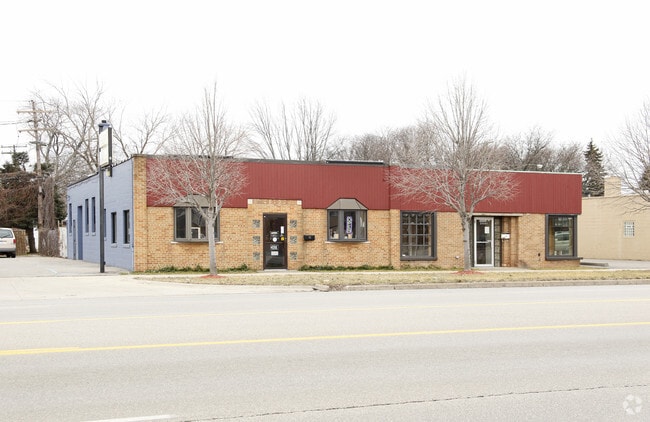

Property Detail
Warren
Detroit-Warren-Dearborn, MI
08B883 LOT 883 ALSO N 1/2 ADJ VAC ALLEY DEARBORN WARREN SUB NO. 2 T2S R10E L57 P61 WCR
33-015-02-0883-000
WAYNE
Commercialacreage
Michigan
B and X Area of moderate flood hazard, usually the area between the limits of the 100-year and 500-year floods.
883
2025
0.05 AC
2025
Dearborn
572100
Detroit
NEARBY LISTINGS FOR SALE OR LEASE
DEMOGRAPHICS near Warren
1 mile
3 mile
5 mile
2025 Total Population
14,902
127,757
332,742
2030 Population
14,570
125,565
328,314
Pop Growth 2025-2030
(2.23%)
(1.72%)
(1.33%)
Average Age
38
38
39
2025 Total Households
5,183
47,508
126,784
HH Growth 2025-2030
(2.26%)
(1.75%)
(1.39%)
Median Household Inc
$64,775
$62,556
$59,364
Avg Household Size
2.80
2.60
2.60
2025 Avg HH Vehicles
2.00
2.00
2.00
Median Home Value
$213,831
$184,961
$169,187
Median Year Built
1958
1955
1955
Nearby Places
Map Layers
Map Styles
 Street
 Aerial
Layers
 Traffic
 Biking
Places
Listings with unknown addresses are not visible on the map
- Restaurants
- Banks
- Shops
- Fitness
- Groceries
PUBLIC TRANSPORTATION
COMMUTER RAIL
Dearborn (Wolverine - Amtrak)
Drive
Walk
Distance
Dearborn (Wolverine - Amtrak)
11 min
5.3 mi
AIRPORT
Detroit Metro Wayne County
Drive
Walk
Distance
Detroit Metro Wayne County
25 min
13.6 mi
Windsor International
Drive
Walk
Distance
Windsor International
44 min
27.4 mi
Freight Ports
Port of Toledo
Drive
Walk
Distance
Port of Toledo
77 min
56.9 mi
Nearby Properties
Address
Land Use
TOTAL SIZE
Lot Size
Zoning
Address
Land Use
TOTAL SIZE
Lot Size
Zoning
324,414 SF
18.68 AC
RD
Address
Land Use
TOTAL SIZE
Lot Size
Zoning
335,133 SF
22.08 AC
Address
Land Use
TOTAL SIZE
Lot Size
Zoning
85.45 AC
Address
Land Use
TOTAL SIZE
Lot Size
Zoning
126,712 SF
4.52 AC
BC
Address
Land Use
TOTAL SIZE
Lot Size
Zoning
261,917 SF
9.31 AC
PD
Address
Land Use
TOTAL SIZE
Lot Size
Zoning
463,642 SF
22.82 AC
Address
Land Use
TOTAL SIZE
Lot Size
Zoning
247,588 SF
4.12 AC
RE
Address
Land Use
TOTAL SIZE
Lot Size
Zoning
835,383 SF
36.85 AC
Address
Land Use
TOTAL SIZE
Lot Size
Zoning
158,354 SF
43.70 AC
M4
Address
Land Use
TOTAL SIZE
Lot Size
Zoning
107,680 SF
7.46 AC
BC
Address
Land Use
TOTAL SIZE
Lot Size
Zoning
286,524 SF
16.58 AC
Address
Land Use
TOTAL SIZE
Lot Size
Zoning
179,412 SF
2.17 AC
Address
Land Use
TOTAL SIZE
Lot Size
Zoning
149,735 SF
6.64 AC
Address
Land Use
TOTAL SIZE
Lot Size
Zoning
141,206 SF
14.01 AC
M-1
Address
Land Use
TOTAL SIZE
Lot Size
Zoning
152,424 SF
5.02 AC
Address
Land Use
TOTAL SIZE
Lot Size
Zoning
58,958 SF
2.15 AC
BC
Address
Land Use
TOTAL SIZE
Lot Size
Zoning
127,017 SF
6.91 AC
Address
Land Use
TOTAL SIZE
Lot Size
Zoning
94,353 SF
8.70 AC
BC
Address
Land Use
TOTAL SIZE
Lot Size
Zoning
57,345 SF
0.73 AC
BC
Address
Land Use
TOTAL SIZE
Lot Size
Zoning
176,883 SF
10.83 AC
Address
Land Use
TOTAL SIZE
Lot Size
Zoning
114,337 SF
3.94 AC
RE
Address
Land Use
TOTAL SIZE
Lot Size
Zoning
88,769 SF
0.91 AC
IB
Address
Land Use
TOTAL SIZE
Lot Size
Zoning
138,447 SF
11.40 AC
BC
Address
Land Use
TOTAL SIZE
Lot Size
Zoning
171,414 SF
23.57 AC
Address
Land Use
TOTAL SIZE
Lot Size
Zoning
97,114 SF
2.10 AC
R1
Address
Land Use
TOTAL SIZE
Lot Size
Zoning
240,100 SF
4.09 AC
OS
Address
Land Use
TOTAL SIZE
Lot Size
Zoning
207,088 SF
14.25 AC
R-1
Address
Land Use
TOTAL SIZE
Lot Size
Zoning
61,031 SF
5.14 AC
BC
Address
Land Use
TOTAL SIZE
Lot Size
Zoning
47,900 SF
2.34 AC
BC
Address
Land Use
TOTAL SIZE
Lot Size
Zoning
42,928 SF
4.88 AC
The World's #1 Commercial Real Estate Marketplace
Connect with us
© 2026 CoStar Group
The information above has been obtained from sources believed reliable. While we do not doubt its accuracy we have not verified it and make no guarantee, warranty or representation about it. It is your responsibility to independently confirm its accuracy and completeness. Any projections, opinions, assumptions, or estimates used are for example only and do not represent the current or future performance of the property. The value of this transaction to you depends on tax and other factors which should be evaluated by your tax, financial, and legal advisors. You and your advisors should conduct a careful, independent investigation of the property to determine to your satisfaction the suitability of the property for your needs.